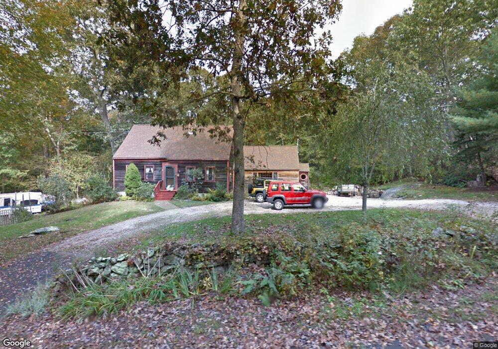
24 Fern Dr Westerly, RI 02891
Estimated Value: $509,097 - $606,000
3
Beds
2
Baths
1,604
Sq Ft
$338/Sq Ft
Est. Value
About This Home
This home is located at 24 Fern Dr, Westerly, RI 02891 and is currently estimated at $541,774, approximately $337 per square foot. 24 Fern Dr is a home located in Washington County with nearby schools including Westerly High School.
Ownership History
Date
Name
Owned For
Owner Type
Purchase Details
Closed on
Jul 13, 2016
Sold by
Dennis-Lowe Melinda S and Lowe Gary A
Bought by
Lowe Melinda S Dennis
Current Estimated Value
Purchase Details
Closed on
Jul 28, 1994
Sold by
Jones Thomas L and Jones Susan
Bought by
Dennis Mark M and Dennis Melinda
Home Financials for this Owner
Home Financials are based on the most recent Mortgage that was taken out on this home.
Original Mortgage
$85,000
Interest Rate
8.25%
Mortgage Type
Purchase Money Mortgage
Create a Home Valuation Report for This Property
The Home Valuation Report is an in-depth analysis detailing your home's value as well as a comparison with similar homes in the area
Home Values in the Area
Average Home Value in this Area
Purchase History
| Date | Buyer | Sale Price | Title Company |
|---|---|---|---|
| Lowe Melinda S Dennis | -- | -- | |
| Dennis Mark M | $140,000 | -- |
Source: Public Records
Mortgage History
| Date | Status | Borrower | Loan Amount |
|---|---|---|---|
| Previous Owner | Dennis Mark M | $100,500 | |
| Previous Owner | Dennis Mark M | $50,000 | |
| Previous Owner | Dennis Mark M | $96,000 | |
| Previous Owner | Dennis Mark M | $85,000 |
Source: Public Records
Tax History Compared to Growth
Tax History
| Year | Tax Paid | Tax Assessment Tax Assessment Total Assessment is a certain percentage of the fair market value that is determined by local assessors to be the total taxable value of land and additions on the property. | Land | Improvement |
|---|---|---|---|---|
| 2024 | $3,569 | $363,800 | $171,000 | $192,800 |
| 2023 | $3,500 | $363,800 | $171,000 | $192,800 |
| 2022 | $3,478 | $363,800 | $171,000 | $192,800 |
| 2021 | $3,447 | $299,200 | $150,200 | $149,000 |
| 2020 | $3,384 | $299,200 | $150,200 | $149,000 |
| 2019 | $3,351 | $299,200 | $150,200 | $149,000 |
| 2018 | $3,300 | $277,800 | $150,200 | $127,600 |
| 2017 | $3,220 | $277,800 | $150,200 | $127,600 |
| 2016 | $3,245 | $277,800 | $150,200 | $127,600 |
| 2015 | $3,073 | $284,000 | $153,100 | $130,900 |
| 2014 | $3,022 | $284,000 | $153,100 | $130,900 |
Source: Public Records
Map
Nearby Homes
- 53 Bradford Rd
- 118 Dunns Corner Rd
- 12 Fallon Trail
- 0 Woody Hill Rd Unit 73432704
- 0 Woody Hill Rd Unit 1334811
- 2 N Capalbo Dr Unit 19
- 2 N Capalbo Dr
- 5 Robin Hollow Ln
- 120 Post Rd
- 304 Post Rd
- 160 Ross Hill Rd
- 9 Lofty Heights Rd
- 162 Church St Unit 164
- 194 Ross Hill Rd
- 4 E Stuart St
- 16 Vars Ln Unit B
- 14 Piezzo Dr
- 342 Post Rd
- 4 Village Rd
- 395 Bradford Rd
- 40 Fern Dr
- 15 Fern Dr
- 6 Fern Dr
- 27 Fern Dr
- 11 Fern Dr
- 151 Dunns Corner Rd
- 11 Fletcher Dr
- 7 Fletcher Dr
- 5 Fletcher Dr
- 15 Fletcher Dr
- 153 Dunns Corner Rd
- 145 Dunns Corner Rd
- 157 Dunns Corner Rd
- 157 Dunns Corner Rd Unit RD
- 157 Dunns Corner Rd Unit BRADFORD
- 157 Dunns Corner Rd
- 148 Dunns Corner-Bradford Rd
- 159 Dunns Corner Rd
- 6 Fletcher Dr
- 157 Dunns Corners Bradford