
Seller's Agent in 2025
Katrice Jalbert
Sopris
(603) 833-5191
1 in this area
7 Total Sales
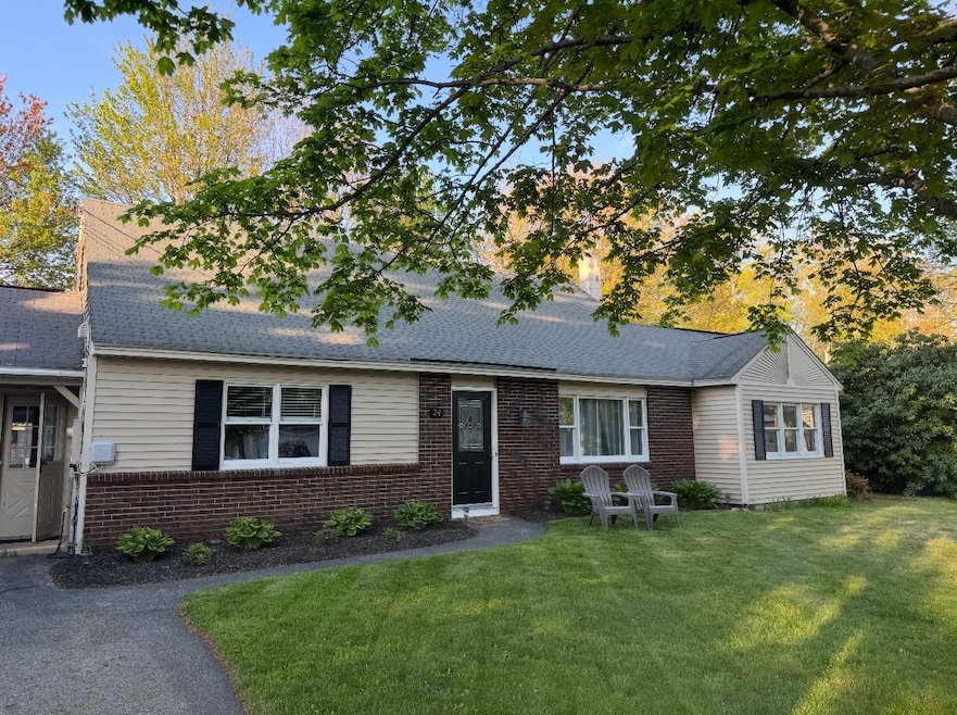
Price Improvement – Motivated Seller!
Welcome to 24 Hale Ave in South Hooksett, now listed at $535,000!
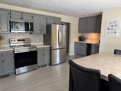
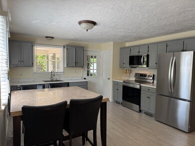
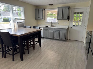
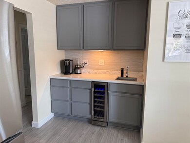
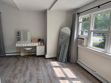
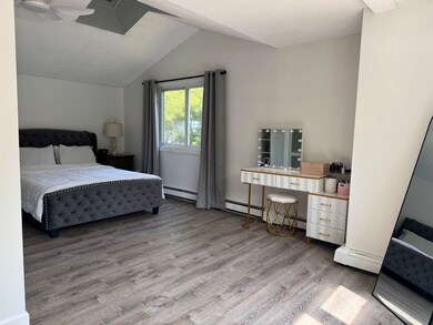
This charming Cape blends fresh updates with timeless appeal. Set on a sunny corner lot next to a neighborhood park with tennis courts and a playground. Step inside to find a brand-new kitchen with all new appliances with modern finishes, a 4-season porch and a cozy 3-season screened porch. The main floor also features two standard bedrooms, a primary bedroom, a full bath, and a versatile bonus room with direct backyard access, ideal for a music studio, home office, or guest space.
The home sits on a low-maintenance slab foundation, with the furnace and water heater conveniently located in an exterior utility closet for easy service. As an added bonus the home is also equipped with an energy recovery ventilator, ensuring a continuous exchange of fresh air in the home.
With its unbeatable location, thoughtful updates, and inviting layout, this home is move-in ready. The seller is already under contract on their next home and is motivated to sell quickly, don’t miss your chance to get into Hooksett at this new price. Schedule your showing today before it’s gone!
| Date | Type | Sale Price | Title Company |
|---|---|---|---|
| Warranty Deed | $535,000 | -- | |
| Quit Claim Deed | -- | None Available | |
| Quit Claim Deed | -- | -- | |
| Quit Claim Deed | -- | -- | |
| Warranty Deed | $113,000 | -- | |
| Quit Claim Deed | -- | -- | |
| Warranty Deed | $113,000 | -- |
| Date | Status | Loan Amount | Loan Type |
|---|---|---|---|
| Open | $535,000 | Credit Line Revolving | |
| Previous Owner | $240,000 | New Conventional | |
| Previous Owner | $244,000 | Stand Alone Refi Refinance Of Original Loan | |
| Previous Owner | $109,610 | Purchase Money Mortgage |
| Date | Event | Price | List to Sale | Price per Sq Ft |
|---|---|---|---|---|
| 09/19/2025 09/19/25 | Sold | $535,000 | +3.1% | $280 / Sq Ft |
| 08/27/2025 08/27/25 | Pending | -- | -- | -- |
| 08/26/2025 08/26/25 | Price Changed | $519,000 | -3.0% | $271 / Sq Ft |
| 08/19/2025 08/19/25 | Price Changed | $535,000 | -2.7% | $280 / Sq Ft |
| 08/15/2025 08/15/25 | Price Changed | $549,900 | -2.7% | $288 / Sq Ft |
| 08/10/2025 08/10/25 | For Sale | $565,000 | -- | $296 / Sq Ft |
| Year | Tax Paid | Tax Assessment Tax Assessment Total Assessment is a certain percentage of the fair market value that is determined by local assessors to be the total taxable value of land and additions on the property. | Land | Improvement |
|---|---|---|---|---|
| 2024 | $7,496 | $442,000 | $119,000 | $323,000 |
| 2023 | $7,063 | $442,000 | $119,000 | $323,000 |
| 2022 | $6,015 | $250,100 | $68,900 | $181,200 |
| 2021 | $5,557 | $250,100 | $68,900 | $181,200 |
| 2020 | $5,630 | $250,100 | $68,900 | $181,200 |
| 2019 | $5,390 | $250,100 | $68,900 | $181,200 |
| 2018 | $4,502 | $250,100 | $68,900 | $181,200 |
| 2017 | $5,650 | $211,300 | $69,600 | $141,700 |
| 2016 | $5,576 | $211,300 | $69,600 | $141,700 |
| 2015 | $5,223 | $211,300 | $69,600 | $141,700 |
| 2014 | $5,247 | $211,300 | $69,600 | $141,700 |
| 2013 | $4,961 | $211,300 | $69,600 | $141,700 |
Seller's Agent in 2025
Katrice Jalbert
Sopris
(603) 833-5191
1 in this area
7 Total Sales
Buyer's Agent in 2025
Lila Mohammed
REAL Broker NH, LLC
(603) 552-0709
7 in this area
67 Total Sales
Buyer Co-Listing Agent in 2025
Shawna Phillips
REAL Broker NH, LLC
(603) 315-6693
13 in this area
101 Total Sales
Source: PrimeMLS
MLS Number: 5055809
APN: HOOK-000045-000000-000019
Disclaimer: Certain information contained herein is derived from information provided by parties other than Homes.com. All information provided is deemed reliable, but is not guaranteed to be accurate and should be independently verified.
![]() Copyright 2026 PrimeMLS, Inc. All rights reserved. This information is deemed reliable, but not guaranteed. The data relating to real estate displayed on this display comes in part from the IDX Program of PrimeMLS. The information being provided is for consumers’ personal, non-commercial use and may not be used for any purpose other than to identify prospective properties consumers may be interested in purchasing.
Copyright 2026 PrimeMLS, Inc. All rights reserved. This information is deemed reliable, but not guaranteed. The data relating to real estate displayed on this display comes in part from the IDX Program of PrimeMLS. The information being provided is for consumers’ personal, non-commercial use and may not be used for any purpose other than to identify prospective properties consumers may be interested in purchasing.
Ask me questions while you tour the home.