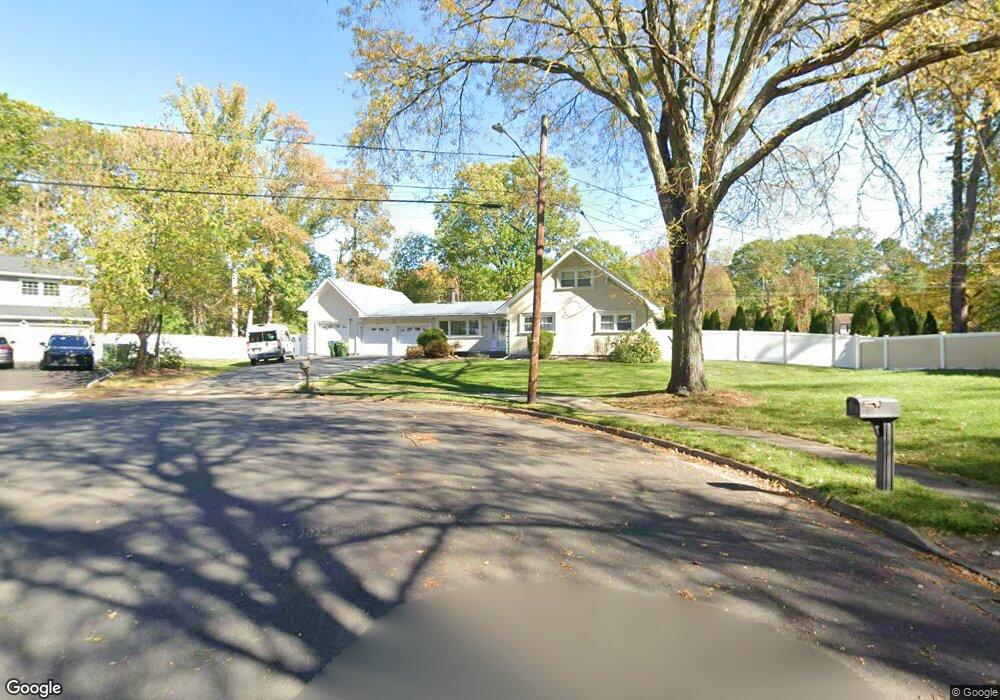
24 Highpoint Dr Edison, NJ 08820
Estimated Value: $897,741 - $1,082,000
5
Beds
3
Baths
1,913
Sq Ft
$497/Sq Ft
Est. Value
About This Home
This home is located at 24 Highpoint Dr, Edison, NJ 08820 and is currently estimated at $951,685, approximately $497 per square foot. 24 Highpoint Dr is a home located in Middlesex County with nearby schools including James Madison Primary School, James Madison Intermediate School, and John Adams Middle School.
Ownership History
Date
Name
Owned For
Owner Type
Purchase Details
Closed on
Nov 4, 2016
Sold by
Francis George and Sadowski Pamela Sadowski
Bought by
Gupta Ajay
Current Estimated Value
Home Financials for this Owner
Home Financials are based on the most recent Mortgage that was taken out on this home.
Interest Rate
3.54%
Purchase Details
Closed on
Nov 30, 2006
Sold by
The Paramount Grp Inc
Bought by
Francis George and Sadowski Pamela
Home Financials for this Owner
Home Financials are based on the most recent Mortgage that was taken out on this home.
Original Mortgage
$478,400
Interest Rate
6.35%
Purchase Details
Closed on
Oct 21, 2005
Sold by
Hakken Paul
Bought by
The Paramount Group Inc
Create a Home Valuation Report for This Property
The Home Valuation Report is an in-depth analysis detailing your home's value as well as a comparison with similar homes in the area
Home Values in the Area
Average Home Value in this Area
Purchase History
| Date | Buyer | Sale Price | Title Company |
|---|---|---|---|
| Gupta Ajay | $565,000 | -- | |
| Francis George | $598,000 | -- | |
| The Paramount Group Inc | $529,000 | -- |
Source: Public Records
Mortgage History
| Date | Status | Borrower | Loan Amount |
|---|---|---|---|
| Closed | Gupta Ajay | -- | |
| Previous Owner | Francis George | $478,400 |
Source: Public Records
Tax History
| Year | Tax Paid | Tax Assessment Tax Assessment Total Assessment is a certain percentage of the fair market value that is determined by local assessors to be the total taxable value of land and additions on the property. | Land | Improvement |
|---|---|---|---|---|
| 2025 | $15,424 | $259,100 | $125,800 | $133,300 |
| 2024 | $15,341 | $259,100 | $125,800 | $133,300 |
| 2023 | $15,341 | $259,100 | $125,800 | $133,300 |
| 2022 | $15,346 | $259,100 | $125,800 | $133,300 |
| 2021 | $15,295 | $259,100 | $125,800 | $133,300 |
| 2020 | $15,155 | $259,100 | $125,800 | $133,300 |
| 2019 | $14,302 | $259,100 | $125,800 | $133,300 |
| 2018 | $14,052 | $259,100 | $125,800 | $133,300 |
| 2017 | $13,923 | $259,100 | $125,800 | $133,300 |
| 2016 | $13,670 | $259,100 | $125,800 | $133,300 |
| 2015 | $13,147 | $259,100 | $125,800 | $133,300 |
| 2014 | $12,763 | $253,500 | $125,800 | $127,700 |
Source: Public Records
Map
Nearby Homes
- 3 Hummingbird Ln
- 48 Lynnwood Rd
- 87 Ellmyer Rd
- 1821 Oak Tree Rd
- 1868 Oak Tree Rd
- 30 Bender Ave
- 1610 Oak Tree Rd
- 34 Stratford Cir
- 41 W Henry Place
- 275 Alden Ave
- 304 Maplecrest Rd Unit 4
- 303 Maplecrest Rd
- 28 W Francis St
- 4 Maureen Ct
- 628 New Dover Rd
- 37 Jersey Ave
- 5001 Stonehedge Rd Unit 5001
- 3606 Springbrook Dr
- 1704 Deerfield Dr
- 77 W Arthur Place
- 25 Highpoint Dr
- 22 Highpoint Dr
- 20 Highpoint Dr
- 23 Highpoint Dr
- 72 Livingston Ave
- 29 Ellmyer Rd
- 74 Livingston Ave
- 34 Ellmyer Rd
- 18 Highpoint Dr
- 21 Highpoint Dr
- 76 Livingston Ave
- 27 Ellmyer Rd
- 2 Jonathan Dr
- 38 Ellmyer Rd
- 4 Malibu Dr
- 32 Ellmyer Rd
- 3 Jonathan Dr
- 64 Livingston Ave
- 19 Highpoint Dr
- 77 Livingston Ave
Your Personal Tour Guide
Ask me questions while you tour the home.