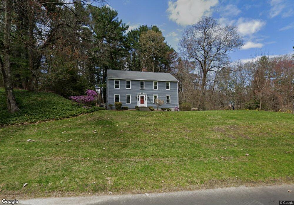
24 Lands End Ln Sudbury, MA 01776
Estimated Value: $993,098 - $1,348,000
5
Beds
3
Baths
2,308
Sq Ft
$512/Sq Ft
Est. Value
About This Home
This home is located at 24 Lands End Ln, Sudbury, MA 01776 and is currently estimated at $1,182,525, approximately $512 per square foot. 24 Lands End Ln is a home located in Middlesex County with nearby schools including Israel Loring Elementary School, Ephraim Curtis Middle School, and Lincoln-Sudbury Regional High School.
Ownership History
Date
Name
Owned For
Owner Type
Purchase Details
Closed on
Sep 8, 2006
Sold by
Mulcahey Brian D and Hsu Lydia J
Bought by
Graham Alexander R and Graham Shelly M
Current Estimated Value
Home Financials for this Owner
Home Financials are based on the most recent Mortgage that was taken out on this home.
Original Mortgage
$514,000
Outstanding Balance
$310,690
Interest Rate
6.79%
Mortgage Type
Purchase Money Mortgage
Estimated Equity
$871,835
Purchase Details
Closed on
Jul 28, 1995
Sold by
Odonnell Charles E and Odonnell Patricia A
Bought by
Mulcahey Brian D and Hsu Lydia J
Create a Home Valuation Report for This Property
The Home Valuation Report is an in-depth analysis detailing your home's value as well as a comparison with similar homes in the area
Home Values in the Area
Average Home Value in this Area
Purchase History
| Date | Buyer | Sale Price | Title Company |
|---|---|---|---|
| Graham Alexander R | $642,500 | -- | |
| Graham Alexander R | $642,500 | -- | |
| Mulcahey Brian D | $340,000 | -- | |
| Mulcahey Brian D | $340,000 | -- |
Source: Public Records
Mortgage History
| Date | Status | Borrower | Loan Amount |
|---|---|---|---|
| Open | Mulcahey Brian D | $130,000 | |
| Open | Graham Alexander R | $514,000 | |
| Closed | Mulcahey Brian D | $514,000 | |
| Previous Owner | Mulcahey Brian D | $175,000 |
Source: Public Records
Tax History Compared to Growth
Tax History
| Year | Tax Paid | Tax Assessment Tax Assessment Total Assessment is a certain percentage of the fair market value that is determined by local assessors to be the total taxable value of land and additions on the property. | Land | Improvement |
|---|---|---|---|---|
| 2025 | $14,489 | $989,700 | $500,900 | $488,800 |
| 2024 | $13,983 | $957,100 | $486,500 | $470,600 |
| 2023 | $13,069 | $828,700 | $434,500 | $394,200 |
| 2022 | $13,057 | $723,400 | $398,500 | $324,900 |
| 2021 | $12,624 | $670,400 | $398,500 | $271,900 |
| 2020 | $12,369 | $670,400 | $398,500 | $271,900 |
| 2019 | $12,007 | $670,400 | $398,500 | $271,900 |
| 2018 | $12,049 | $672,000 | $424,100 | $247,900 |
| 2017 | $11,815 | $666,000 | $420,500 | $245,500 |
| 2016 | $11,440 | $642,700 | $404,500 | $238,200 |
| 2015 | $10,747 | $610,600 | $377,200 | $233,400 |
| 2014 | $10,722 | $594,700 | $366,100 | $228,600 |
Source: Public Records
Map
Nearby Homes
- 84 Hopestill Brown Rd
- 14 Eisenhower Rd
- 91 Eaton Rd W
- 19 Nob Hill Dr
- 32 Eaton Rd W
- 0 Wagonwheel Rd
- 128 Nobscot Rd
- 27 Sloane Dr
- 30 Nobscot Rd Unit 14
- 63 Landham Rd
- 1011 Boston Post Rd
- 41 James St
- 216 Landham Rd
- 30 Edith Rd
- 40 Gregory Rd
- 24 Woodland Rd
- 53 Davidson Rd
- 106 Baldwin Ave
- 78 Apple d or Rd
- 23 Massasoit Ave
- 16 Lands End Ln
- 21 Lands End Ln
- 27 Lands End Ln
- 30 Robert Frost Rd
- 33 Lands End Ln
- 8 Lands End Ln
- 15 Lands End Ln
- 38 Lands End Ln
- 39 Lands End Ln
- 9 Lands End Ln
- 26 Lombard Ln
- 46 Lands End Ln
- 38 Robert Frost Rd
- 27 Robert Frost Rd
- 35 Robert Frost Rd
- 19 Robert Frost Rd
- 18 Lombard Ln
- 47 Lands End Ln
- 27 Lombard Ln
- 50 Lands End Ln