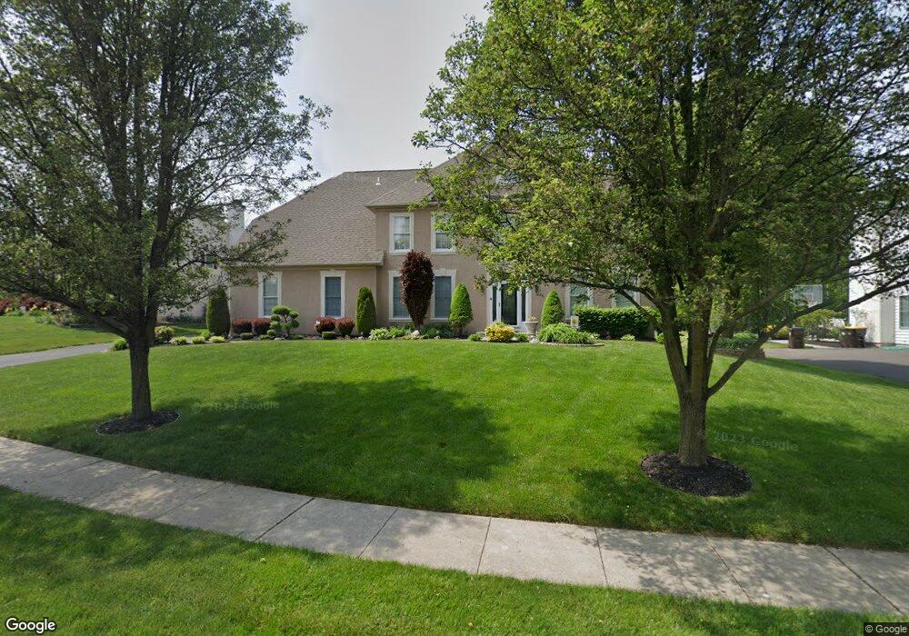
24 Leapson Ln Doylestown, PA 18901
Estimated Value: $955,000 - $1,003,000
5
Beds
4
Baths
3,760
Sq Ft
$263/Sq Ft
Est. Value
About This Home
This home is located at 24 Leapson Ln, Doylestown, PA 18901 and is currently estimated at $988,264, approximately $262 per square foot. 24 Leapson Ln is a home located in Bucks County with nearby schools including Mill Creek Elementary School, Unami Middle School, and Central Bucks High School - South.
Ownership History
Date
Name
Owned For
Owner Type
Purchase Details
Closed on
Jul 5, 1999
Sold by
Ridgeway John and Ridgeway Sherri D
Bought by
Graul Stephen P and Graul Benita
Current Estimated Value
Home Financials for this Owner
Home Financials are based on the most recent Mortgage that was taken out on this home.
Original Mortgage
$115,000
Outstanding Balance
$32,162
Interest Rate
7.54%
Estimated Equity
$956,102
Purchase Details
Closed on
Sep 14, 1998
Sold by
Cedarcrest Farm Ltd Partnership
Bought by
Ridgeway John and Ridgeway Sherri D
Purchase Details
Closed on
Jun 19, 1998
Sold by
Cedarcrest Farm Ltd Partnership
Bought by
Ridgeway John and Ridgeway Sherri D
Home Financials for this Owner
Home Financials are based on the most recent Mortgage that was taken out on this home.
Original Mortgage
$291,766
Interest Rate
7.04%
Create a Home Valuation Report for This Property
The Home Valuation Report is an in-depth analysis detailing your home's value as well as a comparison with similar homes in the area
Home Values in the Area
Average Home Value in this Area
Purchase History
| Date | Buyer | Sale Price | Title Company |
|---|---|---|---|
| Graul Stephen P | $350,000 | -- | |
| Ridgeway John | $488 | -- | |
| Ridgeway John | $324,185 | -- |
Source: Public Records
Mortgage History
| Date | Status | Borrower | Loan Amount |
|---|---|---|---|
| Open | Graul Stephen P | $115,000 | |
| Previous Owner | Ridgeway John | $291,766 |
Source: Public Records
Tax History Compared to Growth
Tax History
| Year | Tax Paid | Tax Assessment Tax Assessment Total Assessment is a certain percentage of the fair market value that is determined by local assessors to be the total taxable value of land and additions on the property. | Land | Improvement |
|---|---|---|---|---|
| 2025 | $10,979 | $62,040 | $6,680 | $55,360 |
| 2024 | $10,979 | $62,040 | $6,680 | $55,360 |
| 2023 | $10,469 | $62,040 | $6,680 | $55,360 |
| 2022 | $10,352 | $62,040 | $6,680 | $55,360 |
| 2021 | $10,139 | $62,040 | $6,680 | $55,360 |
| 2020 | $10,092 | $62,040 | $6,680 | $55,360 |
| 2019 | $9,984 | $62,040 | $6,680 | $55,360 |
| 2018 | $9,953 | $62,040 | $6,680 | $55,360 |
| 2017 | $9,875 | $62,040 | $6,680 | $55,360 |
| 2016 | $9,813 | $62,040 | $6,680 | $55,360 |
| 2015 | -- | $62,040 | $6,680 | $55,360 |
| 2014 | -- | $62,040 | $6,680 | $55,360 |
Source: Public Records
Map
Nearby Homes
- 13 Cedar Crest Ct
- 8 Elizabeth Ln
- 1 Elizabeth Ln
- 3633 Meadow Ln
- 977 Hickory Ridge Dr
- 158 W Butler Ave
- 12 Warren Dr
- 34 Warren Dr Unit 16
- 30 Warren Dr Unit 14
- 47 Mill Creek Dr Unit 32
- 47 Mill Creek Dr
- 25 Mill Creek Dr
- 25 Mill Creek Dr Unit 13
- 79 Becker Dr
- 23 Mill Creek Dr
- 21 Mill Creek Dr Unit 11
- 21 Mill Creek Dr
- 60 Becker Dr Unit 27
- 62 Becker Dr Unit 28
- 58 Becker Dr Unit 26
- 22 Leapson Ln
- 26 Leapson Ln
- 23 Leapson Ln
- 20 Leapson Ln
- 25 Leapson Ln
- 28 Leapson Ln
- 21 Leapson Ln
- 19 Leapson Ln
- 18 Leapson Ln
- 27 Leapson Ln
- 17 Leapson Ln
- 16 Leapson Ln
- 11 Cedar Crest Ct
- 31 Cedar Crest Ct
- 29 Cedar Crest Ct
- 27 Cedar Crest Ct
- 15 Leapson Ln
- 33 Cedar Crest Ct
- 17 Cedar Crest Ct
- 9 Cedar Crest Ct