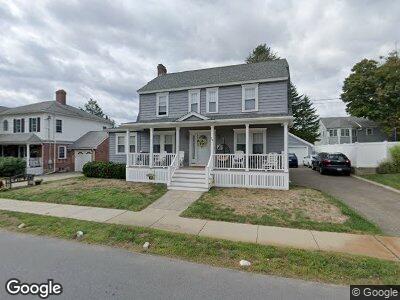
24 Longfellow Rd Watertown, MA 02472
Estimated Value: $1,018,000 - $1,085,000
4
Beds
2
Baths
1,750
Sq Ft
$607/Sq Ft
Est. Value
About This Home
This home is located at 24 Longfellow Rd, Watertown, MA 02472 and is currently estimated at $1,062,972, approximately $607 per square foot. 24 Longfellow Rd is a home located in Middlesex County with nearby schools including Jackson Walnut Park School, JCDS, Boston's Jewish Community Day School, and Beacon High School.
Ownership History
Date
Name
Owned For
Owner Type
Purchase Details
Closed on
Mar 26, 2024
Sold by
Loughran John T and Loughran Clare A
Bought by
John T Loughran Ret and Loughran
Current Estimated Value
Purchase Details
Closed on
Apr 19, 1995
Sold by
Melanson Francis J and Melanson Janet H
Bought by
Loughran John T
Home Financials for this Owner
Home Financials are based on the most recent Mortgage that was taken out on this home.
Original Mortgage
$145,000
Interest Rate
8.55%
Mortgage Type
Purchase Money Mortgage
Create a Home Valuation Report for This Property
The Home Valuation Report is an in-depth analysis detailing your home's value as well as a comparison with similar homes in the area
Home Values in the Area
Average Home Value in this Area
Purchase History
| Date | Buyer | Sale Price | Title Company |
|---|---|---|---|
| John T Loughran Ret | -- | None Available | |
| John T Loughran Ret | -- | None Available | |
| Loughran John T | $235,000 | -- |
Source: Public Records
Mortgage History
| Date | Status | Borrower | Loan Amount |
|---|---|---|---|
| Previous Owner | Loughran John T | $330,000 | |
| Previous Owner | Loughran John T | $100,000 | |
| Previous Owner | Loughran John T | $100,000 | |
| Previous Owner | Loughran John T | $114,000 | |
| Previous Owner | Loughran John T | $116,300 | |
| Previous Owner | Loughran John T | $100,000 | |
| Previous Owner | Loughran John T | $150,000 | |
| Previous Owner | Loughran John T | $145,000 |
Source: Public Records
Tax History Compared to Growth
Tax History
| Year | Tax Paid | Tax Assessment Tax Assessment Total Assessment is a certain percentage of the fair market value that is determined by local assessors to be the total taxable value of land and additions on the property. | Land | Improvement |
|---|---|---|---|---|
| 2025 | $10,748 | $920,200 | $481,300 | $438,900 |
| 2024 | $9,537 | $815,100 | $461,200 | $353,900 |
| 2023 | $10,246 | $754,500 | $439,200 | $315,300 |
| 2022 | $9,580 | $723,000 | $417,200 | $305,800 |
| 2021 | $8,678 | $708,400 | $402,600 | $305,800 |
| 2020 | $8,423 | $693,800 | $388,000 | $305,800 |
| 2019 | $7,987 | $620,100 | $373,300 | $246,800 |
| 2018 | $7,802 | $579,200 | $366,000 | $213,200 |
| 2017 | $7,231 | $520,600 | $307,400 | $213,200 |
| 2016 | $6,803 | $497,300 | $307,400 | $189,900 |
| 2015 | $7,178 | $477,600 | $287,700 | $189,900 |
| 2014 | $7,145 | $477,600 | $287,700 | $189,900 |
Source: Public Records
Map
Nearby Homes
- 20 Whitman Rd Unit 1-4
- 51 Warren St Unit 2-2
- 654 Main St
- 58 Edward Rd
- 19 Beal Rd
- 78 Barbara Rd Unit 1
- 64 Wilmot St
- 54 Bromfield St
- 108 Edward Rd
- 22 Grove St Unit 1
- 127 Highland Ave
- 17 Puritan Rd
- 17 Olcott St
- 50 Jefferson Ave
- 51 Edwin Rd
- 230 Beal Rd
- 36-38 Brandley Rd
- 139 Madison Ave
- 44 Prescott St
- 3 Repton Cir Unit 3407
- 24 Longfellow Rd
- 30 Longfellow Rd
- 18 Longfellow Rd
- 25 Whitman Rd
- 31 Whitman Rd
- 21 Whitman Rd
- 25 Longfellow Rd
- 21 Longfellow Rd
- 34 Longfellow Rd
- 12 Longfellow Rd
- 37 Whitman Rd
- 15 Longfellow Rd
- 15 Whitman Rd
- 35 Longfellow Rd
- 40 Longfellow Rd
- 20 Emerson Rd
- 14 Emerson Rd
- 707 Main St
- 43 Whitman Rd
- 719 Main St