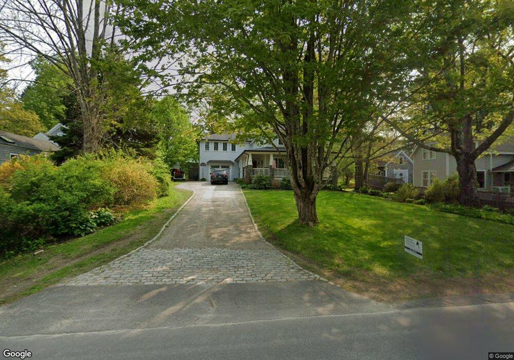
24 Main St Freeport, ME 04032
Estimated Value: $1,170,000 - $1,736,000
4
Beds
4
Baths
3,208
Sq Ft
$458/Sq Ft
Est. Value
About This Home
This home is located at 24 Main St, Freeport, ME 04032 and is currently estimated at $1,470,043, approximately $458 per square foot. 24 Main St is a home located in Cumberland County with nearby schools including Morse Street School, Mast Landing School, and Freeport Middle School.
Ownership History
Date
Name
Owned For
Owner Type
Purchase Details
Closed on
Jun 15, 2011
Sold by
Ordway Guy T and Ordway Winnett C
Bought by
Meyer Daniel A and Meyer Molly A
Current Estimated Value
Home Financials for this Owner
Home Financials are based on the most recent Mortgage that was taken out on this home.
Original Mortgage
$500,000
Outstanding Balance
$340,232
Interest Rate
4.74%
Mortgage Type
Purchase Money Mortgage
Estimated Equity
$1,129,811
Purchase Details
Closed on
Feb 19, 2009
Sold by
Ordway Winnett C
Bought by
Ordway Winnett C and Ordway Guy T
Home Financials for this Owner
Home Financials are based on the most recent Mortgage that was taken out on this home.
Original Mortgage
$250,000
Interest Rate
5.06%
Mortgage Type
Purchase Money Mortgage
Purchase Details
Closed on
Feb 15, 2006
Sold by
Jhb International Inc
Bought by
Barr Maine Props Llc
Create a Home Valuation Report for This Property
The Home Valuation Report is an in-depth analysis detailing your home's value as well as a comparison with similar homes in the area
Home Values in the Area
Average Home Value in this Area
Purchase History
| Date | Buyer | Sale Price | Title Company |
|---|---|---|---|
| Meyer Daniel A | $750,000 | -- | |
| Ordway Winnett C | -- | -- | |
| Barr Maine Props Llc | -- | -- |
Source: Public Records
Mortgage History
| Date | Status | Borrower | Loan Amount |
|---|---|---|---|
| Open | Meyer Daniel A | $500,000 | |
| Previous Owner | Ordway Winnett C | $250,000 |
Source: Public Records
Tax History
| Year | Tax Paid | Tax Assessment Tax Assessment Total Assessment is a certain percentage of the fair market value that is determined by local assessors to be the total taxable value of land and additions on the property. | Land | Improvement |
|---|---|---|---|---|
| 2024 | $16,184 | $1,212,300 | $545,700 | $666,600 |
| 2023 | $14,779 | $1,074,800 | $496,100 | $578,700 |
| 2022 | $13,945 | $1,021,600 | $442,900 | $578,700 |
| 2021 | $13,677 | $1,024,500 | $445,800 | $578,700 |
| 2020 | $13,306 | $950,400 | $412,800 | $537,600 |
| 2019 | $12,801 | $895,200 | $389,400 | $505,800 |
| 2018 | $12,564 | $834,800 | $361,600 | $473,200 |
| 2017 | $11,773 | $787,500 | $335,800 | $451,700 |
| 2016 | $11,464 | $725,600 | $309,100 | $416,500 |
| 2015 | $11,728 | $698,100 | $303,000 | $395,100 |
| 2014 | $11,030 | $698,100 | $303,000 | $395,100 |
| 2013 | $9,478 | $598,000 | $255,100 | $342,900 |
Source: Public Records
Map
Nearby Homes
- 20 Harvest Ridge Rd Unit 23
- 26 Harvest Ridge Rd Unit 24
- 15 Linwood Rd Unit 15
- 67 Farmview Ln
- 58 Maquoit Dr
- 200 Sisquisic Trail
- 10 Durham Rd
- 212 Main St
- 11 Orchard Hill Rd
- 203 Bluff Rd Unit 13
- 42 Durham Rd
- 5 Arrowhead Ridge Rd
- 9 Gables Dr Unit 9
- 52 Blueberry Cove Rd Unit 52
- 0 Bayview St
- 172 E Main St
- 6 Daybreak Ln Unit 18
- 304 Pownal Rd
- 109 Melissa Dr
- 16 Rocky Hill Rd
Your Personal Tour Guide
Ask me questions while you tour the home.