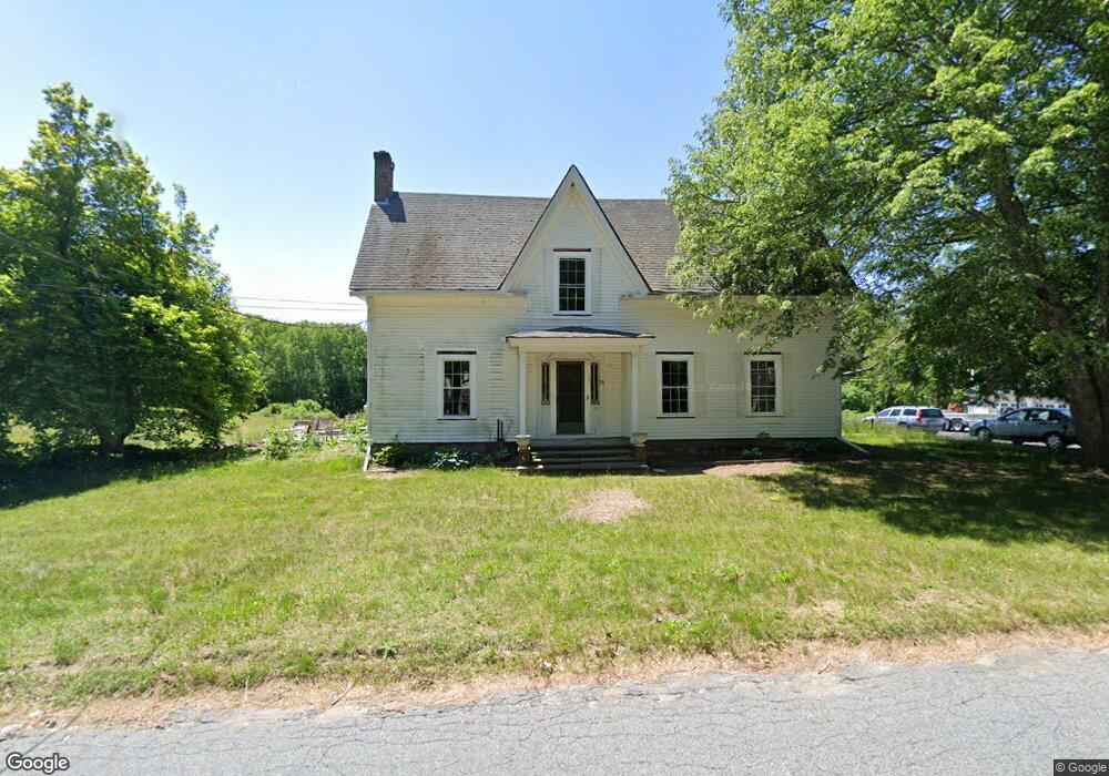
24 Providence St Unit 24 Uxbridge, MA 01569
Estimated Value: $634,000 - $702,000
4
Beds
2
Baths
2,000
Sq Ft
$332/Sq Ft
Est. Value
About This Home
This home is located at 24 Providence St Unit 24, Uxbridge, MA 01569 and is currently estimated at $663,778, approximately $331 per square foot. 24 Providence St Unit 24 is a home located in Worcester County with nearby schools including Uxbridge High School.
Ownership History
Date
Name
Owned For
Owner Type
Purchase Details
Closed on
Jan 14, 2022
Sold by
Nuissl Margot S
Bought by
Nuissl Kurt
Current Estimated Value
Purchase Details
Closed on
Jul 5, 2016
Sold by
Nuissl Gunther and Nuissl Stacey
Bought by
Nuissl Kurt W
Purchase Details
Closed on
Oct 21, 1993
Sold by
Helen Hoffman Rt and Nuissl Carl W
Bought by
Fieldman Arnold and Fieldman Sheila
Create a Home Valuation Report for This Property
The Home Valuation Report is an in-depth analysis detailing your home's value as well as a comparison with similar homes in the area
Home Values in the Area
Average Home Value in this Area
Purchase History
| Date | Buyer | Sale Price | Title Company |
|---|---|---|---|
| Nuissl Kurt | -- | None Available | |
| Nuissl Kurt W | -- | -- | |
| Fieldman Arnold | $10,000 | -- |
Source: Public Records
Mortgage History
| Date | Status | Borrower | Loan Amount |
|---|---|---|---|
| Previous Owner | Fieldman Arnold | $130,000 | |
| Previous Owner | Fieldman Arnold | $75,000 | |
| Previous Owner | Fieldman Arnold | $102,000 | |
| Previous Owner | Fieldman Arnold | $25,000 |
Source: Public Records
Tax History Compared to Growth
Tax History
| Year | Tax Paid | Tax Assessment Tax Assessment Total Assessment is a certain percentage of the fair market value that is determined by local assessors to be the total taxable value of land and additions on the property. | Land | Improvement |
|---|---|---|---|---|
| 2025 | $57 | $438,300 | $173,500 | $264,800 |
| 2024 | $5,550 | $429,600 | $164,800 | $264,800 |
| 2023 | $5,312 | $380,800 | $142,300 | $238,500 |
| 2022 | $5,042 | $332,600 | $124,900 | $207,700 |
| 2021 | $5,221 | $330,000 | $122,300 | $207,700 |
| 2020 | $5,486 | $327,700 | $120,500 | $207,200 |
| 2019 | $5,509 | $317,500 | $120,500 | $197,000 |
| 2018 | $5,347 | $311,400 | $120,500 | $190,900 |
| 2017 | $5,527 | $325,900 | $110,700 | $215,200 |
| 2016 | $5,227 | $297,500 | $105,400 | $192,100 |
| 2015 | $5,107 | $293,500 | $105,400 | $188,100 |
Source: Public Records
Map
Nearby Homes
- 133 Providence St Unit D
- 23 Chesley St
- 111 Cider Mill Rd
- 0 Buxton St Unit 1386233
- 24 Lincoln St
- 77 Chestnut Hill Rd
- 34 Lincoln St
- 16 Preston St
- 1003 Victory Hwy
- 784 Victory Hwy
- 90 Chestnut Hill Rd
- 104 Old Great Rd
- 41 Thayer St
- 12 Silver Pines Blvd Unit 12
- 124 Benedict Rd
- 179 Thayer St
- 119 Albee Rd
- 160 Thayer St
- 57 Kempton Rd
- 0 Main St
- 24 Providence St
- 26 Providence St
- 15 Providence St
- 25 Providence St
- 40 Providence St
- 35 Providence St
- 163 F Providence St Unit 163 F
- 163 Providence St Unit F
- 163 Providence St Unit E
- 163 Providence St Unit D
- 163 Providence St Unit C
- 163 Providence St Unit B
- 163 Providence St Unit A
- 163 Providence St
- 163 Providence St Unit B
- 163 Providence St Unit F
- 163 Providence St Unit 163
- 12 Quaker St
- 14 Quaker St
- 91 Quaker St