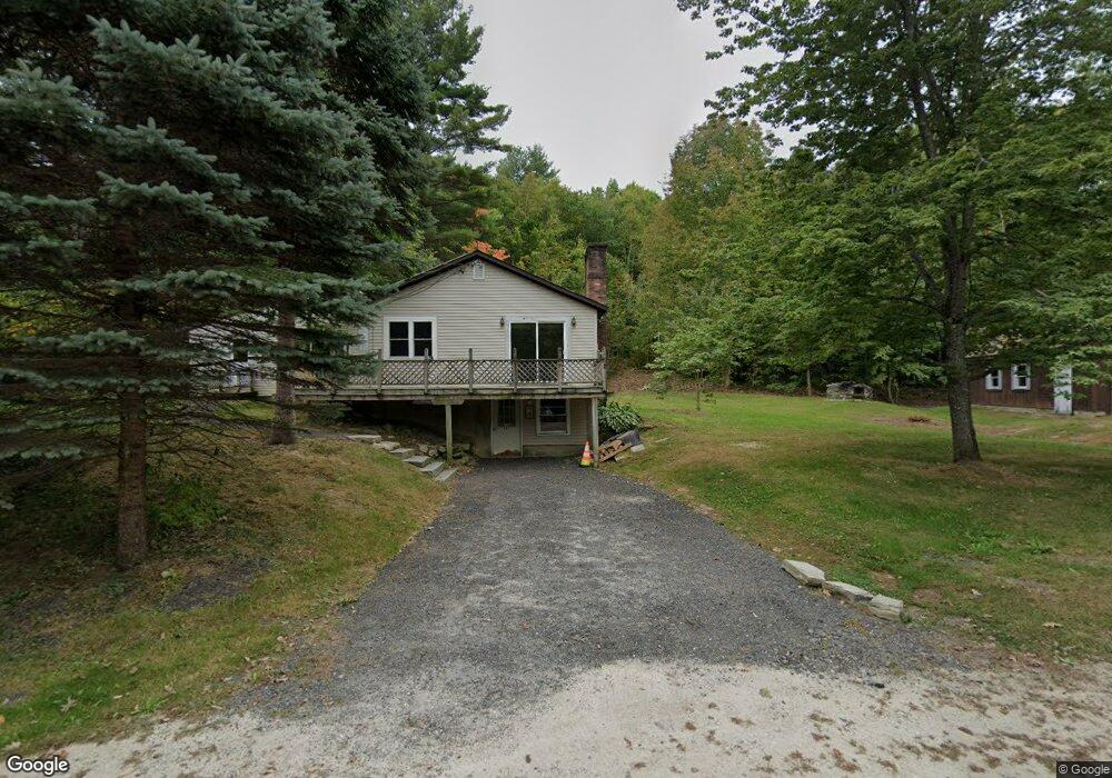
24 Range Rd New Gloucester, ME 04260
Estimated Value: $205,000 - $424,000
2
Beds
1
Bath
1,118
Sq Ft
$278/Sq Ft
Est. Value
About This Home
This home is located at 24 Range Rd, New Gloucester, ME 04260 and is currently estimated at $310,369, approximately $277 per square foot. 24 Range Rd is a home located in Cumberland County with nearby schools including Gray-New Gloucester High School.
Ownership History
Date
Name
Owned For
Owner Type
Purchase Details
Closed on
Mar 6, 2017
Sold by
Lavallee Paul E and Lavallee Brenda M
Bought by
Jordan Robin and Jordan Garrett
Current Estimated Value
Home Financials for this Owner
Home Financials are based on the most recent Mortgage that was taken out on this home.
Original Mortgage
$112,000
Outstanding Balance
$92,219
Interest Rate
4.09%
Mortgage Type
New Conventional
Estimated Equity
$218,150
Create a Home Valuation Report for This Property
The Home Valuation Report is an in-depth analysis detailing your home's value as well as a comparison with similar homes in the area
Home Values in the Area
Average Home Value in this Area
Purchase History
| Date | Buyer | Sale Price | Title Company |
|---|---|---|---|
| Jordan Robin | -- | -- |
Source: Public Records
Mortgage History
| Date | Status | Borrower | Loan Amount |
|---|---|---|---|
| Open | Jordan Robin | $112,000 |
Source: Public Records
Tax History
| Year | Tax Paid | Tax Assessment Tax Assessment Total Assessment is a certain percentage of the fair market value that is determined by local assessors to be the total taxable value of land and additions on the property. | Land | Improvement |
|---|---|---|---|---|
| 2025 | $2,487 | $160,748 | $61,840 | $98,908 |
| 2024 | $2,394 | $160,748 | $61,840 | $98,908 |
| 2023 | $2,297 | $160,748 | $61,840 | $98,908 |
| 2022 | $2,218 | $160,748 | $61,840 | $98,908 |
| 2021 | $2,218 | $160,748 | $61,840 | $98,908 |
| 2020 | $2,194 | $160,748 | $61,840 | $98,908 |
| 2019 | $2,405 | $142,300 | $56,500 | $85,800 |
| 2018 | $2,248 | $142,300 | $56,500 | $85,800 |
| 2017 | $2,220 | $142,300 | $56,500 | $85,800 |
| 2016 | $2,092 | $142,300 | $56,500 | $85,800 |
| 2015 | $2,085 | $142,300 | $56,500 | $85,800 |
| 2014 | $2,063 | $142,300 | $56,500 | $85,800 |
| 2013 | $1,914 | $142,300 | $56,500 | $85,800 |
Source: Public Records
Map
Nearby Homes
- 436 Foster Rd
- 436 Lot A Foster Rd
- 436 Lot B Foster Rd
- 10-56 C&E Bowdoin Way
- Bowdoin Way
- 306 Empire Rd
- 46-47D Hines Rd & Main St
- 795Lot #3 Empire Rd
- 795 Lot #2 Empire Rd
- Lot #2,#3 Empire Rd
- Lot 47C Hines Rd
- 53 Westview Dr
- 26 Front Ave
- 2578 Hotel Rd
- 16 Harvest Hill Ln Unit 2
- 50 Harvest Hill Ln Unit 15
- 6 Williams Way
- 14 Harvest Hill Ln Unit 1
- 15 Country Club Dr
- TBD Emmaus Rd
- 20 Range Rd
- 29 Range Rd
- 30 Range Rd
- 568 Bald Hill Rd
- 0 Range Rd
- 598 Bald Hill Rd
- 569 Bald Hill Rd
- 581 Bald Hill Rd
- 8 Vivian Verrill Rd
- 19 Vivian Verrill Rd
- 567 Bald Hill Rd
- 607 Bald Hill Rd
- 526 Bald Hill Rd
- 626 Bald Hill Rd
- 76 Range Rd
- 75 Range Rd
- 508 Bald Hill Rd
- 501 Bald Hill Rd
- 94 Range Rd
- 632 Bald Hill Rd
Your Personal Tour Guide
Ask me questions while you tour the home.