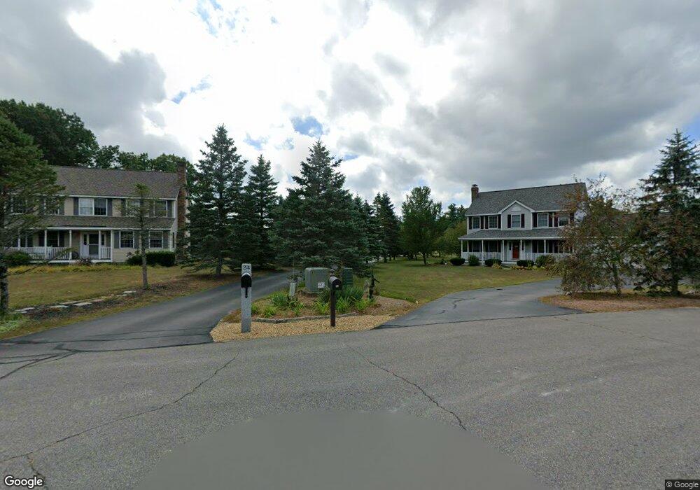
24 Riverlea Rd Extension Milford, NH 03055
Estimated Value: $589,000 - $718,000
4
Beds
3
Baths
2,478
Sq Ft
$269/Sq Ft
Est. Value
About This Home
This home is located at 24 Riverlea Rd Extension, Milford, NH 03055 and is currently estimated at $666,880, approximately $269 per square foot. 24 Riverlea Rd Extension is a home with nearby schools including Jacques Memorial Elementary School, Heron Pond Elementary School, and Milford Middle School.
Ownership History
Date
Name
Owned For
Owner Type
Purchase Details
Closed on
May 29, 2002
Sold by
Asselin Brothers Const
Bought by
Roadcap Nigel A and Roadcap Joy P
Current Estimated Value
Home Financials for this Owner
Home Financials are based on the most recent Mortgage that was taken out on this home.
Original Mortgage
$219,000
Interest Rate
7%
Create a Home Valuation Report for This Property
The Home Valuation Report is an in-depth analysis detailing your home's value as well as a comparison with similar homes in the area
Home Values in the Area
Average Home Value in this Area
Purchase History
| Date | Buyer | Sale Price | Title Company |
|---|---|---|---|
| Roadcap Nigel A | $299,000 | -- |
Source: Public Records
Mortgage History
| Date | Status | Borrower | Loan Amount |
|---|---|---|---|
| Open | Roadcap Nigel A | $232,742 | |
| Closed | Roadcap Nigel A | $40,000 | |
| Closed | Roadcap Nigel A | $162,860 | |
| Closed | Roadcap Nigel A | $219,000 |
Source: Public Records
Tax History Compared to Growth
Tax History
| Year | Tax Paid | Tax Assessment Tax Assessment Total Assessment is a certain percentage of the fair market value that is determined by local assessors to be the total taxable value of land and additions on the property. | Land | Improvement |
|---|---|---|---|---|
| 2024 | $10,997 | $464,600 | $79,700 | $384,900 |
| 2023 | $10,300 | $464,600 | $79,700 | $384,900 |
| 2022 | $9,659 | $464,600 | $79,700 | $384,900 |
| 2021 | $9,362 | $464,600 | $79,700 | $384,900 |
| 2020 | $9,854 | $388,400 | $66,700 | $321,700 |
| 2019 | $10,087 | $388,400 | $66,700 | $321,700 |
| 2018 | $9,661 | $330,500 | $66,700 | $263,800 |
| 2017 | $9,713 | $330,500 | $66,700 | $263,800 |
| 2016 | $9,571 | $330,500 | $66,700 | $263,800 |
| 2015 | $9,362 | $327,800 | $66,700 | $261,100 |
| 2014 | $8,949 | $327,800 | $66,700 | $261,100 |
| 2013 | $8,525 | $316,100 | $66,700 | $249,400 |
Source: Public Records
Map
Nearby Homes
- 131 Homestead Cir
- 229 Mont Vernon Rd
- 42 Quarry Cir
- 0 Briar Cliff Dr
- 32 Larch Rd
- 78 Quarry Circle Dr
- 83 Patch Hill Ln
- 57 Patch Hill Ln
- 64 Lyndeborough Rd
- 30 Perkins St Unit 1
- 18 Adams St
- 24 Spaulding St
- 545 Elm St Unit 34
- 84 North St
- 160 Bridge St
- 40 North St
- 18 Souhegan St
- 14 North St
- 112 Union St
- 2 Trask Way
- 23 Riverlea Rd Extension
- 22 Riverlea Rd Extension
- 19 Riverlea Rd Extension
- 12 Riverlea Rd Extension
- 11 Riverlea Rd Extension
- 5 Riverlea Rd Extension
- 4 Riverlea Rd Extension
- 5 Riverlea Rd
- 148 N River Rd
- 197 N River Rd
- 201 N River Rd
- 215 N River Rd
- 185 N River Rd
- 14 Jennison Rd
- 1 Jennison Rd
- 1 Jennison Rd
- 5 Jennison Rd
- 155 N River Rd
- 165 N River Rd
- 8 Riverlea Rd