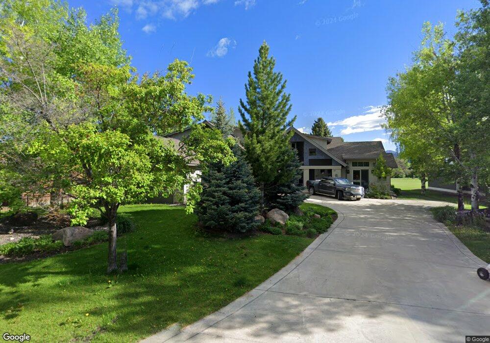
24 Riverside Dr Bozeman, MT 59715
North Bozeman NeighborhoodEstimated Value: $1,201,000 - $1,545,459
4
Beds
4
Baths
3,965
Sq Ft
$349/Sq Ft
Est. Value
About This Home
This home is located at 24 Riverside Dr, Bozeman, MT 59715 and is currently estimated at $1,382,365, approximately $348 per square foot. 24 Riverside Dr is a home located in Gallatin County with nearby schools including Hawthorne Elementary School, Chief Joseph Middle School, and Gallatin High School.
Ownership History
Date
Name
Owned For
Owner Type
Purchase Details
Closed on
Dec 17, 2019
Sold by
Livesay Trevor J
Bought by
Livesay Trevor J and Trevor J Livesay Living Trust
Current Estimated Value
Purchase Details
Closed on
Sep 3, 2019
Sold by
Livesay Trevor J and Trevor J Livesay Living Trust
Bought by
Livesay Trevor
Home Financials for this Owner
Home Financials are based on the most recent Mortgage that was taken out on this home.
Original Mortgage
$480,000
Outstanding Balance
$419,478
Interest Rate
3.7%
Mortgage Type
New Conventional
Estimated Equity
$962,887
Purchase Details
Closed on
Jun 10, 2019
Sold by
Livesay Trevor J
Bought by
Trevor J Livesay Living Trust
Purchase Details
Closed on
May 27, 2015
Sold by
Livesay Trevor J and Trevor J Livesay Living Trust
Bought by
Livesay Trevor J
Home Financials for this Owner
Home Financials are based on the most recent Mortgage that was taken out on this home.
Original Mortgage
$417,000
Interest Rate
3.64%
Mortgage Type
New Conventional
Purchase Details
Closed on
Dec 15, 2011
Sold by
Livesay Trevor and Livesay Trevor J
Bought by
Livesay Trevor J and Trevor J Livesay Living Trust
Purchase Details
Closed on
May 3, 2011
Sold by
Livesay Robert L and Livesay Jan M
Bought by
Livesay Trevor
Home Financials for this Owner
Home Financials are based on the most recent Mortgage that was taken out on this home.
Original Mortgage
$417,000
Interest Rate
4.72%
Mortgage Type
New Conventional
Purchase Details
Closed on
Jul 8, 2010
Sold by
Kamp Mary D
Bought by
Livesay Robert L and Livesay Jan M
Home Financials for this Owner
Home Financials are based on the most recent Mortgage that was taken out on this home.
Original Mortgage
$417,000
Interest Rate
4.79%
Mortgage Type
New Conventional
Purchase Details
Closed on
May 4, 2005
Sold by
Kamp Danny J
Bought by
Kamp Mary D
Create a Home Valuation Report for This Property
The Home Valuation Report is an in-depth analysis detailing your home's value as well as a comparison with similar homes in the area
Home Values in the Area
Average Home Value in this Area
Purchase History
| Date | Buyer | Sale Price | Title Company |
|---|---|---|---|
| Livesay Trevor J | -- | None Available | |
| Livesay Trevor | -- | Montana Title And Escrow | |
| Trevor J Livesay Living Trust | -- | None Available | |
| Livesay Trevor J | -- | Montana Title & Escrow | |
| Livesay Trevor J | -- | None Available | |
| Livesay Trevor | -- | Montana Title & Escrow | |
| Livesay Robert L | -- | It | |
| Kamp Mary D | -- | American Land Title Company |
Source: Public Records
Mortgage History
| Date | Status | Borrower | Loan Amount |
|---|---|---|---|
| Open | Livesay Trevor | $480,000 | |
| Closed | Livesay Trevor J | $417,000 | |
| Closed | Livesay Trevor | $417,000 | |
| Closed | Livesay Robert L | $417,000 |
Source: Public Records
Tax History
| Year | Tax Paid | Tax Assessment Tax Assessment Total Assessment is a certain percentage of the fair market value that is determined by local assessors to be the total taxable value of land and additions on the property. | Land | Improvement |
|---|---|---|---|---|
| 2025 | $7,073 | $1,392,814 | $0 | $0 |
| 2024 | $10,461 | $1,571,546 | $0 | $0 |
| 2023 | $11,154 | $1,571,546 | $0 | $0 |
| 2022 | $6,837 | $1,025,900 | $0 | $0 |
| 2021 | $7,879 | $1,025,900 | $0 | $0 |
| 2020 | $6,667 | $811,700 | $0 | $0 |
| 2019 | $6,777 | $811,700 | $0 | $0 |
| 2018 | $6,680 | $728,143 | $0 | $0 |
| 2017 | $6,192 | $728,143 | $0 | $0 |
| 2016 | $5,763 | $634,300 | $0 | $0 |
| 2015 | $5,725 | $634,300 | $0 | $0 |
| 2014 | $6,862 | $462,439 | $0 | $0 |
Source: Public Records
Map
Nearby Homes
- 25 Riverside Dr
- NHN Springhill Rd
- 3646 N 27th Ave
- 263 Nelson Rd
- TBD Prince Ln
- TBD Royal Wolf Way
- 27737 Frontage Rd
- 3380 Prince Ln
- 65 Naya-Nuki Dr
- 3341 N 27th Ave Unit 26
- 510 Cold Smoke
- 3481 Royal Wolf Way Unit B
- 3481 Royal Wolf Way Unit A
- 685 Naya Nuki Dr
- 94 Snowcat Dr
- 3555 Royal Wolf Way Unit Lot 18
- 3589 Royal Wolf Way Unit A
- 2915 Branding Iron Rd
- 3210 Warbler Way Unit 8
- 3206 Warbler Way Unit 11
- 23 Riverside Dr
- 23 Riverside Dr
- 32 Riverside Dr
- 31 Riverside Dr
- 22 Riverside Dr
- 26 Riverside Dr
- 33 Riverside Dr
- 27 Riverside Dr
- 21 Riverside Dr
- 34 Riverside Dr
- 29 Riverside Dr
- 28 Riverside Dr
- 20 Riverside Dr
- 35 Riverside Dr
- 532 Stonegate Dr
- 500 Stonegate Dr
- 19 Riverside Dr
- 19 Riverside Dr
- 36 Riverside Dr
- TBD Stonegate Drive (Lot 161)
Your Personal Tour Guide
Ask me questions while you tour the home.