Estimated Value: $435,176 - $518,000
3
Beds
3
Baths
1,828
Sq Ft
$259/Sq Ft
Est. Value
About This Home
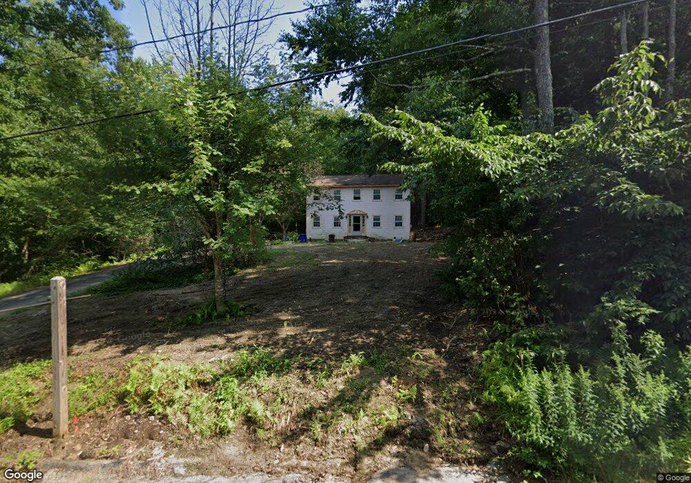
This home is located at 24 Rocky Point Dr, Bow, NH 03304 and is currently estimated at $472,544, approximately $258 per square foot. 24 Rocky Point Dr is a home with nearby schools including Bow Elementary School, Bow Memorial School, and Bow High School.
Ownership History
Date
Name
Owned For
Owner Type
Purchase Details
Closed on
Aug 11, 2023
Sold by
Ives Robert W and Ives Joanne
Bought by
100 Dow Llc
Current Estimated Value
Purchase Details
Closed on
Aug 5, 2021
Sold by
Frances H Gill Irt and Gill
Bought by
Frances H Gill Ret and Gill
Purchase Details
Closed on
Apr 16, 2003
Sold by
Clancy Barbara E
Bought by
Thorne Thomas K and Thorne Lisa A
Home Financials for this Owner
Home Financials are based on the most recent Mortgage that was taken out on this home.
Original Mortgage
$236,000
Interest Rate
5.75%
Mortgage Type
Purchase Money Mortgage
Create a Home Valuation Report for This Property
The Home Valuation Report is an in-depth analysis detailing your home's value as well as a comparison with similar homes in the area
Home Values in the Area
Average Home Value in this Area
Purchase History
| Date | Buyer | Sale Price | Title Company |
|---|---|---|---|
| 100 Dow Llc | $250,000 | None Available | |
| Frances H Gill Ret | -- | None Available | |
| Thorne Thomas K | $295,000 | -- |
Source: Public Records
Mortgage History
| Date | Status | Borrower | Loan Amount |
|---|---|---|---|
| Previous Owner | Thorne Thomas K | $236,000 |
Source: Public Records
Tax History
| Year | Tax Paid | Tax Assessment Tax Assessment Total Assessment is a certain percentage of the fair market value that is determined by local assessors to be the total taxable value of land and additions on the property. | Land | Improvement |
|---|---|---|---|---|
| 2025 | $7,579 | $378,000 | $144,600 | $233,400 |
| 2024 | $7,477 | $378,000 | $144,600 | $233,400 |
| 2023 | $7,086 | $254,800 | $102,800 | $152,000 |
| 2022 | $6,757 | $254,800 | $102,800 | $152,000 |
| 2021 | $6,712 | $263,300 | $102,800 | $160,500 |
| 2020 | $6,735 | $263,300 | $102,800 | $160,500 |
| 2019 | $6,901 | $263,300 | $102,800 | $160,500 |
| 2018 | $6,453 | $232,300 | $89,700 | $142,600 |
| 2017 | $6,451 | $232,300 | $89,700 | $142,600 |
| 2016 | $6,107 | $232,300 | $89,700 | $142,600 |
| 2015 | $6,093 | $213,500 | $89,700 | $123,800 |
| 2014 | $6,404 | $217,000 | $89,700 | $127,300 |
| 2011 | $5,715 | $210,500 | $89,700 | $120,800 |
Source: Public Records
Map
Nearby Homes
- 77 White Rock Hill Rd
- 107 Page Rd
- 4 Bow Center Rd Unit F2
- 13 Birchdale Rd
- 104 White Rock Hill Rd
- 5 Holly Cir
- 5 Windchime Dr
- 0 Brown Hill Rd Unit 5032600
- 8 Longview Dr
- 47 Bog Rd Unit G2
- 99 Brown Hill Rd
- 289 South St
- 592 Page Rd
- 40 Nivelle St
- 15 Clearview Dr
- 42 Westover Ln
- 99 Bow Bog Rd
- 192 Grapevine Rd
- 0 South St Unit 4969509
- 17 Erin Dr
- 22 Rocky Point Dr
- 26 Rocky Point Dr
- 25 Rocky Point Dr
- 12 Shore View Dr
- 28 Rocky Point Dr
- 29 Rocky Point Dr
- 14 Shore View Dr
- 10 Shore View Dr
- 23 Rocky Point Dr
- 3 Surrey Dr
- 8 Shore View Dr
- 2 Blueberry Ln
- 31 Rocky Point Dr
- 30 Rocky Point Dr
- 18 Rocky Point Dr
- 21 Rocky Point Dr
- 5 Surrey Dr
- 32 Rocky Point Dr
- 6 Shore View Dr
- 1 Blueberry Ln
Your Personal Tour Guide
Ask me questions while you tour the home.