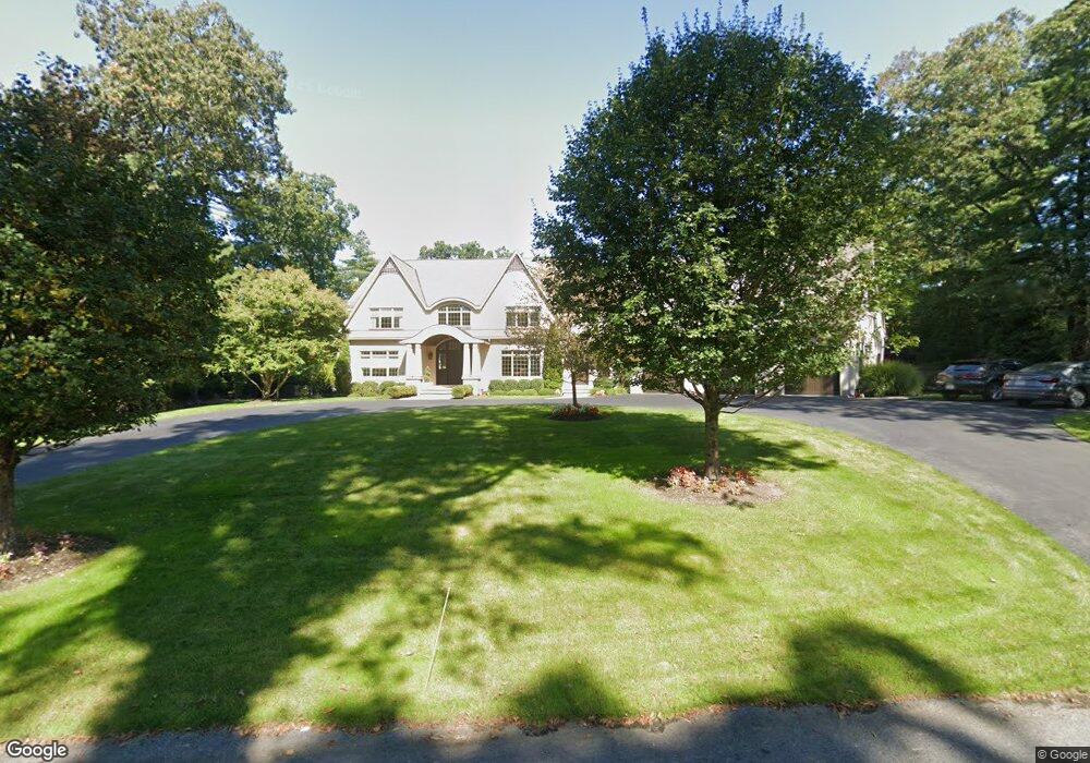
24 Scott Rd Needham, MA 02492
Estimated Value: $2,884,000 - $3,875,000
5
Beds
5
Baths
3,651
Sq Ft
$957/Sq Ft
Est. Value
About This Home
This home is located at 24 Scott Rd, Needham, MA 02492 and is currently estimated at $3,494,570, approximately $957 per square foot. 24 Scott Rd is a home located in Norfolk County with nearby schools including Newman Elementary School, High Rock Middle School, and Pollard Middle School.
Ownership History
Date
Name
Owned For
Owner Type
Purchase Details
Closed on
Jan 27, 2026
Sold by
Weinstein Denisa
Bought by
Weinstein Lewis A and Weinstein Denisa
Current Estimated Value
Purchase Details
Closed on
Aug 28, 2013
Sold by
Weinstein Lewis A and Weinstein Denisa
Bought by
Weinstein Denisa
Purchase Details
Closed on
Nov 30, 2010
Sold by
Kurkjian John M and Kurkjian Vartouhy
Bought by
Weinstein Lewis A and Weinstein Denisa
Home Financials for this Owner
Home Financials are based on the most recent Mortgage that was taken out on this home.
Original Mortgage
$850,000
Interest Rate
4.25%
Mortgage Type
Purchase Money Mortgage
Purchase Details
Closed on
Mar 5, 2010
Sold by
Kurkjian Rt and Kurkjian
Bought by
Kurkjian John M and Kurkjian Vartouhy
Purchase Details
Closed on
Apr 20, 2006
Sold by
Kurkjian John M and Kurkjian Marguerite
Bought by
Kurkjian John M and Kurkjian Rt
Create a Home Valuation Report for This Property
The Home Valuation Report is an in-depth analysis detailing your home's value as well as a comparison with similar homes in the area
Home Values in the Area
Average Home Value in this Area
Purchase History
| Date | Buyer | Sale Price | Title Company |
|---|---|---|---|
| Weinstein Lewis A | -- | -- | |
| Weinstein Denisa | -- | -- | |
| Weinstein Lewis A | $825,000 | -- | |
| Kurkjian John M | -- | -- | |
| Kurkjian John M | -- | -- |
Source: Public Records
Mortgage History
| Date | Status | Borrower | Loan Amount |
|---|---|---|---|
| Previous Owner | Weinstein Lewis A | $850,000 |
Source: Public Records
Tax History
| Year | Tax Paid | Tax Assessment Tax Assessment Total Assessment is a certain percentage of the fair market value that is determined by local assessors to be the total taxable value of land and additions on the property. | Land | Improvement |
|---|---|---|---|---|
| 2025 | $34,893 | $3,291,800 | $791,500 | $2,500,300 |
| 2024 | $37,635 | $3,006,000 | $807,600 | $2,198,400 |
| 2023 | $37,024 | $2,839,300 | $807,600 | $2,031,700 |
| 2022 | $35,418 | $2,649,100 | $702,600 | $1,946,500 |
| 2021 | $34,518 | $2,649,100 | $702,600 | $1,946,500 |
| 2020 | $32,453 | $2,598,300 | $703,100 | $1,895,200 |
| 2019 | $31,580 | $2,548,800 | $702,600 | $1,846,200 |
| 2018 | $30,280 | $2,548,800 | $702,600 | $1,846,200 |
| 2017 | $27,582 | $2,319,800 | $702,600 | $1,617,200 |
| 2016 | $26,775 | $2,320,200 | $702,600 | $1,617,600 |
| 2015 | $26,195 | $2,320,200 | $702,600 | $1,617,600 |
| 2014 | $25,898 | $2,224,900 | $702,600 | $1,522,300 |
Source: Public Records
Map
Nearby Homes
- 34 Stratford Rd
- 37 Carleton Dr
- 24 Moseley Ave
- 189 Bridle Trail Rd
- 1780 Central Ave
- 8 Crestview Rd
- 95 Deerfield Rd
- 365 Charles River St
- 52 Willow St
- 55 Willow St
- 620 High Rock St
- 287 High Rock St
- 1 Mill St
- 957 South St
- 4 Claybrook Rd
- 47 Emerson Rd
- 569 Chestnut St
- 21 Brewster Dr
- 73 Maple St Unit 1
- 37 Standish Rd
- 155 Country Way
- 32 Scott Rd
- 185 Country Way
- 233 Country Way
- 141 Country Way
- 203 Country Way
- 245 Country Way
- 160 Country Way
- 180 Country Way
- 47 Scott Rd
- 123 Country Way
- 48 Scott Rd
- 48 Scott Rd Unit 48
- 257 Country Way
- 12 Cranberry Ln
- 150 Country Way
- 7 Cranberry Ln
- 138 Country Way
- 224 Country Way
- 269 Country Way
Your Personal Tour Guide
Ask me questions while you tour the home.