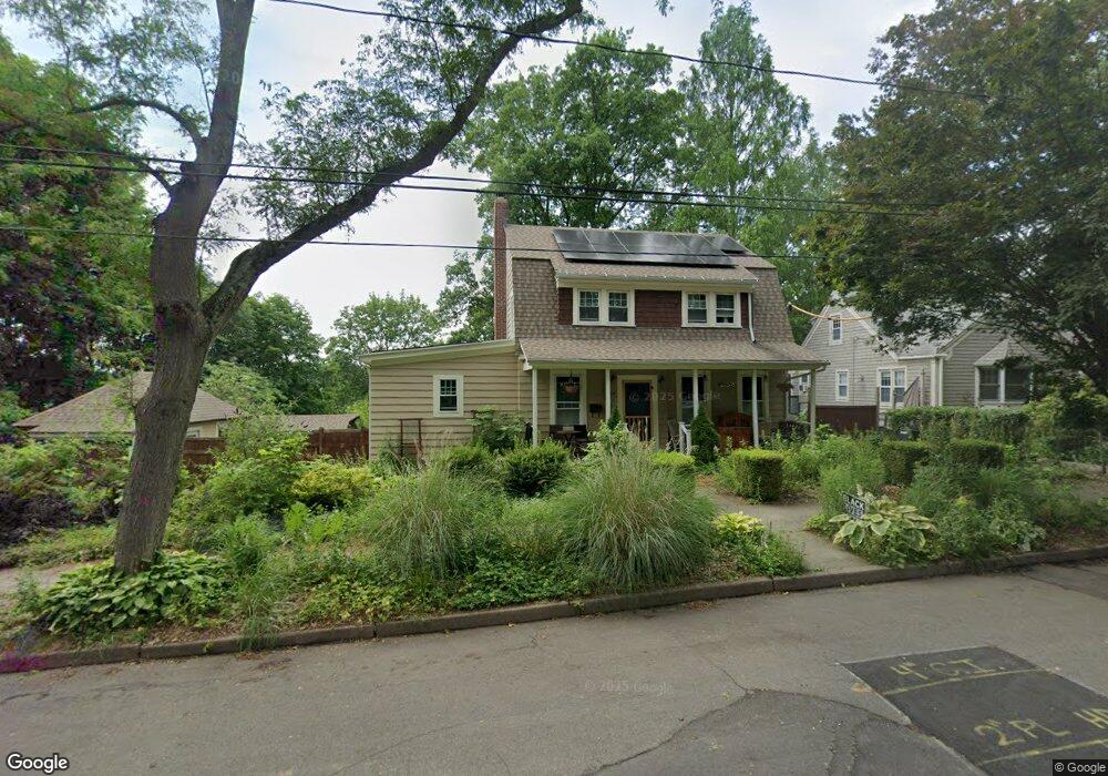
24 Sherland Ave New Haven, CT 06513
Fair Haven Heights NeighborhoodEstimated Value: $397,000 - $496,000
4
Beds
4
Baths
1,960
Sq Ft
$225/Sq Ft
Est. Value
About This Home
This home is located at 24 Sherland Ave, New Haven, CT 06513 and is currently estimated at $441,679, approximately $225 per square foot. 24 Sherland Ave is a home located in New Haven County with nearby schools including St Francis & St Rose Of Lima School and All Nations Christian Academy.
Ownership History
Date
Name
Owned For
Owner Type
Purchase Details
Closed on
Feb 12, 2002
Sold by
Martin Ronld J and Martin Jane D
Bought by
Mooney William P and Mooney Lori
Current Estimated Value
Home Financials for this Owner
Home Financials are based on the most recent Mortgage that was taken out on this home.
Original Mortgage
$48,000
Interest Rate
7.13%
Create a Home Valuation Report for This Property
The Home Valuation Report is an in-depth analysis detailing your home's value as well as a comparison with similar homes in the area
Home Values in the Area
Average Home Value in this Area
Purchase History
| Date | Buyer | Sale Price | Title Company |
|---|---|---|---|
| Mooney William P | $125,000 | -- |
Source: Public Records
Mortgage History
| Date | Status | Borrower | Loan Amount |
|---|---|---|---|
| Open | Mooney William P | $180,000 | |
| Closed | Mooney William P | $48,000 |
Source: Public Records
Tax History Compared to Growth
Tax History
| Year | Tax Paid | Tax Assessment Tax Assessment Total Assessment is a certain percentage of the fair market value that is determined by local assessors to be the total taxable value of land and additions on the property. | Land | Improvement |
|---|---|---|---|---|
| 2025 | $8,900 | $225,890 | $42,000 | $183,890 |
| 2024 | $8,697 | $225,890 | $42,000 | $183,890 |
| 2023 | $8,403 | $225,890 | $42,000 | $183,890 |
| 2022 | $8,979 | $225,890 | $42,000 | $183,890 |
| 2021 | $7,068 | $161,070 | $20,160 | $140,910 |
| 2020 | $5,090 | $115,990 | $20,160 | $95,830 |
| 2019 | $4,985 | $115,990 | $20,160 | $95,830 |
| 2018 | $4,985 | $115,990 | $20,160 | $95,830 |
| 2017 | $4,486 | $115,990 | $20,160 | $95,830 |
| 2016 | $5,104 | $122,850 | $30,240 | $92,610 |
| 2015 | $5,104 | $122,850 | $30,240 | $92,610 |
| 2014 | $5,104 | $122,850 | $30,240 | $92,610 |
Source: Public Records
Map
Nearby Homes
- 34 Hulse St
- 533 Quinnipiac Ave
- 634 Quinnipiac Ave Unit A
- 714 Quinnipiac Ave
- 728 Quinnipiac Ave
- 442 Lexington Ave
- 76 Front St Unit 76
- 121 Lexington Ave Unit 21
- 1 Front St Unit 1 Kel
- 1 Front St Unit 113
- 32 E Pearl St
- 34 Rosewood Ave
- 57 Houston St
- 44 Rosewood Ave
- 33 Chapel St
- 72 Pierpont St
- 12 E Ferry St
- 191 Ferry St
- 85 Pierpont St
- 193 Farren Ave
- 30 Sherland Ave
- 20 Howard St
- 38 Sherland Ave
- 10 Howard St
- 321 Lexington Ave
- 317 Lexington Ave
- 303 Lexington Ave
- 303 Lexington Ave Unit 2
- 44 Sherland Ave
- 323 Lexington Ave
- 297 Lexington Ave
- 15 Sherland Ave
- 23 Sherland Ave
- 291 Lexington Ave Unit 2
- 291 Lexington Ave Unit 1
- 50 Sherland Ave
- 54 Howard St
- 35 Sherland Ave
- 25 Howard St
- 35 Howard St