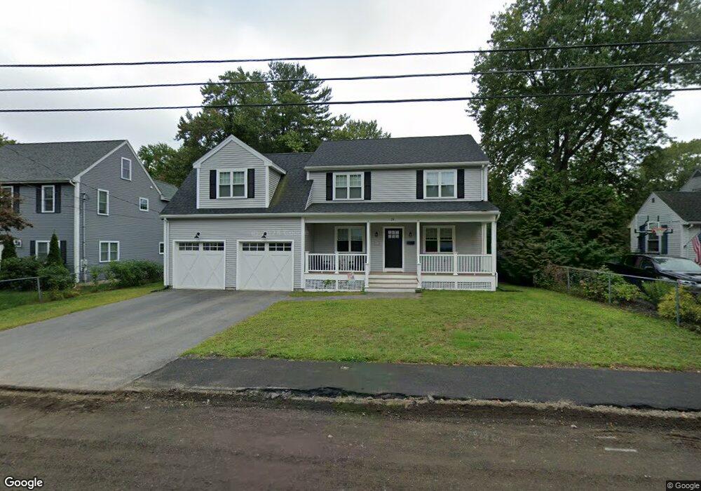
24 Sylvester Rd Natick, MA 01760
Estimated Value: $1,011,000 - $1,190,000
3
Beds
3
Baths
2,166
Sq Ft
$502/Sq Ft
Est. Value
About This Home
This home is located at 24 Sylvester Rd, Natick, MA 01760 and is currently estimated at $1,087,291, approximately $501 per square foot. 24 Sylvester Rd is a home located in Middlesex County with nearby schools including Natick High School, J F Kennedy Middle School, and Johnson Elementary School.
Ownership History
Date
Name
Owned For
Owner Type
Purchase Details
Closed on
Nov 18, 2019
Sold by
Oneil Michael P and Oneil Katherine M
Bought by
Oneil Michael P and Oneil Katherine M
Current Estimated Value
Home Financials for this Owner
Home Financials are based on the most recent Mortgage that was taken out on this home.
Original Mortgage
$410,260
Outstanding Balance
$356,987
Interest Rate
3.6%
Mortgage Type
New Conventional
Estimated Equity
$730,304
Purchase Details
Closed on
Oct 17, 2012
Sold by
Jordan Mary M
Bought by
Oneil Michael P
Home Financials for this Owner
Home Financials are based on the most recent Mortgage that was taken out on this home.
Original Mortgage
$172,500
Interest Rate
3.57%
Mortgage Type
New Conventional
Create a Home Valuation Report for This Property
The Home Valuation Report is an in-depth analysis detailing your home's value as well as a comparison with similar homes in the area
Home Values in the Area
Average Home Value in this Area
Purchase History
| Date | Buyer | Sale Price | Title Company |
|---|---|---|---|
| Oneil Michael P | -- | -- | |
| Oneil Michael P | $230,000 | -- | |
| Oneil Michael P | $230,000 | -- |
Source: Public Records
Mortgage History
| Date | Status | Borrower | Loan Amount |
|---|---|---|---|
| Open | Oneil Michael P | $410,260 | |
| Previous Owner | Oneil Michael P | $172,500 |
Source: Public Records
Tax History
| Year | Tax Paid | Tax Assessment Tax Assessment Total Assessment is a certain percentage of the fair market value that is determined by local assessors to be the total taxable value of land and additions on the property. | Land | Improvement |
|---|---|---|---|---|
| 2025 | $11,443 | $956,800 | $425,900 | $530,900 |
| 2024 | $10,963 | $894,200 | $400,800 | $493,400 |
| 2023 | $10,695 | $846,100 | $385,700 | $460,400 |
| 2022 | $10,371 | $777,400 | $350,600 | $426,800 |
| 2021 | $14,922 | $730,600 | $330,500 | $400,100 |
| 2020 | $5,486 | $715,600 | $315,500 | $400,100 |
| 2019 | $5,116 | $402,500 | $315,500 | $87,000 |
| 2018 | $4,794 | $364,800 | $300,500 | $64,300 |
| 2017 | $4,359 | $323,100 | $255,600 | $67,500 |
| 2016 | $4,090 | $301,400 | $234,600 | $66,800 |
| 2015 | $4,092 | $296,100 | $234,600 | $61,500 |
Source: Public Records
Map
Nearby Homes
- 28 Sylvester Rd
- 1 Fern St
- 79 Speen St
- 46 Silver Hill Ln Unit 1
- 16 West St
- 3 Silver Hill Ln Unit 6
- 62 Oakland St
- 26 Wellesley Ave Unit B
- 1 Post Oak Ln Unit 19
- 34 Walden Dr Unit 5
- 2 Walden Dr Unit 2
- 30 Walden Dr Unit 7
- 8 Walden Dr Unit 13
- 8 Edwards Road Aka 12
- 15 Edwards Rd
- 25 Forest Ave
- 216-218 S Main St
- 7 Allison Way Unit 7
- 89 W Central St
- 30 Sienna Ln Unit 30
- 26 Sylvester Rd
- 22 Sylvester Rd
- 20 Sylvester Rd
- 23 Sylvester Rd
- 21 Sylvester Rd
- 2 Course Brook Ln
- 25 Sylvester Rd
- 30 Sylvester Rd
- 18 Sylvester Rd
- 19 Sylvester Rd
- 4 Course Brook Ln
- 27 Sylvester Rd
- 4 Bunker Ln
- 17 Sylvester Rd
- 16 Sylvester Rd
- 22 Fern St
- 20 Fern St
- 6 Bunker Ln
- 29 Sylvester Rd
- 24 Fern St
Your Personal Tour Guide
Ask me questions while you tour the home.