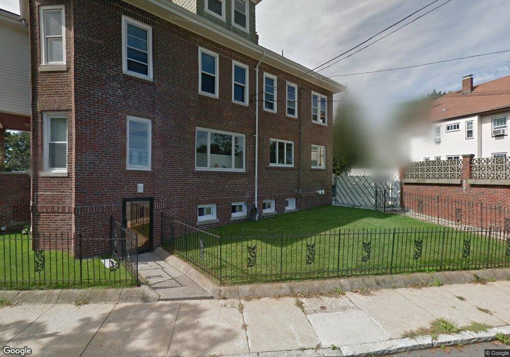
24 Upland Rd Winthrop, MA 02152
Winthrop Highlands NeighborhoodEstimated Value: $1,110,443 - $1,211,000
6
Beds
3
Baths
3,701
Sq Ft
$314/Sq Ft
Est. Value
About This Home
This home is located at 24 Upland Rd, Winthrop, MA 02152 and is currently estimated at $1,161,111, approximately $313 per square foot. 24 Upland Rd is a home with nearby schools including William P. Gorman/Fort Banks Elementary School, Arthur T. Cummings Elementary School, and Winthrop Middle School.
Ownership History
Date
Name
Owned For
Owner Type
Purchase Details
Closed on
Oct 14, 2009
Sold by
2-4 Upland Road Rt and Scoppettuolo
Bought by
Clemente Anthony P
Current Estimated Value
Home Financials for this Owner
Home Financials are based on the most recent Mortgage that was taken out on this home.
Original Mortgage
$371,250
Interest Rate
5.14%
Mortgage Type
Commercial
Create a Home Valuation Report for This Property
The Home Valuation Report is an in-depth analysis detailing your home's value as well as a comparison with similar homes in the area
Home Values in the Area
Average Home Value in this Area
Purchase History
| Date | Buyer | Sale Price | Title Company |
|---|---|---|---|
| Clemente Anthony P | $495,000 | -- | |
| Clemente Anthony P | $495,000 | -- |
Source: Public Records
Mortgage History
| Date | Status | Borrower | Loan Amount |
|---|---|---|---|
| Open | Clemente Anthony P | $415,000 | |
| Closed | Clemente Anthony P | $371,250 | |
| Previous Owner | Clemente Anthony P | $160,500 |
Source: Public Records
Tax History
| Year | Tax Paid | Tax Assessment Tax Assessment Total Assessment is a certain percentage of the fair market value that is determined by local assessors to be the total taxable value of land and additions on the property. | Land | Improvement |
|---|---|---|---|---|
| 2025 | $9,836 | $953,100 | $344,400 | $608,700 |
| 2024 | $9,750 | $935,700 | $331,000 | $604,700 |
| 2023 | $10,151 | $948,700 | $303,000 | $645,700 |
| 2022 | $10,773 | $916,100 | $270,400 | $645,700 |
| 2021 | $10,573 | $833,800 | $241,500 | $592,300 |
| 2020 | $9,538 | $755,800 | $241,500 | $514,300 |
| 2019 | $9,118 | $691,800 | $222,500 | $469,300 |
| 2018 | $8,931 | $630,700 | $191,000 | $439,700 |
| 2017 | $8,162 | $566,400 | $169,100 | $397,300 |
| 2016 | $7,768 | $505,400 | $147,000 | $358,400 |
| 2015 | $6,880 | $479,800 | $142,700 | $337,100 |
| 2014 | $6,604 | $423,900 | $132,800 | $291,100 |
Source: Public Records
Map
Nearby Homes
- 22 Upland Rd
- 47 Highland Ave
- 43 Sagamore Ave Unit 1
- 201 Cliff Ave
- 800 Governors Dr Unit 6
- 100 Governors Dr Unit 118
- 441 Winthrop St
- 3 Seal Harbor Rd Unit 344
- 3 Seal Harbor Rd Unit 133
- 140 Shirley St Unit 201
- 140 Shirley St Unit 309
- 140 Shirley St Unit 310
- 140 Shirley St Unit 204
- 130 Shirley St Unit 202
- 1 Seal Harbor Rd Unit 210
- 1 Seal Harbor Rd Unit 701
- 50-52 Wilshire St
- 426 Winthrop St
- 1000 Winthrop Ave Unit 2
- 203 Winthrop Shore Dr Unit 2
- 2 Upland Rd
- 121 Quincy Ave
- 18 Upland Rd
- 123 Quincy Ave
- 4 Cliff Ave
- 108 Quincy Ave Unit 110
- 108 Quincy Ave Unit 3
- 108 Quincy Ave Unit 1
- 108-110 Quincy Ave
- 110 Quincy Ave Unit 3
- 110 Quincy Ave
- 110 Quincy Ave Unit 2
- 116 Quincy Ave
- 127 Quincy Ave
- 22 Upland Rd Unit 2
- 9 Cliff Ave
- 100 Quincy Ave Unit 6
- 100 Quincy Ave Unit 3
- 100 Quincy Ave Unit 5
- 100 Quincy Ave Unit A
Your Personal Tour Guide
Ask me questions while you tour the home.