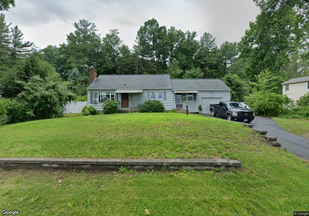
24 W Sutton Rd Sutton, MA 01590
Estimated Value: $448,000 - $571,000
3
Beds
1
Bath
1,310
Sq Ft
$381/Sq Ft
Est. Value
About This Home
This home is located at 24 W Sutton Rd, Sutton, MA 01590 and is currently estimated at $498,789, approximately $380 per square foot. 24 W Sutton Rd is a home located in Worcester County with nearby schools including Sutton Elementary School, Sutton Middle School, and Sutton High School.
Ownership History
Date
Name
Owned For
Owner Type
Purchase Details
Closed on
Oct 7, 2020
Sold by
Gvazdauskas Bertha H and Vazdauskas David
Bought by
Loyko Joel H and Newell-Loyko Christine
Current Estimated Value
Home Financials for this Owner
Home Financials are based on the most recent Mortgage that was taken out on this home.
Original Mortgage
$219,200
Outstanding Balance
$194,967
Interest Rate
2.9%
Mortgage Type
New Conventional
Estimated Equity
$303,822
Purchase Details
Closed on
Jul 26, 2018
Sold by
Daniel F Daly Ret
Bought by
Daniel F Daly Ret
Create a Home Valuation Report for This Property
The Home Valuation Report is an in-depth analysis detailing your home's value as well as a comparison with similar homes in the area
Home Values in the Area
Average Home Value in this Area
Purchase History
| Date | Buyer | Sale Price | Title Company |
|---|---|---|---|
| Loyko Joel H | $274,000 | None Available | |
| Daniel F Daly Ret | -- | -- |
Source: Public Records
Mortgage History
| Date | Status | Borrower | Loan Amount |
|---|---|---|---|
| Open | Loyko Joel H | $219,200 |
Source: Public Records
Tax History
| Year | Tax Paid | Tax Assessment Tax Assessment Total Assessment is a certain percentage of the fair market value that is determined by local assessors to be the total taxable value of land and additions on the property. | Land | Improvement |
|---|---|---|---|---|
| 2025 | $4,767 | $396,600 | $160,400 | $236,200 |
| 2024 | $5,019 | $395,800 | $153,000 | $242,800 |
| 2023 | $4,303 | $310,700 | $138,300 | $172,400 |
| 2022 | $4,307 | $283,700 | $105,400 | $178,300 |
| 2021 | $4,002 | $250,100 | $105,400 | $144,700 |
| 2020 | $3,967 | $250,100 | $105,400 | $144,700 |
| 2019 | $6,775 | $230,300 | $101,600 | $128,700 |
| 2018 | $3,679 | $222,300 | $101,600 | $120,700 |
| 2017 | $3,510 | $212,700 | $88,800 | $123,900 |
| 2016 | $3,468 | $207,900 | $88,800 | $119,100 |
| 2015 | $3,361 | $201,500 | $88,800 | $112,700 |
| 2014 | $3,368 | $199,500 | $91,600 | $107,900 |
Source: Public Records
Map
Nearby Homes
- 11 Laurel Dr
- 0 W Main St
- 303 W Main St
- 13 Emily Dr Unit 13
- 196 Horne Way Unit 196
- 100 Horne Way
- 5 Putnam Hill Rd
- 152 W Main St Unit A
- 168 Burbank Rd
- 354 W Sutton Rd
- 99 Burbank Rd
- 99 Burbank Road Lot 182
- 128 Worcester Providence Turnpike
- 124 Worcester Providence Turnpike
- 1 Burbank Rd
- 38 W Main St
- 4 Jessica j Dr
- 5 Mogren Dr
- 2 Jessica j Dr
- 8 Sycamore Cir
- 30 W Sutton Rd
- 22 W Sutton Rd
- 25 W Sutton Rd
- 20 W Sutton Rd
- 23 1/2 W Sutton Rd
- 27 W Sutton Rd
- 23 W Sutton Rd
- 21 1/2 W Sutton Rd
- 21 W Sutton Rd
- 21 1/2 W Sutton Rd
- 21 1/2 W Sutton Rd
- 16 W Sutton Rd
- 19 1/2 W Sutton Rd
- 31 W Sutton Rd
- 19 W Sutton Rd
- 34 W Sutton Rd
- 17 1/2 W Sutton Rd
- 17 W Sutton Rd
- 33 W Sutton Rd
- 33 W Sutton Rd
Your Personal Tour Guide
Ask me questions while you tour the home.