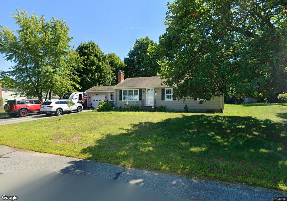
24 Westfield Dr North Attleboro, MA 02760
North Attleboro NeighborhoodEstimated Value: $482,000 - $582,000
3
Beds
1
Bath
1,092
Sq Ft
$484/Sq Ft
Est. Value
About This Home
This home is located at 24 Westfield Dr, North Attleboro, MA 02760 and is currently estimated at $528,796, approximately $484 per square foot. 24 Westfield Dr is a home located in Bristol County with nearby schools including North Attleboro High School, Cadence Academy Preschool - North Attleborough, and St John The Evangelist School.
Ownership History
Date
Name
Owned For
Owner Type
Purchase Details
Closed on
Aug 4, 2020
Sold by
Adams Linda A
Bought by
Harvey Garrett L and Racca Olivia M
Current Estimated Value
Home Financials for this Owner
Home Financials are based on the most recent Mortgage that was taken out on this home.
Original Mortgage
$306,850
Outstanding Balance
$272,198
Interest Rate
3%
Mortgage Type
New Conventional
Estimated Equity
$256,598
Purchase Details
Closed on
May 28, 2013
Sold by
Post Judith A
Bought by
Post Judith A
Purchase Details
Closed on
Jan 1, 1975
Bought by
Post Judith A and Post Stephen A
Create a Home Valuation Report for This Property
The Home Valuation Report is an in-depth analysis detailing your home's value as well as a comparison with similar homes in the area
Home Values in the Area
Average Home Value in this Area
Purchase History
| Date | Buyer | Sale Price | Title Company |
|---|---|---|---|
| Harvey Garrett L | $323,000 | None Available | |
| Post Judith A | -- | -- | |
| Post Judith A | -- | -- |
Source: Public Records
Mortgage History
| Date | Status | Borrower | Loan Amount |
|---|---|---|---|
| Open | Harvey Garrett L | $306,850 |
Source: Public Records
Tax History Compared to Growth
Tax History
| Year | Tax Paid | Tax Assessment Tax Assessment Total Assessment is a certain percentage of the fair market value that is determined by local assessors to be the total taxable value of land and additions on the property. | Land | Improvement |
|---|---|---|---|---|
| 2025 | $5,202 | $441,200 | $133,200 | $308,000 |
| 2024 | $4,921 | $426,400 | $133,200 | $293,200 |
| 2023 | $4,818 | $376,700 | $133,200 | $243,500 |
| 2022 | $4,426 | $317,700 | $133,200 | $184,500 |
| 2021 | $4,476 | $313,700 | $133,200 | $180,500 |
| 2020 | $4,217 | $293,900 | $133,200 | $160,700 |
| 2019 | $4,209 | $295,600 | $121,200 | $174,400 |
| 2018 | $3,493 | $277,100 | $121,200 | $155,900 |
| 2017 | $3,561 | $269,400 | $121,200 | $148,200 |
| 2016 | $3,433 | $259,700 | $134,600 | $125,100 |
| 2015 | $3,360 | $255,700 | $141,400 | $114,300 |
| 2014 | $3,239 | $244,600 | $130,600 | $114,000 |
Source: Public Records
Map
Nearby Homes
- 115 Westfield Dr
- 11 Buckthorn Ln
- 57 Vine St
- 36 Cranberry Rd
- 11 Landry Ave
- 10 Sleepy Hollow Cir
- 546 Towne St
- Lot 2 Jeffrey Dr
- Lot 5 Jeffrey Dr
- 59 Laurelwood Dr
- 122 Mary Ann Way
- 17 Peters Way
- 6 Colts Way
- 20 Sperry Ln
- 16 Raymond Hall Dr
- 12 Houde St
- 70 Sperry Ln Unit Lot 11
- 21 Shady Ln
- 15 Old Wood Rd
- 47 Old Farm Rd
- 36 Westfield Dr
- 224 Kelley Blvd
- 1 Upland Dr
- 124 Westfield Dr
- 3 Upland Dr
- 123 Westfield Dr
- 11 Upland Dr
- 218 Kelley Blvd
- 65 Westfield Dr
- 230 Kelley Blvd
- 46 Westfield Dr
- 21 Upland Dr
- 116 Westfield Dr
- 236 Kelley Blvd
- 212 Kelley Blvd
- 87 Westfield Dr
- 223 Kelley Blvd
- 219 Kelley Blvd
- 215 Kelley Blvd
- 62 Westfield Dr