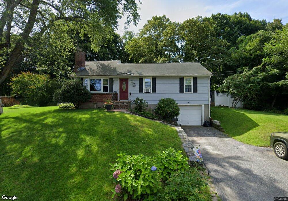
24 Yorktown Rd West Boylston, MA 01583
Estimated Value: $507,219 - $544,000
3
Beds
2
Baths
1,560
Sq Ft
$335/Sq Ft
Est. Value
About This Home
This home is located at 24 Yorktown Rd, West Boylston, MA 01583 and is currently estimated at $523,055, approximately $335 per square foot. 24 Yorktown Rd is a home located in Worcester County with nearby schools including Major Edwards Elementary School, West Boylston Junior/Senior High School, and Abby Kelley Foster Charter Public School.
Ownership History
Date
Name
Owned For
Owner Type
Purchase Details
Closed on
Jul 29, 1999
Sold by
Bloom Glenn A and Bloom Amy L
Bought by
Steeves Sheldon A and Steeves Christine M
Current Estimated Value
Home Financials for this Owner
Home Financials are based on the most recent Mortgage that was taken out on this home.
Original Mortgage
$150,400
Interest Rate
7.61%
Mortgage Type
Purchase Money Mortgage
Purchase Details
Closed on
Feb 23, 1988
Sold by
Covert Theodore B
Bought by
Bloom Glenn A
Create a Home Valuation Report for This Property
The Home Valuation Report is an in-depth analysis detailing your home's value as well as a comparison with similar homes in the area
Home Values in the Area
Average Home Value in this Area
Purchase History
| Date | Buyer | Sale Price | Title Company |
|---|---|---|---|
| Steeves Sheldon A | $150,500 | -- | |
| Bloom Glenn A | $118,000 | -- |
Source: Public Records
Mortgage History
| Date | Status | Borrower | Loan Amount |
|---|---|---|---|
| Open | Bloom Glenn A | $149,100 | |
| Closed | Bloom Glenn A | $49,000 | |
| Closed | Bloom Glenn A | $150,000 | |
| Closed | Bloom Glenn A | $150,400 |
Source: Public Records
Tax History Compared to Growth
Tax History
| Year | Tax Paid | Tax Assessment Tax Assessment Total Assessment is a certain percentage of the fair market value that is determined by local assessors to be the total taxable value of land and additions on the property. | Land | Improvement |
|---|---|---|---|---|
| 2025 | $61 | $438,000 | $94,000 | $344,000 |
| 2024 | $5,900 | $399,200 | $94,000 | $305,200 |
| 2023 | $5,746 | $368,800 | $93,400 | $275,400 |
| 2022 | $5,392 | $305,000 | $93,400 | $211,600 |
| 2021 | $5,226 | $283,100 | $89,600 | $193,500 |
| 2020 | $5,123 | $275,700 | $89,600 | $186,100 |
| 2019 | $4,794 | $254,300 | $89,600 | $164,700 |
| 2018 | $4,573 | $244,300 | $89,600 | $154,700 |
| 2017 | $4,057 | $215,800 | $89,600 | $126,200 |
| 2016 | $3,978 | $215,600 | $83,400 | $132,200 |
| 2015 | $3,804 | $207,400 | $82,500 | $124,900 |
Source: Public Records
Map
Nearby Homes
- 1 Highland Ave
- 12 Birchbrush Ln
- 39 Davidson Rd
- 740 Burncoat St Unit B
- 33 Meola Ave
- 39 Meola Ave
- 33 Isleboro St
- 156 Hillside Village Dr
- 29 Isleboro St
- 1110 W Boylston St Unit A
- 1097 W Boylston St
- 62 Maple St
- 54 Maple St
- 83 Hillside Village Dr
- 59 Santoro Rd
- 97 Hillside Village Dr
- 44 Dixfield St
- 22 Danielles Way
- 26 Danielles Way
- 31 Danielles Way
- 28 Yorktown Rd
- 20 Yorktown Rd
- 27 Edgewood Ave
- 23 Yorktown Rd
- 33 Edgewood Ave
- 32 Yorktown Rd
- 91 Bunkerhill Pkwy
- 16 Yorktown Rd
- 27 Yorktown Rd
- 31 Yorktown Rd
- 21 Edgewood Ave
- 87 Bunkerhill Pkwy
- 36 Yorktown Rd
- 12 Yorktown Rd
- 3 Peach Tree St
- TwentyTwo Edgewood Ave
- 35 Yorktown Rd
- 96 Bunkerhill Pkwy
- 92 Bunkerhill Pkwy
- 31 Highland Ave