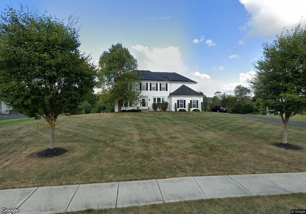
240 Bartlett Dr Mickleton, NJ 08056
East Greenwich AreaEstimated Value: $774,121 - $833,000
About This Home
This home is located at 240 Bartlett Dr, Mickleton, NJ 08056 and is currently estimated at $795,530, approximately $249 per square foot. 240 Bartlett Dr is a home located in Gloucester County with nearby schools including Jeffrey Clark School, Samuel Mickle School, and Kingsway Regional Middle School.
Ownership History
We collect this data history from publicly available records. To have your information removed, we recommend requesting removal directly through your county’s website.
Purchase Details
Home Financials for this Owner
Home Financials are based on the most recent Mortgage that was taken out on this home.Home Values in the Area
Average Home Value in this Area
Purchase History
We collect this data history from publicly available records. To have your information removed, we recommend requesting removal directly through your county’s website.
| Date | Buyer | Sale Price | Title Company |
|---|---|---|---|
| $402,500 | None Available |
Mortgage History
We collect this data history from publicly available records. To have your information removed, we recommend requesting removal directly through your county’s website.
| Date | Status | Borrower | Loan Amount |
|---|---|---|---|
| Open | $248,000 | ||
| Closed | $257,000 | ||
| Closed | $322,000 |
Tax History
We collect this data history from publicly available records. To have your information removed, we recommend requesting removal directly through your county’s website.
| Year | Tax Paid | Tax Assessment Tax Assessment Total Assessment is a certain percentage of the fair market value that is determined by local assessors to be the total taxable value of land and additions on the property. | Land | Improvement |
|---|---|---|---|---|
| 2026 | $14,255 | $447,300 | $115,600 | $331,700 |
| 2025 | $14,255 | $447,300 | $115,600 | $331,700 |
| 2024 | $13,768 | $447,300 | $115,600 | $331,700 |
| 2023 | $13,768 | $447,300 | $115,600 | $331,700 |
| 2022 | $13,379 | $447,300 | $115,600 | $331,700 |
| 2021 | $13,468 | $447,300 | $115,600 | $331,700 |
| 2020 | $13,531 | $447,300 | $115,600 | $331,700 |
| 2019 | $13,392 | $447,300 | $115,600 | $331,700 |
| 2018 | $12,014 | $364,400 | $101,000 | $263,400 |
| 2017 | $11,858 | $364,400 | $101,000 | $263,400 |
| 2016 | $11,719 | $364,400 | $101,000 | $263,400 |
| 2015 | $11,231 | $364,400 | $101,000 | $263,400 |
| 2014 | $10,538 | $364,400 | $101,000 | $263,400 |
Map
- 4 Randolph Ct
- 71 W Tomlin Station Rd
- 68 W Tomlin Station Rd
- 710 Nicole Dr
- 49 W Tomlin Station Rd
- 51 Forage Dr
- 50 Mill Rd
- 705 Elaine Dr
- 120 Asbury Station Rd
- 542 Kings Hwy
- 0 Tomlin Station Rd Unit NJGL2061600
- 159 Mill Rd
- 76 E Tomlin Station Rd
- 112 Waterford Way
- 792 Paulsboro Rd
- 788 Paulsboro Rd
- 55 Woodbury Ct
- 10 & 26 Garwin Rd
- 55 Repaupo Station Rd
- 314 Salarno Ct
- 238 Bartlett Dr
- 236 Bartlett Dr
- 229 Bartlett Dr
- 234 Bartlett Dr
- 242 Bartlett Dr
- 231 Bartlett Dr
- 227 Bartlett Dr
- 232 Bartlett Dr
- 244 Bartlett Dr
- 233 Bartlett Dr
- 225 Bartlett Dr
- 14 Putnam Ct
- 16 Putnam Ct
- 230 Bartlett Dr
- 246 Bartlett Dr
- 12 Putnam Ct
- 18 Putnam Ct
- 223 Bartlett Dr
- 235 Bartlett Dr
- 228 Bartlett Dr Unit 102
Ask me questions while you tour the home.