Estimated Value: $133,000 - $329,512
--
Bed
3
Baths
1,273
Sq Ft
$145/Sq Ft
Est. Value
About This Home
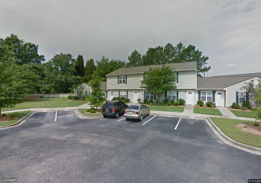
This home is located at 240 Date Palm Cir Unit 240, Aiken, SC 29803 and is currently estimated at $184,628, approximately $145 per square foot. 240 Date Palm Cir Unit 240 is a home located in Aiken County with nearby schools including East Aiken School of the Arts, M.B. Kennedy Middle School, and Aiken Intermediate School.
Ownership History
Date
Name
Owned For
Owner Type
Purchase Details
Closed on
Sep 12, 2025
Sold by
Grier-Tacc1 Llc and Grier-Tacc 1 Llc
Bought by
Mills Hogsed Llc
Current Estimated Value
Home Financials for this Owner
Home Financials are based on the most recent Mortgage that was taken out on this home.
Original Mortgage
$70,833
Outstanding Balance
$70,833
Interest Rate
6.72%
Mortgage Type
Seller Take Back
Estimated Equity
$113,795
Purchase Details
Closed on
Jan 4, 2023
Sold by
United States Of America
Bought by
Grier-Tacc 1 Llc
Purchase Details
Closed on
Jun 10, 2010
Sold by
Nunn Jerry Dean
Bought by
Williams Orgie D
Home Financials for this Owner
Home Financials are based on the most recent Mortgage that was taken out on this home.
Original Mortgage
$96,429
Interest Rate
3.87%
Mortgage Type
VA
Create a Home Valuation Report for This Property
The Home Valuation Report is an in-depth analysis detailing your home's value as well as a comparison with similar homes in the area
Home Values in the Area
Average Home Value in this Area
Purchase History
| Date | Buyer | Sale Price | Title Company |
|---|---|---|---|
| Mills Hogsed Llc | $133,333 | None Listed On Document | |
| Grier-Tacc 1 Llc | $98,000 | -- | |
| Williams Orgie D | $94,400 | -- |
Source: Public Records
Mortgage History
| Date | Status | Borrower | Loan Amount |
|---|---|---|---|
| Open | Mills Hogsed Llc | $70,833 | |
| Previous Owner | Williams Orgie D | $96,429 |
Source: Public Records
Tax History Compared to Growth
Tax History
| Year | Tax Paid | Tax Assessment Tax Assessment Total Assessment is a certain percentage of the fair market value that is determined by local assessors to be the total taxable value of land and additions on the property. | Land | Improvement |
|---|---|---|---|---|
| 2025 | $1,399 | $5,500 | -- | -- |
| 2023 | $1,290 | $5,500 | $1,080 | $73,630 |
| 2022 | $1,275 | $5,500 | $0 | $0 |
| 2021 | $1,276 | $5,500 | $0 | $0 |
| 2020 | $1,135 | $4,800 | $0 | $0 |
| 2019 | $1,135 | $4,800 | $0 | $0 |
| 2018 | $298 | $4,800 | $1,080 | $3,720 |
| 2017 | $1,112 | $0 | $0 | $0 |
| 2016 | $1,113 | $0 | $0 | $0 |
| 2015 | $1,312 | $0 | $0 | $0 |
| 2014 | $1,313 | $0 | $0 | $0 |
| 2013 | -- | $0 | $0 | $0 |
Source: Public Records
Map
Nearby Homes
- 500 Date Palm Cir
- Lot 8 Bolton Ct
- Lot 9 Bolton Ct
- 0 E Pine Log Rd Unit 1575901
- 4068 Sorensten Dr
- 4047 Sorensten Dr
- 107 Robinwood Dr
- 159 Mallard Lake Dr
- 327 Southbank Dr
- 503 E Pine Log Rd
- 260 Southbank Dr
- 124 Driftwood Cir
- 1570 Powderhouse Rd SE
- 515 Henry St
- 221 Surrey Cir
- 1244 Carriage Dr
- 115 Poplar Place
- 118 Fox Haven Dr
- 543 Wildhaven Dr
- 103 Clifton St
- 230 Date Palm Cir
- 220 Date Palm Cir
- 250 Date Palm Cir Unit 250
- 210 Date Palm Cir
- 300 Date Palm Cir Unit 300
- 310 Date Palm Cir
- 320 Date Palm Cir
- 330 Date Palm Cir
- 340 Date Palm Cir
- 350 Date Palm Cir Unit 350
- 400 Date Palm Cir Unit 400
- 410 Date Palm Cir
- 650 Date Palm Cir
- 420 Date Palm Cir
- 430 Date Palm Cir
- 640 Date Palm Cir
- 170 Sierra Dr
- 440 Date Palm Cir
- 630 Date Palm Cir
- 176 Sierra Dr