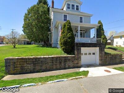
240 Dewey St Morgantown, WV 26501
South Park NeighborhoodEstimated Value: $260,000 - $359,000
4
Beds
3
Baths
2,445
Sq Ft
$135/Sq Ft
Est. Value
About This Home
This home is located at 240 Dewey St, Morgantown, WV 26501 and is currently estimated at $329,029, approximately $134 per square foot. 240 Dewey St is a home located in Monongalia County with nearby schools including Mountainview Elementary School, South Middle School, and Morgantown High School.
Ownership History
Date
Name
Owned For
Owner Type
Purchase Details
Closed on
Dec 19, 2022
Sold by
Nacarate Keith A
Bought by
Boland Christopher J and Boland Courtney D
Current Estimated Value
Home Financials for this Owner
Home Financials are based on the most recent Mortgage that was taken out on this home.
Original Mortgage
$292,500
Outstanding Balance
$284,988
Interest Rate
6.61%
Mortgage Type
New Conventional
Estimated Equity
$34,482
Create a Home Valuation Report for This Property
The Home Valuation Report is an in-depth analysis detailing your home's value as well as a comparison with similar homes in the area
Home Values in the Area
Average Home Value in this Area
Purchase History
| Date | Buyer | Sale Price | Title Company |
|---|---|---|---|
| Boland Christopher J | $325,000 | -- | |
| Nacarate Keith A | -- | -- |
Source: Public Records
Mortgage History
| Date | Status | Borrower | Loan Amount |
|---|---|---|---|
| Open | Boland Christopher J | $292,500 | |
| Previous Owner | Nacarate Keith A | $92,000 | |
| Previous Owner | Nacarate Keith A | $113,300 | |
| Previous Owner | Nacarate Keith A | $135,660 |
Source: Public Records
Tax History Compared to Growth
Tax History
| Year | Tax Paid | Tax Assessment Tax Assessment Total Assessment is a certain percentage of the fair market value that is determined by local assessors to be the total taxable value of land and additions on the property. | Land | Improvement |
|---|---|---|---|---|
| 2024 | $2,022 | $153,660 | $35,640 | $118,020 |
| 2023 | $2,022 | $107,880 | $35,640 | $72,240 |
| 2022 | $1,323 | $103,800 | $35,640 | $68,160 |
| 2021 | $1,331 | $103,980 | $35,640 | $68,340 |
| 2020 | $1,264 | $98,400 | $35,640 | $62,760 |
| 2019 | $1,273 | $98,580 | $35,640 | $62,940 |
| 2018 | $1,278 | $98,700 | $35,640 | $63,060 |
| 2017 | $58 | $4,440 | $4,440 | $0 |
| 2016 | $51 | $3,900 | $3,900 | $0 |
| 2015 | $40 | $3,180 | $3,180 | $0 |
| 2014 | $31 | $2,520 | $2,520 | $0 |
Source: Public Records
Map
Nearby Homes
- 216 Reay Alley
- 309 Green St
- 436 Pennsylvania Ave
- 204 Kingwood St
- 574 Pennsylvania Ave
- 629 Brockway Ave
- 125 Park St
- 301 E Brockway Ave
- 401 Conn St
- 320 Ash St
- 332 E Brockway Ave
- 236 Cobun Ave
- 408 Forest Ave
- 417 Forest Ave
- 409 Forest Ave
- 390 Forest Ave
- 450 Dallas St
- 466 Dallas St
- 315 Nolan Ave
- 416 E Brockway Ave