Estimated Value: $428,561 - $445,000
4
Beds
3
Baths
2,458
Sq Ft
$176/Sq Ft
Est. Value
About This Home
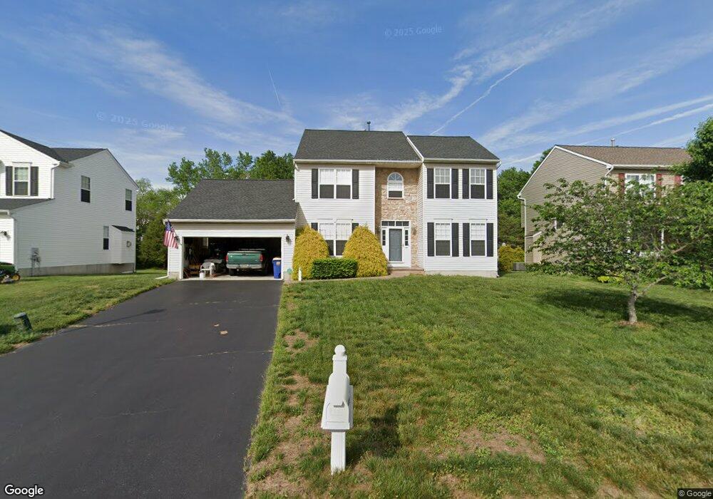
This home is located at 240 Norton Cir, Dover, DE 19904 and is currently estimated at $433,390, approximately $176 per square foot. 240 Norton Cir is a home located in Kent County with nearby schools including Towne Point Elementary School, William Henry Middle School, and Central Middle School.
Ownership History
Date
Name
Owned For
Owner Type
Purchase Details
Closed on
Apr 29, 2010
Sold by
Dunlap Lamont and Dunlap Brenda Y
Bought by
Desbrow Earl P and Desbrow Judith W
Current Estimated Value
Home Financials for this Owner
Home Financials are based on the most recent Mortgage that was taken out on this home.
Original Mortgage
$197,520
Outstanding Balance
$132,000
Interest Rate
4.99%
Mortgage Type
New Conventional
Estimated Equity
$301,390
Create a Home Valuation Report for This Property
The Home Valuation Report is an in-depth analysis detailing your home's value as well as a comparison with similar homes in the area
Home Values in the Area
Average Home Value in this Area
Purchase History
| Date | Buyer | Sale Price | Title Company |
|---|---|---|---|
| Desbrow Earl P | $246,900 | None Available |
Source: Public Records
Mortgage History
| Date | Status | Borrower | Loan Amount |
|---|---|---|---|
| Open | Desbrow Earl P | $197,520 |
Source: Public Records
Tax History
| Year | Tax Paid | Tax Assessment Tax Assessment Total Assessment is a certain percentage of the fair market value that is determined by local assessors to be the total taxable value of land and additions on the property. | Land | Improvement |
|---|---|---|---|---|
| 2025 | $2,039 | $346,000 | $93,900 | $252,100 |
| 2024 | $1,918 | $346,000 | $93,900 | $252,100 |
| 2023 | $1,590 | $55,300 | $3,800 | $51,500 |
| 2022 | $1,508 | $55,300 | $3,800 | $51,500 |
| 2021 | $1,542 | $55,300 | $3,800 | $51,500 |
| 2020 | $1,477 | $55,300 | $3,800 | $51,500 |
| 2019 | $1,394 | $55,300 | $3,800 | $51,500 |
| 2018 | $1,272 | $55,300 | $3,800 | $51,500 |
| 2017 | $1,254 | $55,300 | $0 | $0 |
| 2016 | $1,101 | $55,300 | $0 | $0 |
| 2015 | $1,074 | $55,300 | $0 | $0 |
| 2014 | $1,074 | $55,300 | $0 | $0 |
Source: Public Records
Map
Nearby Homes
- 2187 Lynnbury Woods Rd
- 78 Slate Rd
- 138 Basalt Dr
- 125 Potash Rd
- 13 Brayton Place
- 90 Potash Rd
- 6215 N Dupont Hwy
- 397 Boggs Run
- 1153 Charleston Cir Unit JEFFERSON
- 1153 Charleston Cir Unit LEGEND
- 1153 Charleston Cir Unit CHARLESTON
- 1153 Charleston Cir Unit GLADWYN
- 1153 Charleston Cir Unit HANCOCK
- 1153 Charleston Cir Unit BRANDYWINE
- 1153 Charleston Cir Unit ABBOTT
- 1153 Charleston Cir Unit BERKSHIRE
- 219 Wheatsheaf Ln
- Lot 16 Dodge Dr
- 211 Laks Ct Unit BERKSHIRE
- 211 Laks Ct Unit BRANDYWINE
Your Personal Tour Guide
Ask me questions while you tour the home.