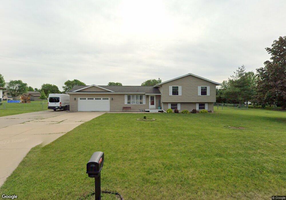
240 S Mentzer Rd Robins, IA 52328
Estimated Value: $285,000 - $347,000
3
Beds
3
Baths
1,683
Sq Ft
$184/Sq Ft
Est. Value
About This Home
This home is located at 240 S Mentzer Rd, Robins, IA 52328 and is currently estimated at $310,073, approximately $184 per square foot. 240 S Mentzer Rd is a home located in Linn County with nearby schools including Nixon Elementary School, Harding Middle School, and John F. Kennedy High School.
Ownership History
Date
Name
Owned For
Owner Type
Purchase Details
Closed on
Oct 19, 2010
Sold by
Robertson Martin and Robertson Diana
Bought by
England Julie M
Current Estimated Value
Home Financials for this Owner
Home Financials are based on the most recent Mortgage that was taken out on this home.
Original Mortgage
$147,200
Outstanding Balance
$97,186
Interest Rate
4.36%
Mortgage Type
New Conventional
Estimated Equity
$212,887
Purchase Details
Closed on
Aug 15, 2003
Sold by
Boonstra Daniel E and Boonstra Patricia A
Bought by
Robertson Martin and Robertson Diana
Home Financials for this Owner
Home Financials are based on the most recent Mortgage that was taken out on this home.
Original Mortgage
$119,960
Interest Rate
5.87%
Mortgage Type
Purchase Money Mortgage
Create a Home Valuation Report for This Property
The Home Valuation Report is an in-depth analysis detailing your home's value as well as a comparison with similar homes in the area
Home Values in the Area
Average Home Value in this Area
Purchase History
| Date | Buyer | Sale Price | Title Company |
|---|---|---|---|
| England Julie M | $183,500 | None Available | |
| Robertson Martin | $149,500 | -- |
Source: Public Records
Mortgage History
| Date | Status | Borrower | Loan Amount |
|---|---|---|---|
| Open | England Julie M | $147,200 | |
| Previous Owner | Robertson Martin | $119,960 | |
| Closed | Robertson Martin | $29,990 |
Source: Public Records
Tax History Compared to Growth
Tax History
| Year | Tax Paid | Tax Assessment Tax Assessment Total Assessment is a certain percentage of the fair market value that is determined by local assessors to be the total taxable value of land and additions on the property. | Land | Improvement |
|---|---|---|---|---|
| 2025 | $3,078 | $280,600 | $47,400 | $233,200 |
| 2024 | $3,130 | $238,500 | $47,400 | $191,100 |
| 2023 | $3,130 | $238,500 | $47,400 | $191,100 |
| 2022 | $3,332 | $214,300 | $47,400 | $166,900 |
| 2021 | $3,260 | $214,300 | $47,400 | $166,900 |
| 2020 | $3,260 | $194,900 | $47,400 | $147,500 |
| 2019 | $3,020 | $184,400 | $47,400 | $137,000 |
| 2018 | $2,970 | $184,400 | $47,400 | $137,000 |
| 2017 | $3,026 | $175,900 | $47,400 | $128,500 |
| 2016 | $3,026 | $175,900 | $47,400 | $128,500 |
| 2015 | $3,036 | $175,900 | $47,400 | $128,500 |
| 2014 | $2,886 | $175,900 | $47,400 | $128,500 |
| 2013 | $2,820 | $175,900 | $47,400 | $128,500 |
Source: Public Records
Map
Nearby Homes
- 745 Eastview Dr
- 9124 Grand Oaks Dr NE
- 8926 Norway Dr NE
- 495 Woodview Ave
- 8908 Norway Dr NE
- 199 Shelly Dr
- 8809 Middlebury Ct NE
- 325 Landau St
- 9615 Grand Oaks Dr NE
- 8615 Harrington Dr NE
- 320 Shannon Dr
- 210 Brougham Rd
- 1321 Winchell Dr NE
- 70.78 Acres M L Quass Rd
- 3000 Trailside Dr
- 0 Maple St
- 400 S Troy Rd
- 1275 E Knoll Dr
- 8201 Council St NE
- 525 Chestnut Dr
- 200 S Mentzer Rd
- 260 S Mentzer Rd
- 25 Charlotte Ct
- 255 S Mentzer Rd
- 30 Charlotte Ct
- 295 S Mentzer Rd
- 110 S Mentzer Rd
- 795 Eastview Dr
- 45 Kinson Ct
- 35 Kinson Ct
- 15 Charlotte Ct
- 280 S Mentzer Rd
- 355 S Mentzer Rd
- 10 Charlotte Ct
- 220 Camelot Place
- 425 S Mentzer Rd
- 300 Camelot Place
- 40 Kinson Ct
- 25 Kinson Ct
- 360 Camelot Place