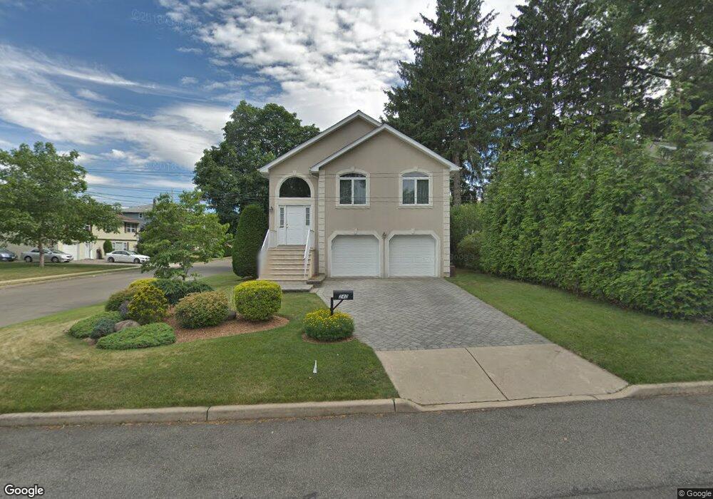
240 West St New Milford, NJ 07646
Estimated Value: $766,000 - $832,000
--
Bed
--
Bath
2,320
Sq Ft
$346/Sq Ft
Est. Value
About This Home
This home is located at 240 West St, New Milford, NJ 07646 and is currently estimated at $803,829, approximately $346 per square foot. 240 West St is a home located in Bergen County with nearby schools including New Milford High School, Top Stone Montesorri, and Solomon Schechter Day School.
Ownership History
Date
Name
Owned For
Owner Type
Purchase Details
Closed on
Aug 25, 2009
Sold by
Betz Gerard and Betz Richard
Bought by
Betz William E
Current Estimated Value
Purchase Details
Closed on
Nov 27, 2002
Sold by
15 Wakelee Drive Corp
Bought by
Betz William E and Betz Edward R
Purchase Details
Closed on
Jun 18, 2002
Sold by
Jordan Walter
Bought by
15 Wakelee Drive Corp
Home Financials for this Owner
Home Financials are based on the most recent Mortgage that was taken out on this home.
Original Mortgage
$200,000
Interest Rate
6.92%
Create a Home Valuation Report for This Property
The Home Valuation Report is an in-depth analysis detailing your home's value as well as a comparison with similar homes in the area
Home Values in the Area
Average Home Value in this Area
Purchase History
| Date | Buyer | Sale Price | Title Company |
|---|---|---|---|
| Betz William E | $100,000 | -- | |
| Betz William E | $427,000 | -- | |
| 15 Wakelee Drive Corp | $91,000 | -- |
Source: Public Records
Mortgage History
| Date | Status | Borrower | Loan Amount |
|---|---|---|---|
| Previous Owner | 15 Wakelee Drive Corp | $200,000 |
Source: Public Records
Tax History Compared to Growth
Tax History
| Year | Tax Paid | Tax Assessment Tax Assessment Total Assessment is a certain percentage of the fair market value that is determined by local assessors to be the total taxable value of land and additions on the property. | Land | Improvement |
|---|---|---|---|---|
| 2025 | $15,624 | $689,400 | $394,100 | $295,300 |
| 2024 | $15,159 | $387,200 | $158,800 | $228,400 |
| 2023 | $14,415 | $387,200 | $158,800 | $228,400 |
| 2022 | $14,415 | $387,200 | $158,800 | $228,400 |
| 2021 | $14,125 | $387,200 | $158,800 | $228,400 |
| 2020 | $13,959 | $387,200 | $158,800 | $228,400 |
| 2019 | $13,719 | $387,200 | $158,800 | $228,400 |
| 2018 | $13,358 | $387,200 | $158,800 | $228,400 |
| 2017 | $13,087 | $387,200 | $158,800 | $228,400 |
| 2016 | $12,863 | $387,200 | $158,800 | $228,400 |
| 2015 | $12,603 | $387,200 | $158,800 | $228,400 |
| 2014 | $12,228 | $387,200 | $158,800 | $228,400 |
Source: Public Records
Map
Nearby Homes
- 335 River Rd
- 211 Madison Ave
- 227 Milford Ave
- 274 Milford Ave
- 421 Ryeside Ave
- 243 Main St
- 227 Cedar Rd
- 256 Stevens Ct
- 410 Monroe Ave
- 171 Cleveland St
- 147 Pine Ave
- 314 Hirshfeld Place
- 552 Ryeside Ave
- 5 Lawrence Ave
- 652 Stockton St
- 595 Duke Rd
- 133 Center St Unit E5
- 140 River Edge Ave
- 109 Center St
- 855 Kinderkamack Rd