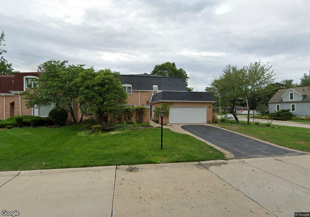
2400 Colony Ct Northbrook, IL 60062
Estimated Value: $886,262 - $948,000
4
Beds
3
Baths
2,832
Sq Ft
$322/Sq Ft
Est. Value
About This Home
This home is located at 2400 Colony Ct, Northbrook, IL 60062 and is currently estimated at $910,816, approximately $321 per square foot. 2400 Colony Ct is a home located in Cook County with nearby schools including Westmoor Elementary School, Northbrook Junior High School, and Glenbrook North High School.
Ownership History
Date
Name
Owned For
Owner Type
Purchase Details
Closed on
Nov 27, 2017
Sold by
Stamos James J
Bought by
Gao Wei and Pan Xiaoming
Current Estimated Value
Home Financials for this Owner
Home Financials are based on the most recent Mortgage that was taken out on this home.
Original Mortgage
$433,500
Outstanding Balance
$364,686
Interest Rate
3.91%
Mortgage Type
New Conventional
Estimated Equity
$546,130
Purchase Details
Closed on
Nov 6, 2003
Sold by
Stamos John J
Bought by
Stamos John J
Create a Home Valuation Report for This Property
The Home Valuation Report is an in-depth analysis detailing your home's value as well as a comparison with similar homes in the area
Home Values in the Area
Average Home Value in this Area
Purchase History
| Date | Buyer | Sale Price | Title Company |
|---|---|---|---|
| Gao Wei | $510,000 | None Available | |
| Stamos John J | -- | -- |
Source: Public Records
Mortgage History
| Date | Status | Borrower | Loan Amount |
|---|---|---|---|
| Open | Gao Wei | $433,500 |
Source: Public Records
Tax History Compared to Growth
Tax History
| Year | Tax Paid | Tax Assessment Tax Assessment Total Assessment is a certain percentage of the fair market value that is determined by local assessors to be the total taxable value of land and additions on the property. | Land | Improvement |
|---|---|---|---|---|
| 2024 | $12,291 | $57,119 | $10,277 | $46,842 |
| 2023 | $11,899 | $57,119 | $10,277 | $46,842 |
| 2022 | $11,899 | $57,119 | $10,277 | $46,842 |
| 2021 | $10,762 | $46,410 | $8,300 | $38,110 |
| 2020 | $10,602 | $46,410 | $8,300 | $38,110 |
| 2019 | $11,032 | $51,000 | $8,300 | $42,700 |
| 2018 | $10,495 | $51,000 | $7,312 | $43,688 |
| 2017 | $11,635 | $51,000 | $7,312 | $43,688 |
| 2016 | $12,675 | $63,357 | $7,312 | $56,045 |
| 2015 | $10,732 | $49,795 | $6,126 | $43,669 |
| 2014 | $10,273 | $49,795 | $6,126 | $43,669 |
| 2013 | $10,780 | $53,655 | $6,126 | $47,529 |
Source: Public Records
Map
Nearby Homes
- 2409 Center Ave
- 2411 Woodlawn Rd
- 2117 Illinois Rd
- 2022 Center Ave
- 1445 Pfingsten Rd
- 1455 Shermer Rd Unit 208C
- 1435 Pfingsten Rd
- 1331 Pfingsten Rd
- 1611 Pfingsten Rd
- 2810 Weller Ln
- 1746 Ellendale Dr
- 1060 Cedar Ln
- 945 Hawthorne Ln
- 1922 Lincoln Ave
- 1947 Summerton Place
- 821 Woodbine Ln
- 1928 Somerset Ln Unit 54
- 1721 Elm Ave
- 1781 Tudor Ln Unit 308
- 2814 Crimson Ct
- 2408 Colony Ct
- 2349 Walters Ave
- 2401 Colony Ct
- 2416 Colony Ct
- 2409 Colony Ct
- 1394 Western Ave
- 2408 Walters Ave
- 2412 Walters Ave
- 2345 Walters Ave
- 2422 Colony Ct
- 2417 Colony Ct
- 2425 Colony Ct
- 1343 Western Ave
- 2339 Walters Ave
- 2424 Walters Ave
- 2400 Maple Ave
- 2412 Maple Ave
- 1382 Western Ave
- 2423 Walters Ave
- 2413 Center Ave