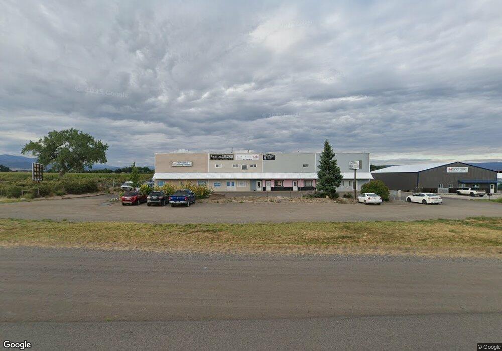
2400 E Main St Unit F Montrose, CO 81401
Estimated Value: $160,790
Studio
4
Baths
1,655
Sq Ft
$97/Sq Ft
Est. Value
About This Home
This home is located at 2400 E Main St Unit F, Montrose, CO 81401 and is currently estimated at $160,790, approximately $97 per square foot. 2400 E Main St Unit F is a home located in Montrose County with nearby schools including Johnson Elementary School, Centennial Middle School, and Montrose High School.
Ownership History
Date
Name
Owned For
Owner Type
Purchase Details
Closed on
Aug 9, 2019
Sold by
Jack A Mitchek Trust No 1
Bought by
Arbaney Michael E
Current Estimated Value
Home Financials for this Owner
Home Financials are based on the most recent Mortgage that was taken out on this home.
Original Mortgage
$40,250
Interest Rate
3.73%
Purchase Details
Closed on
Oct 1, 2008
Sold by
Firstview Communications Llc
Bought by
Mitchek Jack
Purchase Details
Closed on
Dec 8, 2000
Sold by
Coram Gary and Coram Lisa A
Bought by
Firstview Communications Llc
Create a Home Valuation Report for This Property
The Home Valuation Report is an in-depth analysis detailing your home's value as well as a comparison with similar homes in the area
Purchase History
| Date | Buyer | Sale Price | Title Company |
|---|---|---|---|
| Arbaney Michael E | $95,000 | Land Title Guarantee | |
| Mitchek Jack | -- | None Available | |
| Firstview Communications Llc | $160,000 | -- |
Source: Public Records
Mortgage History
| Date | Status | Borrower | Loan Amount |
|---|---|---|---|
| Closed | Arbaney Michael E | $40,250 |
Source: Public Records
Tax History
| Year | Tax Paid | Tax Assessment Tax Assessment Total Assessment is a certain percentage of the fair market value that is determined by local assessors to be the total taxable value of land and additions on the property. | Land | Improvement |
|---|---|---|---|---|
| 2025 | $2,499 | $71,120 | $35,560 | $35,560 |
| 2024 | $2,521 | $34,980 | $0 | $34,980 |
| 2023 | $2,538 | $36,360 | $0 | $36,360 |
| 2022 | $2,035 | $29,150 | $0 | $29,150 |
| 2021 | $2,037 | $29,150 | $0 | $29,150 |
| 2020 | $1,785 | $26,250 | $0 | $26,250 |
| 2019 | $1,796 | $26,250 | $0 | $26,250 |
Source: Public Records
Map
Nearby Homes
- 13+ Acres Highway 50
- TBD Highway 50 Iron Horse Dr
- 2141 tbd Oregon St
- 67133 Locust Rd
- 133 Castle Ave
- 266 Crossroads Cir
- 230 Crossroads Cir
- 2091 Locust Rd
- 33 Pullman St
- 2500 Columbine Ln
- 403 6600 Rd
- 381 6600 Rd
- 224 Sage Dr
- 383 S Hillcrest Dr Unit 62
- 383 S Hillcrest Dr Unit 49
- 383 S Hillcrest Dr Unit 30
- 383 S Hillcrest Dr Unit 13
- 1513 Arizona St
- 2806 Bluebell Ct
- TBD Lot 11 E Star Ct
- 2400 E Main St Unit F
- 2400 E Main St Unit G
- 2400 E Main St Unit B & C
- 2390 E Main St
- 13.33 Acres Highway 50
- 71150 E Main St
- E Hwy 50 Hwy Unit 271
- E Hwy 50 Hwy
- E Hwy 50 Hwy Unit 18
- & 2330 E Main St
- 2320 E Highway 50
- 2320 E Main St
- 2320 E Main St
- 2540 Locust Rd
- TBD 46.73 Ac Highway 50
- 2370 Locust Rd
- Q 72 Rd
- 2233 E Main St
- 2530 Locust Rd
- 2460 Locust Rd
Your Personal Tour Guide
Ask me questions while you tour the home.