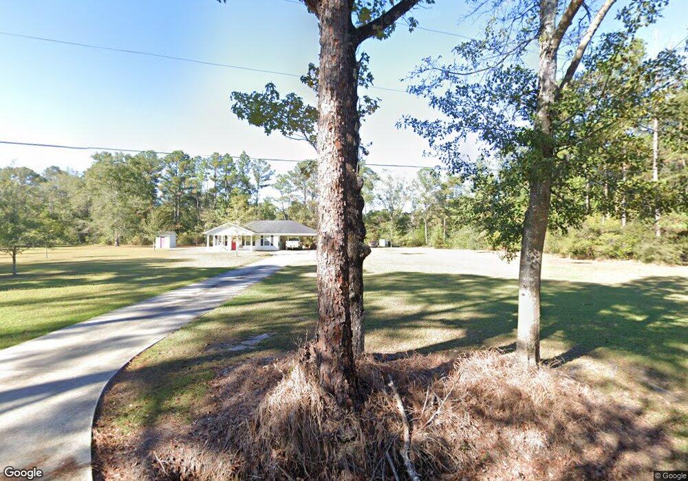
2400 Ellis Merchant Rd Moss Point, MS 39562
Estimated Value: $302,000 - $627,232
4
Beds
3
Baths
3,394
Sq Ft
$128/Sq Ft
Est. Value
About This Home
This home is located at 2400 Ellis Merchant Rd, Moss Point, MS 39562 and is currently estimated at $434,808, approximately $128 per square foot. 2400 Ellis Merchant Rd is a home located in Jackson County with nearby schools including East Central Lower Elementary School, East Central Upper Elementary School, and East Central Middle School.
Ownership History
Date
Name
Owned For
Owner Type
Purchase Details
Closed on
Feb 10, 2018
Sold by
Payne 3Rd Phillip E
Bought by
Forman Matthew and Forman Haley
Current Estimated Value
Purchase Details
Closed on
Jan 27, 2017
Sold by
Robinson Jessie Royce
Bought by
Payne Phillip E
Purchase Details
Closed on
Jan 25, 2011
Sold by
Matthews Jerry G and Matthews Lisa G
Bought by
Matthews Lisa G
Create a Home Valuation Report for This Property
The Home Valuation Report is an in-depth analysis detailing your home's value as well as a comparison with similar homes in the area
Home Values in the Area
Average Home Value in this Area
Purchase History
| Date | Buyer | Sale Price | Title Company |
|---|---|---|---|
| Forman Matthew | -- | -- | |
| Payne Phillip E | -- | None Available | |
| Matthews Lisa G | -- | -- |
Source: Public Records
Tax History Compared to Growth
Tax History
| Year | Tax Paid | Tax Assessment Tax Assessment Total Assessment is a certain percentage of the fair market value that is determined by local assessors to be the total taxable value of land and additions on the property. | Land | Improvement |
|---|---|---|---|---|
| 2024 | $4,096 | $36,605 | $1,041 | $35,564 |
| 2023 | $4,096 | $36,628 | $1,064 | $35,564 |
| 2022 | $3,977 | $36,652 | $1,088 | $35,564 |
| 2021 | $3,987 | $36,757 | $1,113 | $35,644 |
| 2020 | $4,291 | $35,504 | $1,094 | $34,410 |
| 2019 | $94 | $774 | $774 | $0 |
| 2018 | $110 | $888 | $888 | $0 |
| 2017 | $108 | $855 | $855 | $0 |
| 2016 | $96 | $788 | $788 | $0 |
| 2015 | $87 | $4,760 | $4,760 | $0 |
| 2014 | $79 | $653 | $653 | $0 |
| 2013 | $1,953 | $24,701 | $1,120 | $23,581 |
Source: Public Records
Map
Nearby Homes
- 21629 Mississippi 63
- 2530 Hardy Parker Rd
- 3513 Jerry Davis Rd
- 19029 Roger Davis Rd
- 5402 Huckleberry Ln
- 17116 Pierce St
- 6105 Mccormack Rd
- 0 Cedar Creek Rd
- 24040 Robert e Lee Rd
- 21217 E Trails End Rd
- 0 Big Point Unit 4125782
- 6201 Lum Reeves Rd
- 0 Mississippi 614
- 24900 Highway 613
- 0 Davis Dead River Dr Unit 4084515
- 0 Cypress Lake Rd
- 0 Dr Unit 4052148
- 0 Big Cedar Creek Rd
- 0 Hwy 613 Unit 4108899
- 0 Hwy 613 Unit 4123325
- 00 Ellis Merchant Rd
- 2321 Ellis Merchant Rd
- 2313 Ellis Merchant Rd
- 2313 Ellis Merchant Rd
- 2209 Ellis Merchant Rd
- 2329 Ellis Merchant Rd
- 0 Ellis Merchant
- 2412 Ellis Merchant Rd
- 23.87 AC 23 87 Ac Ellis Merchant Rd
- 2437 Ellis Merchant Rd
- 2193 Ellis Merchant Rd
- 2302 Tearose Ln
- 2520 Ellis Merchant Rd
- 21309 Clifford Johnson Rd
- 0 Tearose Ln
- 2500 Tearose Ln
- 2300 Tearose Ln
- 20752 Highway 63
- 21352 Clifford Johnson Rd
- 21432 Clifford Johnson Rd