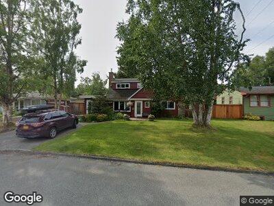
2400 Foraker Dr Anchorage, AK 99517
Turnagain NeighborhoodEstimated Value: $261,000 - $598,000
4
Beds
2
Baths
1,986
Sq Ft
$236/Sq Ft
Est. Value
About This Home
This home is located at 2400 Foraker Dr, Anchorage, AK 99517 and is currently estimated at $467,872, approximately $235 per square foot. 2400 Foraker Dr is a home located in Anchorage Municipality with nearby schools including Turnagain Elementary School, Romig Middle School, and West High School.
Ownership History
Date
Name
Owned For
Owner Type
Purchase Details
Closed on
Sep 17, 2002
Sold by
Miller Lloyd B and Lawson Carole M
Bought by
Grisham Michael A and Hall Helena L
Current Estimated Value
Home Financials for this Owner
Home Financials are based on the most recent Mortgage that was taken out on this home.
Original Mortgage
$251,750
Interest Rate
6.24%
Create a Home Valuation Report for This Property
The Home Valuation Report is an in-depth analysis detailing your home's value as well as a comparison with similar homes in the area
Home Values in the Area
Average Home Value in this Area
Purchase History
| Date | Buyer | Sale Price | Title Company |
|---|---|---|---|
| Grisham Michael A | -- | -- |
Source: Public Records
Mortgage History
| Date | Status | Borrower | Loan Amount |
|---|---|---|---|
| Open | Grisham Michael A | $325,000 | |
| Closed | Grisham Michael A | $332,000 | |
| Closed | Grisham Michael A | $256,500 | |
| Closed | Grisham Michael A | $251,750 |
Source: Public Records
Tax History Compared to Growth
Tax History
| Year | Tax Paid | Tax Assessment Tax Assessment Total Assessment is a certain percentage of the fair market value that is determined by local assessors to be the total taxable value of land and additions on the property. | Land | Improvement |
|---|---|---|---|---|
| 2024 | $6,750 | $493,100 | $191,300 | $301,800 |
| 2023 | $7,837 | $460,200 | $191,300 | $268,900 |
| 2022 | $6,941 | $462,200 | $191,200 | $271,000 |
| 2021 | $7,401 | $410,700 | $191,200 | $219,500 |
| 2020 | $6,214 | $415,800 | $191,200 | $224,600 |
| 2019 | $5,791 | $404,000 | $191,200 | $212,800 |
| 2018 | $5,784 | $402,700 | $191,200 | $211,500 |
| 2017 | $6,251 | $419,200 | $191,200 | $228,000 |
| 2016 | $5,784 | $428,900 | $180,800 | $248,100 |
| 2015 | $5,784 | $439,500 | $181,300 | $258,200 |
| 2014 | $5,784 | $401,100 | $181,300 | $219,800 |
Source: Public Records
Map
Nearby Homes
- 3601 Knik Ave
- 2535 Saint Elias Dr
- 2422 Telequana Dr
- 3835 Carleton Ave
- 2904 W Northern Lights Blvd Unit 7F
- 2841 W 29th Ave Unit 7A
- 3107 W 31st Ave
- 2447 Loussac Dr
- 2808 W 29th Ave
- 2707 W 31st Ave
- 2140 Atwood Dr
- 4110 Woronzof Dr
- 2512 Forest Park Dr
- 3008 Barbara St
- 4241 Bridle Cir
- 4230 Woronzof Dr Unit D
- 2923 Captain Cook Estates Cir
- 3517 Vintage Cir
- 1665 Bob Atwood Cir Unit 7
- 2921 Wiley Post Ave
- 2400 Foraker Dr
- 2414 Foraker Dr
- 2314 Foraker Dr
- 2401 Susitna Dr
- 2424 Foraker Dr
- 2415 Susitna Dr
- 2315 Susitna Dr
- 2306 Foraker Dr
- 2401 Foraker Dr
- 2425 Susitna Dr
- 2315 Foraker Dr
- 2415 Foraker Dr
- 2305 Susitna Dr
- 2434 Foraker Dr
- 2305 Foraker Dr
- 3231 Redoubt Ct
- 2224 Foraker Dr
- 2437 Susitna Dr
- 2239 Susitna Dr
- 2500 Foraker Dr