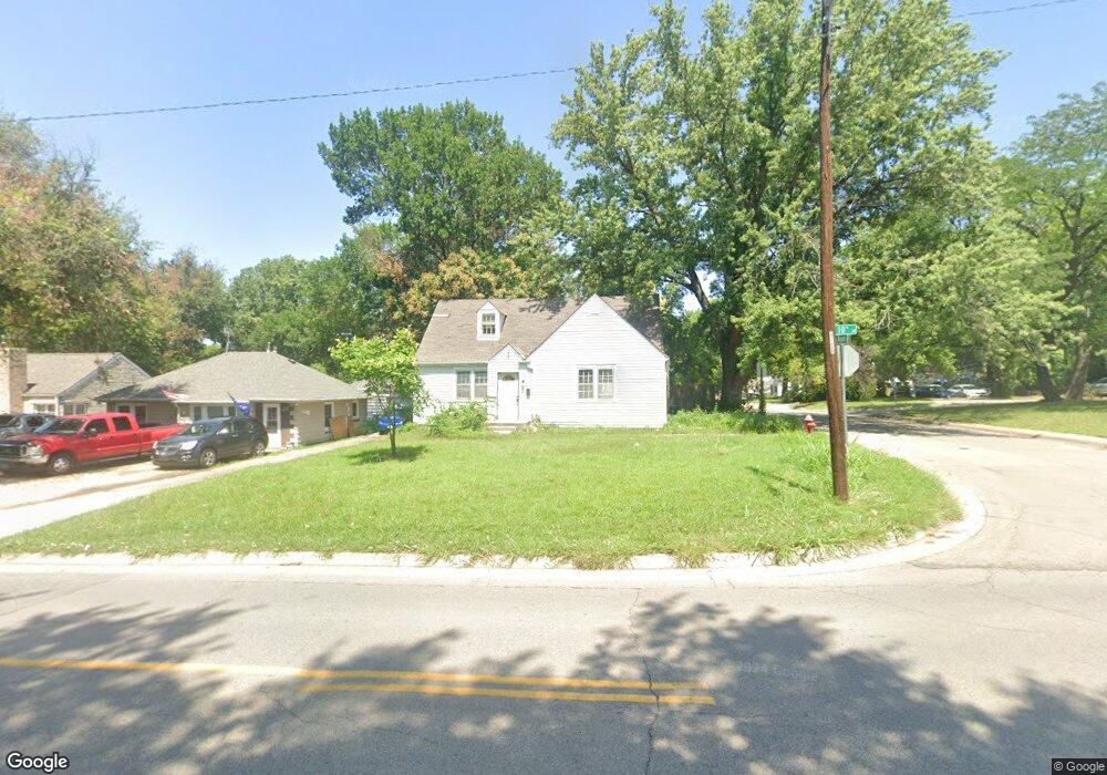
2400 SW 10th Ave Topeka, KS 66604
Central Topeka NeighborhoodEstimated Value: $147,000 - $175,000
3
Beds
1
Bath
1,512
Sq Ft
$103/Sq Ft
Est. Value
About This Home
This home is located at 2400 SW 10th Ave, Topeka, KS 66604 and is currently estimated at $156,105, approximately $103 per square foot. 2400 SW 10th Ave is a home located in Shawnee County with nearby schools including Martin Park Elementary School, Lowman Hill Elementary School, and Landon Middle School.
Ownership History
Date
Name
Owned For
Owner Type
Purchase Details
Closed on
Aug 28, 2025
Sold by
Michael D And Rose M Steenhoven Trust and Steenhoven Michael D
Bought by
Thurman Troy and Grammer Kelly
Current Estimated Value
Purchase Details
Closed on
Apr 21, 2009
Sold by
Bank Of America Na
Bought by
Steenhoven Michael D and Steenhoven Rose M
Home Financials for this Owner
Home Financials are based on the most recent Mortgage that was taken out on this home.
Original Mortgage
$57,600
Interest Rate
5.14%
Mortgage Type
Future Advance Clause Open End Mortgage
Purchase Details
Closed on
Dec 4, 2008
Sold by
Noel Floyd and American General Finance Inc
Bought by
Bank Of America Na
Create a Home Valuation Report for This Property
The Home Valuation Report is an in-depth analysis detailing your home's value as well as a comparison with similar homes in the area
Home Values in the Area
Average Home Value in this Area
Purchase History
| Date | Buyer | Sale Price | Title Company |
|---|---|---|---|
| Thurman Troy | $94,900 | None Listed On Document | |
| Steenhoven Michael D | -- | Kansas Secured Title | |
| Bank Of America Na | $10,122 | Continental Title Company |
Source: Public Records
Mortgage History
| Date | Status | Borrower | Loan Amount |
|---|---|---|---|
| Previous Owner | Steenhoven Michael D | $57,600 |
Source: Public Records
Tax History Compared to Growth
Tax History
| Year | Tax Paid | Tax Assessment Tax Assessment Total Assessment is a certain percentage of the fair market value that is determined by local assessors to be the total taxable value of land and additions on the property. | Land | Improvement |
|---|---|---|---|---|
| 2025 | $2,122 | $15,867 | -- | -- |
| 2023 | $2,122 | $14,397 | $0 | $0 |
| 2022 | $1,844 | $12,519 | $0 | $0 |
| 2021 | $1,696 | $10,886 | $0 | $0 |
| 2020 | $1,678 | $10,886 | $0 | $0 |
| 2019 | $1,654 | $10,672 | $0 | $0 |
| 2018 | $1,606 | $10,362 | $0 | $0 |
| 2017 | $1,610 | $10,362 | $0 | $0 |
| 2014 | $1,591 | $10,146 | $0 | $0 |
Source: Public Records
Map
Nearby Homes
- 1022 SW MacVicar Ave
- 923 SW High Ave
- 2204 SW Kensington Ct
- 2330 SW Hazelton Ct
- 2012 SW 10th Ave
- 804 SW High Ave
- 1164 SW MacVicar Ave
- 1156 SW Woodward Ave
- 1181 SW MacVicar Ave
- 808 SW Lindenwood Ave
- 801 SW Lindenwood Ave
- 2235 SW Kenilworth Ct
- 1147 SW Webster Ave
- 734 SW Lindenwood Ave
- 626 SW Medford Ave
- 1150 SW Collins Ave
- 719 SW Jewell Ave
- 618 SW Randolph Ave
- 1115 SW Billard Ave
- 614 SW Webster Ave
- 2404 SW 10th Ave
- 2410 SW 10th Ave
- 933 SW Wayne Ave
- 2318 SW 10th Ave
- 2414 SW 10th Ave
- 929 SW Wayne Ave
- 2405 SW 10th St
- 2420 SW 10th Ave
- 930 SW Wayne Ave
- 2401 SW 10th Ave
- 2405 SW 10th Ave
- 2306 SW 10th Ave
- 925 SW Wayne Ave
- 2315 SW 10th Ave
- 2411 SW 10th Ave
- 930 SW High Ave
- 926 SW Wayne Ave
- 2415 SW 10th Ave
- 921 SW Wayne Ave
- 922 SW Wayne Ave