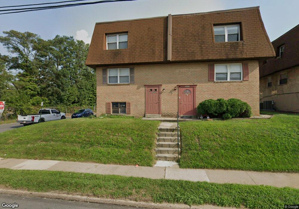
2400 W Township Line Rd Unit B Havertown, PA 19083
Estimated Value: $317,000 - $402,000
2
Beds
1
Bath
900
Sq Ft
$408/Sq Ft
Est. Value
About This Home
This home is located at 2400 W Township Line Rd Unit B, Havertown, PA 19083 and is currently estimated at $367,350, approximately $408 per square foot. 2400 W Township Line Rd Unit B is a home located in Delaware County with nearby schools including Hillcrest El School, Drexel Hill Middle School, and Upper Darby High School.
Ownership History
Date
Name
Owned For
Owner Type
Purchase Details
Closed on
Jul 10, 2018
Sold by
Lincoln Lane Properties Llc
Bought by
Gordon Marjorie H
Current Estimated Value
Home Financials for this Owner
Home Financials are based on the most recent Mortgage that was taken out on this home.
Original Mortgage
$135,375
Outstanding Balance
$116,830
Interest Rate
4.5%
Mortgage Type
New Conventional
Estimated Equity
$250,520
Purchase Details
Closed on
Apr 29, 2015
Sold by
Defino Beth Dawn and Hamilton Beth Dawn
Bought by
Lincoln Lane Properties Llc
Home Financials for this Owner
Home Financials are based on the most recent Mortgage that was taken out on this home.
Original Mortgage
$131,250
Interest Rate
3.65%
Mortgage Type
New Conventional
Create a Home Valuation Report for This Property
The Home Valuation Report is an in-depth analysis detailing your home's value as well as a comparison with similar homes in the area
Home Values in the Area
Average Home Value in this Area
Purchase History
| Date | Buyer | Sale Price | Title Company |
|---|---|---|---|
| Gordon Marjorie H | $180,500 | None Available | |
| Lincoln Lane Properties Llc | $175,000 | Attorney |
Source: Public Records
Mortgage History
| Date | Status | Borrower | Loan Amount |
|---|---|---|---|
| Open | Gordon Marjorie H | $135,375 | |
| Previous Owner | Lincoln Lane Properties Llc | $131,250 |
Source: Public Records
Tax History Compared to Growth
Tax History
| Year | Tax Paid | Tax Assessment Tax Assessment Total Assessment is a certain percentage of the fair market value that is determined by local assessors to be the total taxable value of land and additions on the property. | Land | Improvement |
|---|---|---|---|---|
| 2025 | $8,022 | $189,690 | $26,990 | $162,700 |
| 2024 | $8,022 | $189,690 | $26,990 | $162,700 |
| 2023 | $7,947 | $189,690 | $26,990 | $162,700 |
| 2022 | $7,733 | $189,690 | $26,990 | $162,700 |
| 2021 | $10,427 | $189,690 | $26,990 | $162,700 |
| 2020 | $6,775 | $104,740 | $29,450 | $75,290 |
| 2019 | $6,656 | $104,740 | $29,450 | $75,290 |
| 2018 | $6,580 | $104,740 | $0 | $0 |
| 2017 | $6,409 | $104,740 | $0 | $0 |
| 2016 | $587 | $104,740 | $0 | $0 |
| 2015 | $587 | $104,740 | $0 | $0 |
| 2014 | $575 | $104,740 | $0 | $0 |
Source: Public Records
Map
Nearby Homes
- 1214 Roosevelt Dr
- 8525 Monroe Ave
- 1101 Wilson Dr
- 1114 Roosevelt Dr
- 1237 Bryan St
- 1133 Agnew Dr
- 104 Gilmore Rd
- 1228 Bryan St
- 71 S Brighton Ave
- 110 E Township Line Rd
- 223 E Park Rd
- 1228 Old Ln
- 221 E Park Rd
- 2354 Bond Ave
- 447 W Chester Pike
- 2219 Ardmore Ave
- 142 Foster Ave
- 1025 Shadeland Ave
- 924 Fairfax Rd
- 872 Fairfax Rd
- 2400 W Township Line Rd
- 2402 W Township Line Rd
- 2404 W Township Line Rd
- 1100 Township Line Rd
- 2401 David Dr
- 1016 Township Line Rd
- 2406 W Township Line Rd
- 2405 David Dr Unit 1ST FL
- 2405 David Dr
- 2403 David Dr
- 2403 David Dr Unit 1ST FLOOR
- 2403 David Dr Unit 2ND FLOOR
- 2408 W Township Line Rd
- 2407 David Dr
- 2409 David Dr
- 2410 W Township Line Rd
- 2412 W Township Line Rd
- 2411 David Dr Unit 2
- 2411 David Dr
- 2414 W Township Line Rd