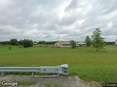
24024 State Route 347 West Mansfield, OH 43358
Estimated Value: $310,000 - $452,529
3
Beds
3
Baths
1,768
Sq Ft
$223/Sq Ft
Est. Value
About This Home
This home is located at 24024 State Route 347, West Mansfield, OH 43358 and is currently estimated at $394,132, approximately $222 per square foot. 24024 State Route 347 is a home located in Union County with nearby schools including Raymond Elementary School, Creekview Intermediate Elementary School, and Bunsold Middle School.
Ownership History
Date
Name
Owned For
Owner Type
Purchase Details
Closed on
Mar 3, 2004
Sold by
Poling Steven J and Poling Samantha J
Bought by
Poling Steven J and Poling Samantha J
Current Estimated Value
Create a Home Valuation Report for This Property
The Home Valuation Report is an in-depth analysis detailing your home's value as well as a comparison with similar homes in the area
Home Values in the Area
Average Home Value in this Area
Purchase History
| Date | Buyer | Sale Price | Title Company |
|---|---|---|---|
| Poling Steven J | -- | -- |
Source: Public Records
Mortgage History
| Date | Status | Borrower | Loan Amount |
|---|---|---|---|
| Closed | Poling Steven J | $107,635 |
Source: Public Records
Tax History Compared to Growth
Tax History
| Year | Tax Paid | Tax Assessment Tax Assessment Total Assessment is a certain percentage of the fair market value that is determined by local assessors to be the total taxable value of land and additions on the property. | Land | Improvement |
|---|---|---|---|---|
| 2024 | $5,298 | $116,750 | $30,590 | $86,160 |
| 2023 | $5,298 | $116,750 | $30,590 | $86,160 |
| 2022 | $5,213 | $116,750 | $30,590 | $86,160 |
| 2021 | $5,028 | $96,560 | $23,530 | $73,030 |
| 2020 | $4,804 | $96,560 | $23,530 | $73,030 |
| 2019 | $4,943 | $96,560 | $23,530 | $73,030 |
| 2018 | $4,257 | $77,490 | $17,510 | $59,980 |
| 2017 | $4,016 | $77,490 | $17,510 | $59,980 |
| 2016 | $4,002 | $77,490 | $17,510 | $59,980 |
| 2015 | $3,514 | $63,270 | $14,140 | $49,130 |
| 2014 | $3,450 | $63,270 | $14,140 | $49,130 |
| 2013 | $3,251 | $63,270 | $14,140 | $49,130 |
Source: Public Records
Map
Nearby Homes
- 25947 Lunda Rd
- 26180 Newton-Perkins Rd
- 0 Powder Lick Rd Unit 1016484
- 21743 Ohio 347
- 0 Johnson Rd Unit 222024368
- 0 Johnson Rd Unit Lot 2 222024351
- 21875 Liberty Rd W
- 9689 Foundry Rd
- 267 W State St
- 304 W Center St
- 162 N Main St
- 210 N Main St
- 238 N Dean St
- 23863 Drake Skidmore Rd
- 28249 State Route 739
- 0 Yearsley Rd
- 0 Shirk Rd
- 24455 Honda Pkwy
- 19015 Powderlick Rd
- 19081 Smokey Rd
- 24059 State Route 347
- 23961 State Route 347
- 23900 State Route 347
- 24010 State Route 347
- 23950 State Route 347
- 24024 State Route 347
- 24010 Ohio 347
- 24010 Ohio 347
- 24724 Lunda Rd
- 24656 Lunda Rd
- 24750 Lunda Rd
- 24570 Lunda Rd
- 24645 Lunda Rd
- 24538 Lunda Rd
- 24200 State Route 347
- 24875 Lunda Rd
- 24585 Lunda Rd
- 24225 State Route 347
- 23806 State Route 347
- 23823 State Route 347