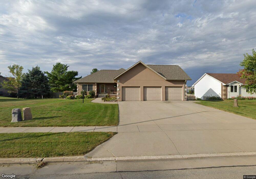
2403 Maple St Granger, IA 50109
Estimated Value: $456,000 - $513,000
2
Beds
3
Baths
1,828
Sq Ft
$263/Sq Ft
Est. Value
About This Home
This home is located at 2403 Maple St, Granger, IA 50109 and is currently estimated at $481,142, approximately $263 per square foot. 2403 Maple St is a home located in Dallas County with nearby schools including Woodward-Granger Elementary School and Woodward-Granger Middle School.
Ownership History
Date
Name
Owned For
Owner Type
Purchase Details
Closed on
Oct 20, 2006
Sold by
Tiernan Dennis J and Tiernan Rose M
Bought by
Hemmingson Curt J
Current Estimated Value
Home Financials for this Owner
Home Financials are based on the most recent Mortgage that was taken out on this home.
Original Mortgage
$185,000
Outstanding Balance
$107,385
Interest Rate
6.25%
Mortgage Type
Adjustable Rate Mortgage/ARM
Estimated Equity
$373,757
Create a Home Valuation Report for This Property
The Home Valuation Report is an in-depth analysis detailing your home's value as well as a comparison with similar homes in the area
Home Values in the Area
Average Home Value in this Area
Purchase History
| Date | Buyer | Sale Price | Title Company |
|---|---|---|---|
| Hemmingson Curt J | $330,000 | None Available |
Source: Public Records
Mortgage History
| Date | Status | Borrower | Loan Amount |
|---|---|---|---|
| Open | Hemmingson Curt J | $185,000 |
Source: Public Records
Tax History
| Year | Tax Paid | Tax Assessment Tax Assessment Total Assessment is a certain percentage of the fair market value that is determined by local assessors to be the total taxable value of land and additions on the property. | Land | Improvement |
|---|---|---|---|---|
| 2025 | $8,120 | $470,500 | $75,000 | $395,500 |
| 2024 | $7,774 | $468,760 | $75,000 | $393,760 |
| 2023 | $7,774 | $453,760 | $60,000 | $393,760 |
| 2022 | $6,826 | $381,040 | $60,000 | $321,040 |
| 2021 | $6,826 | $343,040 | $60,000 | $283,040 |
| 2020 | $6,958 | $333,310 | $60,000 | $273,310 |
| 2019 | $7,146 | $333,310 | $60,000 | $273,310 |
| 2018 | $7,146 | $320,600 | $60,000 | $260,600 |
| 2017 | $6,710 | $302,170 | $41,570 | $260,600 |
| 2016 | $6,428 | $281,100 | $41,570 | $239,530 |
| 2015 | $6,618 | $298,850 | $0 | $0 |
| 2014 | $6,496 | $298,850 | $0 | $0 |
Source: Public Records
Map
Nearby Homes
- 1906 Lowell St
- 2206 White Oak Ln
- 2209 White Oak Ln
- 2100 White Oak Ln
- 2009 White Oak Ln
- 1517 Maple St
- 1513 Maple St
- 1509 Maple St
- 2415 Spruce St
- 2417 Spruce St
- 2009 Locust St
- 2419 Spruce St
- 2407 Chestnut St
- 2412 Spruce St
- 2208 White Oak Ln
- 2311 Oxley Dr
- 2220 Kennedy Blvd
- 2317 Oxley Dr
- 2418 Chestnut St
- 33047 Finestead Dr
Your Personal Tour Guide
Ask me questions while you tour the home.