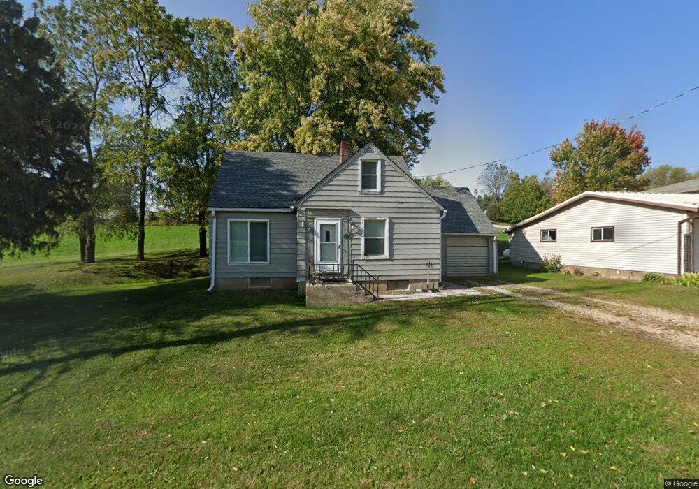
24033 Highway 128 Elkader, IA 52043
Estimated Value: $102,000 - $151,000
3
Beds
1
Bath
1,236
Sq Ft
$99/Sq Ft
Est. Value
About This Home
This home is located at 24033 Highway 128, Elkader, IA 52043 and is currently estimated at $122,292, approximately $98 per square foot. 24033 Highway 128 is a home located in Clayton County with nearby schools including Clayton Ridge Elementary School, Clayton Ridge Middle School, and Clayton Ridge High School.
Ownership History
Date
Name
Owned For
Owner Type
Purchase Details
Closed on
May 9, 2014
Sold by
Hf 58
Bought by
Briggs Brian J
Current Estimated Value
Purchase Details
Closed on
Aug 5, 2009
Sold by
Estate Of Roma S Lahrs
Bought by
Lundt Tonnie
Home Financials for this Owner
Home Financials are based on the most recent Mortgage that was taken out on this home.
Original Mortgage
$32,000
Interest Rate
5.49%
Mortgage Type
Future Advance Clause Open End Mortgage
Create a Home Valuation Report for This Property
The Home Valuation Report is an in-depth analysis detailing your home's value as well as a comparison with similar homes in the area
Home Values in the Area
Average Home Value in this Area
Purchase History
| Date | Buyer | Sale Price | Title Company |
|---|---|---|---|
| Briggs Brian J | $500 | None Available | |
| Lundt Tonnie | $23,000 | None Available |
Source: Public Records
Mortgage History
| Date | Status | Borrower | Loan Amount |
|---|---|---|---|
| Previous Owner | Lundt Tonnie | $32,000 |
Source: Public Records
Tax History Compared to Growth
Tax History
| Year | Tax Paid | Tax Assessment Tax Assessment Total Assessment is a certain percentage of the fair market value that is determined by local assessors to be the total taxable value of land and additions on the property. | Land | Improvement |
|---|---|---|---|---|
| 2025 | $666 | $83,395 | $8,436 | $74,959 |
| 2024 | $646 | $69,151 | $7,336 | $61,815 |
| 2023 | $646 | $69,151 | $7,336 | $61,815 |
| 2022 | $362 | $59,716 | $6,710 | $53,006 |
| 2021 | $482 | $38,577 | $5,670 | $32,907 |
| 2020 | $482 | $37,609 | $5,670 | $31,939 |
| 2019 | $370 | $37,609 | $5,670 | $31,939 |
| 2018 | $370 | $37,617 | $5,670 | $31,947 |
| 2017 | $382 | $37,617 | $5,670 | $31,947 |
| 2015 | $286 | $30,965 | $5,141 | $25,824 |
| 2014 | $278 | $29,674 | $5,141 | $24,533 |
Source: Public Records
Map
Nearby Homes
- 0 13 Hwy Unit NBR20255145
- 249 Franzen Ridge Rd
- 0 E Bridge St
- 247 Franzen Ridge Rd
- 302 N 3rd St
- 27455 Harbor Rd
- 117 S Main St
- 702 N Main St
- 209 2nd St SW
- 301 N 1st St
- 707 N Main St
- 710 Woodland Dr NW
- 26642 Iowa 13
- 108 Adams Ct
- 306 S Monroe St
- 502 S Monroe St
- 305 S Russell St
- 27766 Highway 13
- 0 Grandview Rd
- TBD Country Rd
- 24033 Iowa 128
- 23651 Hickory Ave
- 24085 Highway 128
- 24085 Highway 128
- 23915 Highway 128
- 23597 Hickory Ave
- 23520 Hickory Ave
- 24121 230th St
- 23531 Hickory Ave
- 24121 230 St
- 24188 Highway 128
- 24071 230th St
- 24071 230th St
- 23822 Highway 128
- 23822 Highway 128
- 24216 Highway 128
- 24255 Highway 128
- 24250 Highway 128
- 24284 Highway 128
- 24208 Highway 128