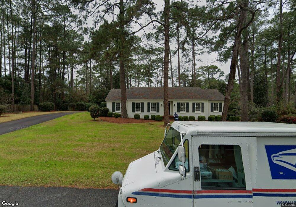
2404 Fieldcrest Dr Valdosta, GA 31602
Estimated Value: $251,271 - $349,000
3
Beds
2
Baths
2,235
Sq Ft
$132/Sq Ft
Est. Value
About This Home
This home is located at 2404 Fieldcrest Dr, Valdosta, GA 31602 and is currently estimated at $294,568, approximately $131 per square foot. 2404 Fieldcrest Dr is a home located in Lowndes County with nearby schools including S.L. Mason Elementary School, Valdosta Middle School, and Valdosta High School.
Ownership History
Date
Name
Owned For
Owner Type
Purchase Details
Closed on
Dec 20, 2018
Sold by
Wansley Lamar S
Bought by
Gilliland Candace and Steve Wansley Irrevocable Home
Current Estimated Value
Purchase Details
Closed on
Feb 2, 2015
Sold by
Joseph Paul J
Bought by
Wansley Lamar S
Home Financials for this Owner
Home Financials are based on the most recent Mortgage that was taken out on this home.
Original Mortgage
$105,000
Interest Rate
3.94%
Mortgage Type
New Conventional
Purchase Details
Closed on
Nov 5, 1987
Bought by
Joseph Paul J and Joseph Judith
Purchase Details
Closed on
Jun 28, 1985
Bought by
Manning Robert S
Create a Home Valuation Report for This Property
The Home Valuation Report is an in-depth analysis detailing your home's value as well as a comparison with similar homes in the area
Home Values in the Area
Average Home Value in this Area
Purchase History
| Date | Buyer | Sale Price | Title Company |
|---|---|---|---|
| Gilliland Candace | -- | -- | |
| Wansley Lamar S | $205,000 | -- | |
| Joseph Paul J | $104,000 | -- | |
| Manning Robert S | $95,000 | -- |
Source: Public Records
Mortgage History
| Date | Status | Borrower | Loan Amount |
|---|---|---|---|
| Previous Owner | Wansley Lamar S | $105,000 |
Source: Public Records
Tax History Compared to Growth
Tax History
| Year | Tax Paid | Tax Assessment Tax Assessment Total Assessment is a certain percentage of the fair market value that is determined by local assessors to be the total taxable value of land and additions on the property. | Land | Improvement |
|---|---|---|---|---|
| 2024 | $1,836 | $75,745 | $16,000 | $59,745 |
| 2023 | $1,836 | $75,745 | $16,000 | $59,745 |
| 2022 | $1,839 | $64,407 | $16,000 | $48,407 |
| 2021 | $1,892 | $64,407 | $16,000 | $48,407 |
| 2020 | $1,932 | $64,407 | $16,000 | $48,407 |
| 2019 | $1,748 | $59,241 | $10,000 | $49,241 |
| 2018 | $1,771 | $59,241 | $10,000 | $49,241 |
| 2017 | $1,783 | $59,241 | $10,000 | $49,241 |
| 2016 | $1,780 | $59,241 | $10,000 | $49,241 |
| 2015 | $1,966 | $59,241 | $10,000 | $49,241 |
| 2014 | $1,797 | $59,241 | $10,000 | $49,241 |
Source: Public Records
Map
Nearby Homes
- 1211 Gornto Rd
- 1108 Kimberly Dr
- 1212 Dellwood Dr
- 2502B Jerry Jones Dr Unit 1
- 1104 Linda Dr
- 2432 Meadowbrook Dr
- 2436 Meadowbrook Dr
- 2424 Westwood Dr
- 908 Maplewood Dr
- 5 Dellwood Cir
- 903 Gornto Rd
- 2208 Dogwood Dr
- 1114 Lake Dr
- 2400 Winding Way
- 2325 White Oak Dr
- 2214 Park Ln
- 1112 Lake Dr
- 1 Fox Hollow Cir
- 68 Pineridge Dr
- 2207 S Sherwood Dr
- 2406 Fieldcrest Dr
- 1203 Westwood Dr
- 1200 Gornto Rd
- 1202 Gornto Rd
- 2405 Fieldcrest Dr
- 2403 Fieldcrest Dr
- 1204 Gornto Rd
- 1205 Westwood Dr
- 2407 Fieldcrest Dr
- 1110 Gornto Rd
- 2409 Fieldcrest Dr
- 1206 Gornto Rd
- 1202 Westwood Dr
- 1204 Westwood Dr
- 1207 Gornto Rd
- 1209 Gornto Rd
- 1200 Westwood Dr
- 1207 Westwood Dr
- 1205 Gornto Rd
- 1108 Gornto Rd