2405 65th Ct SW Olympia, WA 98512
Littlerock NeighborhoodEstimated Value: $525,000 - $585,000
3
Beds
2
Baths
1,156
Sq Ft
$470/Sq Ft
Est. Value
About This Home
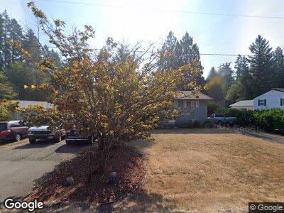
This home is located at 2405 65th Ct SW, Olympia, WA 98512 and is currently estimated at $543,409, approximately $470 per square foot. 2405 65th Ct SW is a home located in Thurston County with nearby schools including Michael T. Simmons Elementary School, Tumwater Middle School, and A.G. West Black Hills High School.
Ownership History
Date
Name
Owned For
Owner Type
Purchase Details
Closed on
Feb 27, 1995
Sold by
Jelvik Robert M and Jelvik Mary L
Bought by
Hamilton Brian L and Hamilton April E
Current Estimated Value
Home Financials for this Owner
Home Financials are based on the most recent Mortgage that was taken out on this home.
Original Mortgage
$80,000
Interest Rate
9.09%
Create a Home Valuation Report for This Property
The Home Valuation Report is an in-depth analysis detailing your home's value as well as a comparison with similar homes in the area
Home Values in the Area
Average Home Value in this Area
Purchase History
| Date | Buyer | Sale Price | Title Company |
|---|---|---|---|
| Hamilton Brian L | $123,000 | Transamerica Title Insurance |
Source: Public Records
Mortgage History
| Date | Status | Borrower | Loan Amount |
|---|---|---|---|
| Open | Hamilton Brian L | $85,000 | |
| Open | Hamilton Rbian L | $155,950 | |
| Closed | Hamilton Brian L | $159,950 | |
| Closed | Hamilton Brian L | $60,000 | |
| Closed | Hamilton Brian L | $80,000 |
Source: Public Records
Tax History Compared to Growth
Tax History
| Year | Tax Paid | Tax Assessment Tax Assessment Total Assessment is a certain percentage of the fair market value that is determined by local assessors to be the total taxable value of land and additions on the property. | Land | Improvement |
|---|---|---|---|---|
| 2024 | $4,418 | $454,300 | $196,300 | $258,000 |
| 2023 | $4,418 | $441,200 | $175,900 | $265,300 |
| 2022 | $4,731 | $418,800 | $139,200 | $279,600 |
| 2021 | $4,369 | $378,300 | $146,500 | $231,800 |
| 2020 | $4,127 | $314,600 | $131,700 | $182,900 |
| 2019 | $3,553 | $289,300 | $96,800 | $192,500 |
| 2018 | $3,573 | $260,600 | $88,000 | $172,600 |
| 2017 | $3,242 | $229,500 | $87,100 | $142,400 |
| 2016 | $3,154 | $216,100 | $86,200 | $129,900 |
| 2014 | -- | $221,900 | $86,200 | $135,700 |
Source: Public Records
Map
Nearby Homes
- 6623 Glenwood Dr SW
- 6445 Brycen Ln SW Unit 103
- 2813 Foster Ct SW
- 2535 70th Ave SW Unit 9
- 2535 70th Ave SW Unit 12
- 1841 Trosper Rd SW Unit 38
- 1841 Trosper Rd SW Unit 30
- 1841 Trosper Rd SW Unit 24
- 7115 Mirasett St SW
- 5279 Bald Eagle Ln SW
- 5302 E Eagle Ln SW
- 3215 64th Ln SW
- 5705 Littlerock Rd SW Unit 16
- 6137 Kirsop Rd SW
- 3234 64th Ln SW
- 3305 63rd Ave SW
- 2890 75th Ave SW Unit Lot 61
- 723 Israel Rd SW
- 6141 Kirsop Rd SW
- 6702 Kirsop Village Dr SW
- 2405 65th Ct SW
- 2327 65th Ct SW
- 2421 65th Ct SW
- 2328 65th Ct SW
- 2315 65th Ct SW
- 2425 65th Ct SW
- 2406 65th Ct SW
- 2430 65th Ct SW
- 6504 Miner Dr SW
- 6508 Miner Dr SW
- 6519 Glenwood Dr SW
- 6428 Miner Dr SW
- 6514 Miner Dr SW
- 6425 Glenwood Dr SW
- 6535 Glenwood Dr SW
- 6524 Miner Dr SW
- 6424 Miner Dr SW
- 6600 Miner Dr SW
- 6418 Miner Dr SW
- 6503 Miner Dr SW