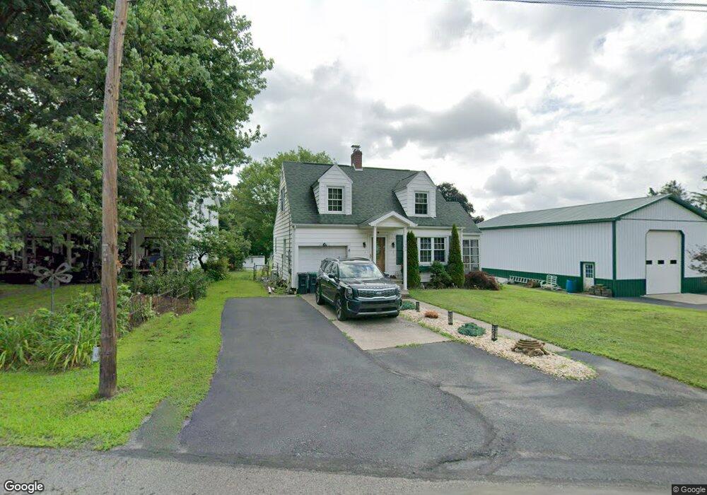
2405 State Route 92 Hwy Harding, PA 18643
Estimated Value: $177,000 - $307,000
--
Bed
--
Bath
1,535
Sq Ft
$165/Sq Ft
Est. Value
About This Home
This home is located at 2405 State Route 92 Hwy, Harding, PA 18643 and is currently estimated at $252,667, approximately $164 per square foot. 2405 State Route 92 Hwy is a home located in Luzerne County with nearby schools including Wyoming Area Secondary Center.
Ownership History
Date
Name
Owned For
Owner Type
Purchase Details
Closed on
Dec 21, 2012
Sold by
Lee Bonnie P
Bought by
Marriott Joshua T
Current Estimated Value
Home Financials for this Owner
Home Financials are based on the most recent Mortgage that was taken out on this home.
Original Mortgage
$68,400
Outstanding Balance
$47,412
Interest Rate
3.38%
Mortgage Type
New Conventional
Estimated Equity
$205,255
Purchase Details
Closed on
Dec 10, 2007
Sold by
Mcdonough Kathleen A
Bought by
Lee Bonnie P
Home Financials for this Owner
Home Financials are based on the most recent Mortgage that was taken out on this home.
Original Mortgage
$84,900
Interest Rate
6.27%
Mortgage Type
Purchase Money Mortgage
Create a Home Valuation Report for This Property
The Home Valuation Report is an in-depth analysis detailing your home's value as well as a comparison with similar homes in the area
Home Values in the Area
Average Home Value in this Area
Purchase History
| Date | Buyer | Sale Price | Title Company |
|---|---|---|---|
| Marriott Joshua T | $72,000 | None Available | |
| Lee Bonnie P | $84,900 | None Available |
Source: Public Records
Mortgage History
| Date | Status | Borrower | Loan Amount |
|---|---|---|---|
| Open | Marriott Joshua T | $68,400 | |
| Previous Owner | Lee Bonnie P | $84,900 |
Source: Public Records
Tax History Compared to Growth
Tax History
| Year | Tax Paid | Tax Assessment Tax Assessment Total Assessment is a certain percentage of the fair market value that is determined by local assessors to be the total taxable value of land and additions on the property. | Land | Improvement |
|---|---|---|---|---|
| 2025 | $2,153 | $74,200 | $14,200 | $60,000 |
| 2024 | $2,058 | $74,200 | $14,200 | $60,000 |
| 2023 | $1,920 | $74,200 | $14,200 | $60,000 |
| 2022 | $1,907 | $74,200 | $14,200 | $60,000 |
| 2021 | $1,880 | $74,200 | $14,200 | $60,000 |
| 2020 | $1,836 | $74,200 | $14,200 | $60,000 |
| 2019 | $1,783 | $74,200 | $14,200 | $60,000 |
| 2018 | $1,723 | $74,200 | $14,200 | $60,000 |
| 2017 | $1,684 | $74,200 | $14,200 | $60,000 |
| 2016 | -- | $74,200 | $14,200 | $60,000 |
| 2015 | -- | $74,200 | $14,200 | $60,000 |
| 2014 | -- | $74,200 | $14,200 | $60,000 |
Source: Public Records
Map
Nearby Homes
- 314 Terrace Ave
- 9 Circle Dr
- 3061 Main St
- 2356 Newton Ransom Blvd
- 2352 Newton Ransom Blvd
- 3018 Main St
- 522 Sutton Creek Rd
- 0 Lockville Rd Church Rd Unit 25-1114
- 675 Apple Tree Rd
- 278 Cider Run Rd
- 2694 Ransom Rd
- 456 Village Rd
- 750 Slocum Ave
- 2225 Cherry Hill Rd
- 2619 Sullivan Trail
- 1932 Newton Ransom Blvd
- 1212 Keelersburg Rd
- 0 Spring & Red Oak Dr Unit GSBSC1753
- 2500 Falls Rd
- L358 River Rd
- 2405 Pennsylvania 92
- 120 Sullivan St
- 2404 Sullivan Trail
- 223 Sr 92n
- 608 Wilson Ave
- 610 Wilson Ave
- 230 Taft Ave
- 2412 Sullivan Trail
- 2413 State Route 92 Hwy
- 311 Taft Ave
- 224 Sullivan St
- 611 Wilson Ave
- 241 Wilson St Unit A
- 2396 State Route 92 Hwy
- 306 Taft Ave
- 242 Wilson St
- 2389 State Route 92 Hwy
- 240 Wilson St
- 2421 State Route 92 Hwy
- 620 Wilson Ave