Estimated Value: $252,000 - $285,000
3
Beds
2
Baths
1,256
Sq Ft
$209/Sq Ft
Est. Value
About This Home
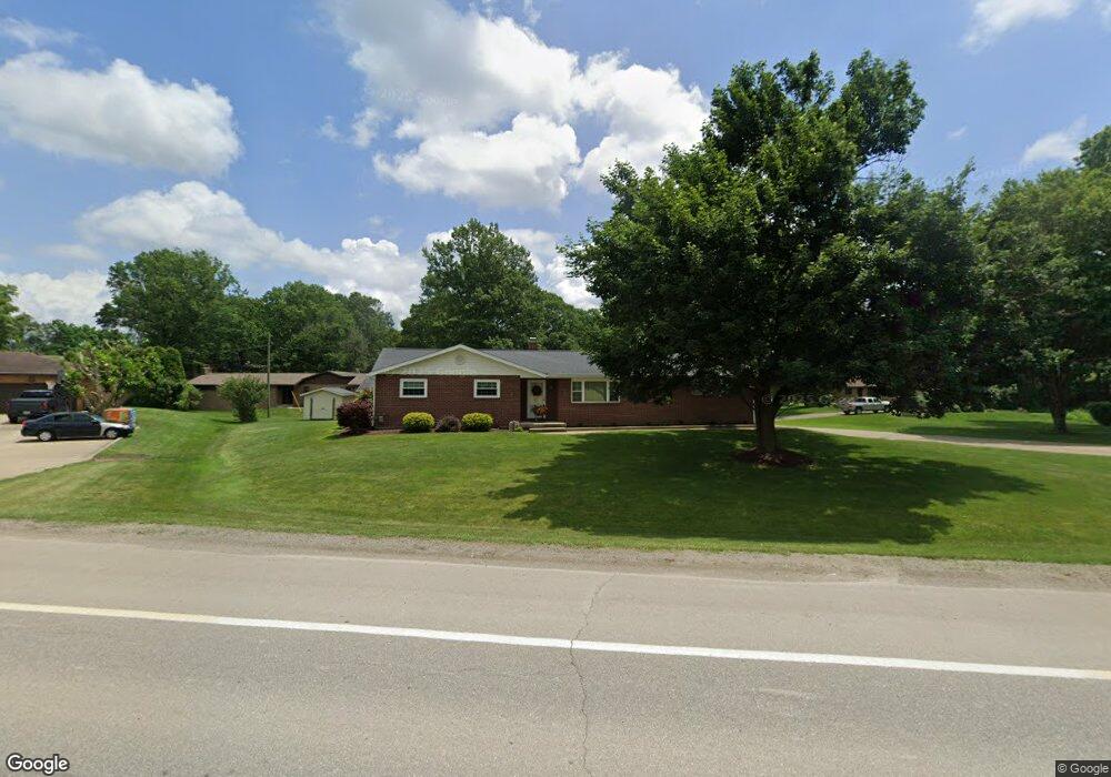
This home is located at 2406 State Route 39 NW, Dover, OH 44622 and is currently estimated at $262,087, approximately $208 per square foot. 2406 State Route 39 NW is a home located in Tuscarawas County with nearby schools including Dover High School, Tuscarawas Central Catholic Elementary School, and Tuscarawas Central Catholic Junior/Senior High School.
Ownership History
Date
Name
Owned For
Owner Type
Purchase Details
Closed on
Jun 14, 2000
Sold by
Bambeck Paul H
Bought by
Reed John G and Reed Mary K
Current Estimated Value
Home Financials for this Owner
Home Financials are based on the most recent Mortgage that was taken out on this home.
Original Mortgage
$64,900
Interest Rate
6.25%
Mortgage Type
New Conventional
Purchase Details
Closed on
Oct 14, 1986
Sold by
Bankbeck Paul H and Gasser Ann E
Bought by
Bambeck Paul H and Gasser Ann E
Create a Home Valuation Report for This Property
The Home Valuation Report is an in-depth analysis detailing your home's value as well as a comparison with similar homes in the area
Home Values in the Area
Average Home Value in this Area
Purchase History
| Date | Buyer | Sale Price | Title Company |
|---|---|---|---|
| Reed John G | $124,900 | -- | |
| Bambeck Paul H | $68,000 | -- |
Source: Public Records
Mortgage History
| Date | Status | Borrower | Loan Amount |
|---|---|---|---|
| Closed | Reed John G | $64,900 |
Source: Public Records
Tax History Compared to Growth
Tax History
| Year | Tax Paid | Tax Assessment Tax Assessment Total Assessment is a certain percentage of the fair market value that is determined by local assessors to be the total taxable value of land and additions on the property. | Land | Improvement |
|---|---|---|---|---|
| 2024 | $2,170 | $63,150 | $12,670 | $50,480 |
| 2023 | $4,755 | $180,420 | $36,190 | $144,230 |
| 2022 | $2,237 | $63,147 | $12,667 | $50,481 |
| 2021 | $1,989 | $54,348 | $10,507 | $43,841 |
| 2020 | $1,989 | $54,348 | $10,507 | $43,841 |
| 2019 | $2,004 | $54,348 | $10,507 | $43,841 |
| 2018 | $1,717 | $45,870 | $8,870 | $37,000 |
| 2017 | $1,717 | $45,870 | $8,870 | $37,000 |
| 2016 | $1,714 | $45,870 | $8,870 | $37,000 |
| 2014 | $1,496 | $41,690 | $8,130 | $33,560 |
| 2013 | $1,498 | $41,690 | $8,130 | $33,560 |
Source: Public Records
Map
Nearby Homes
- 2180 Kimberley Dr NW
- 0000 Red Hill Rd NW
- 500 W 13th St
- 1411 Chestnut St
- 1319 N Walnut St
- 118 W 6th St
- 1688 Hillcrest Dr NW
- 129 E 8th St
- 3030 N Wooster Ave
- 1592 Pleasant View Dr NW
- 0 Bair Rd NW Unit 5124469
- 0 Bair Rd NW Unit 5124477
- 0 Bair Rd NW Unit 5124464
- 0 Bair Rd NW Unit 5124485
- 0 Bair Rd NW Unit 5124339
- 0 Bair Rd NW Unit 5124397
- 0 Bair Rd NW Unit 5124402
- 0 Bair Rd NW Unit 5124415
- 0 Bair Rd NW Unit 5124421
- 306 E 15th St
- 2386 State Route 39 NW
- 2436 State Route 39 NW
- 2524 Renner Dr NW
- 2511 Renner Dr NW
- 2501 Renner Dr NW
- 2370 State Route 39 NW
- 2481 Renner Dr NW
- 2352 State Route 39 NW
- 2340 State Route 39 NW
- 2266 Saltwell Rd NW
- 2248 Saltwell Rd NW
- 2437 Renner Dr NW
- 2480 State Route 39 NW
- 2226 Saltwell Rd NW
- 2208 Saltwell Rd NW
- 0 Saltwell Rd
- 2200 Saltwell Rd NW
- 2309 Sunset Dr NW
- 2348 Renner Dr NW
- 2355 Renner Dr NW