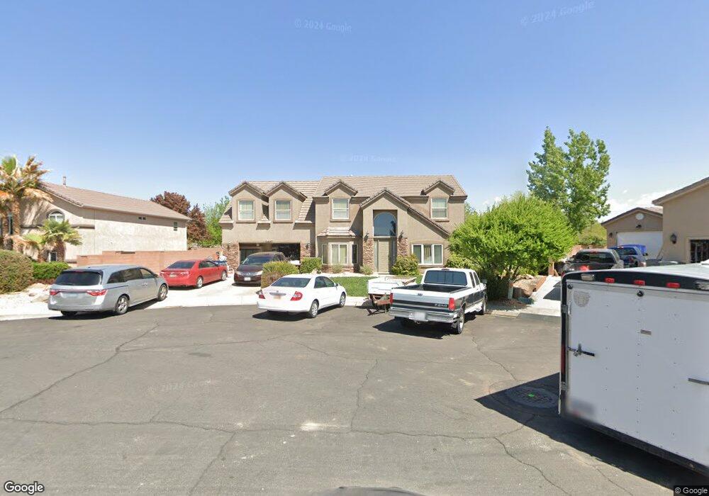
2407 E 440 Cir N St. George, UT 84790
Estimated Value: $554,000 - $609,000
5
Beds
3
Baths
2,900
Sq Ft
$199/Sq Ft
Est. Value
About This Home
This home is located at 2407 E 440 Cir N, St. George, UT 84790 and is currently estimated at $578,315, approximately $199 per square foot. 2407 E 440 Cir N is a home located in Washington County with nearby schools including Panorama School, Pine View Middle School, and Fossil Ridge Intermediate School.
Ownership History
Date
Name
Owned For
Owner Type
Purchase Details
Closed on
Apr 1, 2008
Sold by
Residential Resolve Inc
Bought by
Wcs Enterprises Llc
Current Estimated Value
Purchase Details
Closed on
Sep 13, 2007
Sold by
Coonfer Paula L and Affordable Home Loans Inc
Bought by
Residential Resolve
Purchase Details
Closed on
Jan 24, 2007
Sold by
Dawnridge Properties Llc
Bought by
Residential Resolve Inc
Purchase Details
Closed on
Mar 23, 2006
Sold by
Coonfer Paula
Bought by
Dawnridge Properties Llc and Coonfer Family Land Trust
Create a Home Valuation Report for This Property
The Home Valuation Report is an in-depth analysis detailing your home's value as well as a comparison with similar homes in the area
Purchase History
| Date | Buyer | Sale Price | Title Company |
|---|---|---|---|
| Wcs Enterprises Llc | -- | Patriot National Title Insur | |
| Residential Resolve | $294,000 | None Available | |
| Residential Resolve Inc | -- | Accommodation | |
| Dawnridge Properties Llc | -- | None Available |
Source: Public Records
Tax History
| Year | Tax Paid | Tax Assessment Tax Assessment Total Assessment is a certain percentage of the fair market value that is determined by local assessors to be the total taxable value of land and additions on the property. | Land | Improvement |
|---|---|---|---|---|
| 2025 | $2,073 | $303,820 | $59,400 | $244,420 |
| 2023 | $2,156 | $322,080 | $52,800 | $269,280 |
| 2022 | $2,293 | $322,135 | $52,250 | $269,885 |
| 2021 | $2,040 | $427,500 | $80,000 | $347,500 |
| 2020 | $1,880 | $371,100 | $60,000 | $311,100 |
| 2019 | $1,852 | $357,000 | $60,000 | $297,000 |
| 2018 | $1,750 | $174,185 | $0 | $0 |
| 2017 | $1,772 | $171,215 | $0 | $0 |
| 2016 | $1,846 | $165,000 | $0 | $0 |
| 2015 | $1,836 | $157,465 | $0 | $0 |
| 2014 | $1,737 | $149,930 | $0 | $0 |
Source: Public Records
Map
Nearby Homes
- 2675 E 450 N Unit 2
- 345 N 2450 E Unit 120
- 600 N 2450 E Unit 1001
- 600 N 2450 E Unit 1401
- 2398 E 630 N
- 280 N Sunflower Dr Unit 36
- 345 N 2450 E Unit 120
- 230 N 2230 E
- 2294 E 170 N
- 2720 N 2720 E
- 2832 E 410 St N
- 2843 E 410 St N
- 2639 E 700 N Unit 1-4
- 2801 E 450 N Unit 329
- 499 N 2070 E
- 2870 E 350 N
- 403 N 2900 E
- 790 N 2720 E Unit 24
- 2105 Panorama Pkwy N
- 2930 E 450 N Unit F6
- 2407 E 440 North Cir
- 2395 E 440 North Cir
- 2419 E 440 Cir N
- 2419 E 440 North Cir
- 2410 E 480 Cir N
- 2410 E 480 North Cir
- 2379 E 440 North Cir
- 2420 E 440 Cir N
- 2379 E 440 Cir N
- 2408 E 440 North Cir
- 2422 E 480 North Cir
- 2422 E 480 Cir N
- 2398 E 480 North Cir
- 2408 E 440 Cir N
- 2420 E 440 North Cir
- 2396 E 440 North Cir
- 2434 E 480 Cir N
- 2434 E 480 North Cir
- 2382 E 440 North Cir
- 2382 E 440 Cir N