Estimated Value: $326,000 - $374,000
4
Beds
1
Bath
2,327
Sq Ft
$149/Sq Ft
Est. Value
About This Home
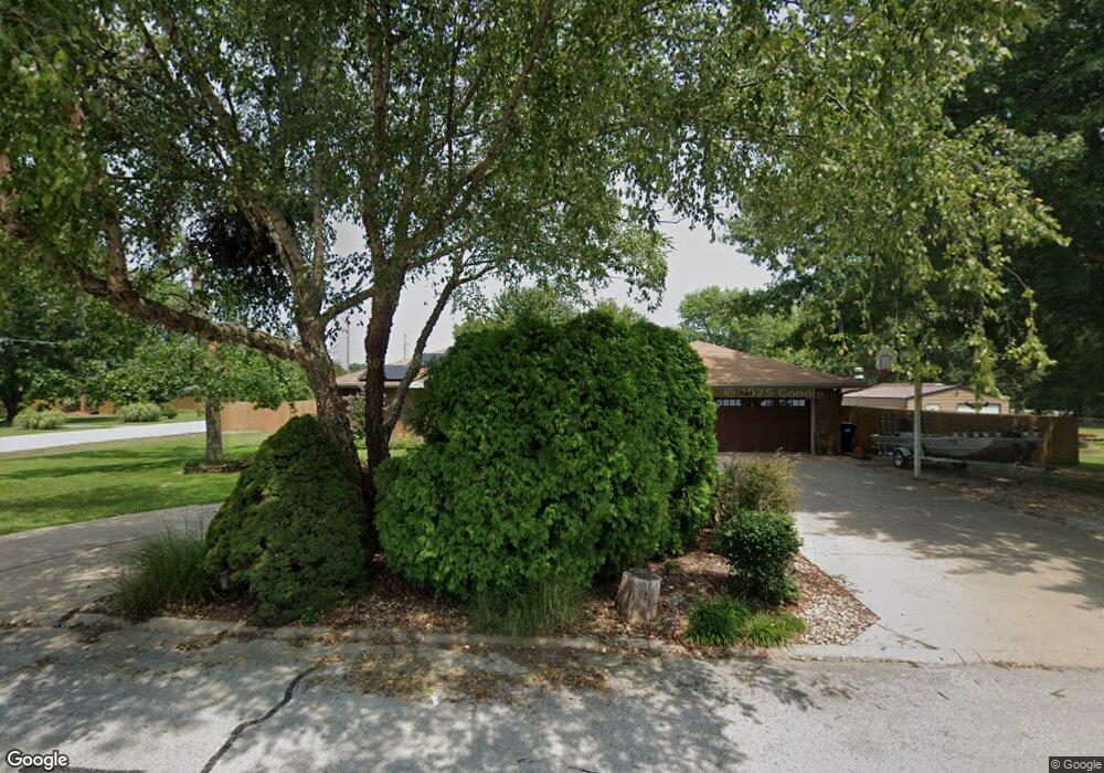
This home is located at 2409 Lamborn Ln, Ozark, MO 65721 and is currently estimated at $346,762, approximately $149 per square foot. 2409 Lamborn Ln is a home with nearby schools including West Elementary School, Ozark Middle School, and Ozark Junior High School.
Ownership History
Date
Name
Owned For
Owner Type
Purchase Details
Closed on
Dec 20, 2007
Sold by
Fretwell Craig J and Fretwell Donna L
Bought by
Helsley Michael L and Helsley Heike M
Current Estimated Value
Home Financials for this Owner
Home Financials are based on the most recent Mortgage that was taken out on this home.
Original Mortgage
$144,900
Outstanding Balance
$89,707
Interest Rate
6.23%
Mortgage Type
New Conventional
Estimated Equity
$257,055
Purchase Details
Closed on
May 20, 2005
Sold by
Buckley David W and Buckley Anne
Bought by
Fretwell Craig J and Fretwell Donna L
Home Financials for this Owner
Home Financials are based on the most recent Mortgage that was taken out on this home.
Original Mortgage
$10,500
Interest Rate
5.83%
Mortgage Type
New Conventional
Create a Home Valuation Report for This Property
The Home Valuation Report is an in-depth analysis detailing your home's value as well as a comparison with similar homes in the area
Home Values in the Area
Average Home Value in this Area
Purchase History
| Date | Buyer | Sale Price | Title Company |
|---|---|---|---|
| Helsley Michael L | -- | None Available | |
| Fretwell Craig J | -- | None Available |
Source: Public Records
Mortgage History
| Date | Status | Borrower | Loan Amount |
|---|---|---|---|
| Open | Helsley Michael L | $144,900 | |
| Previous Owner | Fretwell Craig J | $10,500 |
Source: Public Records
Tax History
| Year | Tax Paid | Tax Assessment Tax Assessment Total Assessment is a certain percentage of the fair market value that is determined by local assessors to be the total taxable value of land and additions on the property. | Land | Improvement |
|---|---|---|---|---|
| 2025 | $1,846 | $32,830 | -- | -- |
| 2024 | $1,843 | $30,820 | -- | -- |
| 2023 | $1,843 | $30,820 | $0 | $0 |
| 2022 | $1,736 | $28,980 | $0 | $0 |
| 2021 | $1,678 | $28,980 | $0 | $0 |
| 2020 | $1,511 | $26,470 | $0 | $0 |
| 2019 | $1,511 | $26,470 | $0 | $0 |
| 2018 | $1,394 | $25,370 | $0 | $0 |
| 2017 | $1,394 | $25,370 | $0 | $0 |
| 2016 | $1,394 | $25,020 | $0 | $0 |
| 2015 | $1,394 | $25,020 | $25,020 | $0 |
| 2014 | $1,422 | $25,840 | $0 | $0 |
| 2013 | $14 | $25,840 | $0 | $0 |
| 2011 | $14 | $51,680 | $0 | $0 |
Source: Public Records
Map
Nearby Homes
- 1099 N Farmer Branch Rd
- 2488 W State Highway Cc
- 5350 N 22nd St
- 6016 Copper Ridge St
- 2497 E Farm Road 194
- 4725 Florence Ave
- 3102 Winged Foot Dr
- 3318 Winged Foot Dr
- 4608 Venice Ave
- 6307 S Meadowview Dr
- 4483 Siena Ave
- 6343 Creeks Edge Ln S
- 6235 S Bluff Ridge Rd
- 4334 Rome Ave
- 3464 E Bluff Point Dr
- 4419 Madrid Ave
- 4105 N Thistle Dr
- 4807 Rolling Hills Dr
- 4107 N 30th St
- 2504 W Chris Ct
- 2407 Lamborn Ln
- 2410 Lamborn Ln
- 6411 N 25th St
- 2408 Westwind Dr
- 2408 Lamborn Ln
- 2404 Westwind Dr
- 2405 Lamborn Ln
- 6407 N 25th St
- 6507 N 25th St
- 2406 Lamborn Ln
- 2409 Westwind Dr
- 2400 Westwind Dr
- 2405 Westwind Dr
- 6311 N 25th St
- 2316 Westwind Dr
- 6697 N Shadywood Dr
- 2401 Lamborn Ln
- 6303 N 25th St
- 2402 Lamborn Ln
- 6696 N Shadywood Dr
Your Personal Tour Guide
Ask me questions while you tour the home.