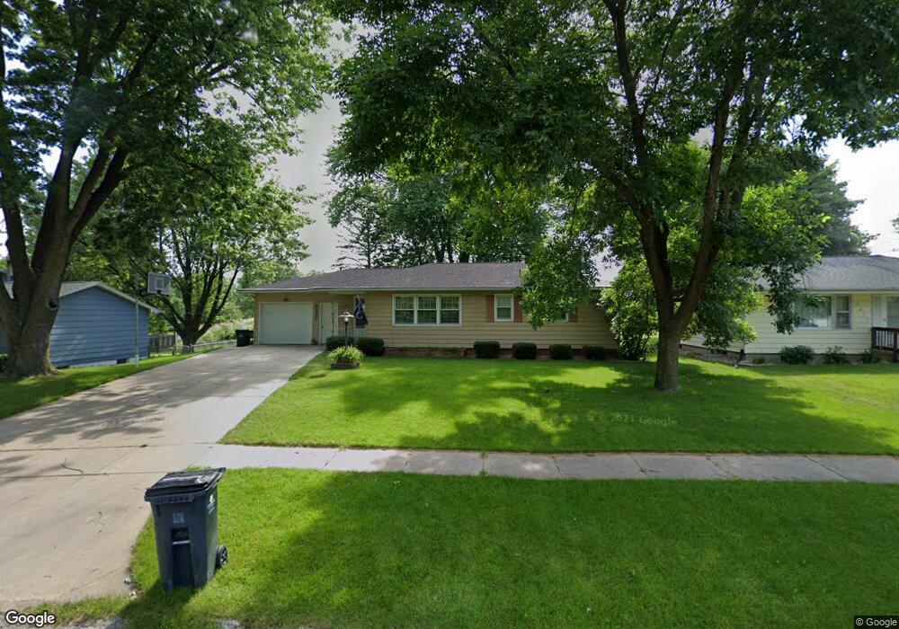
2409 Newport Dr SW Cedar Rapids, IA 52404
Estimated Value: $199,000 - $218,000
3
Beds
2
Baths
1,208
Sq Ft
$171/Sq Ft
Est. Value
About This Home
This home is located at 2409 Newport Dr SW, Cedar Rapids, IA 52404 and is currently estimated at $206,001, approximately $170 per square foot. 2409 Newport Dr SW is a home located in Linn County with nearby schools including Junction City Elementary School, Perryville Elementary School, and Van Buren Elementary School.
Ownership History
Date
Name
Owned For
Owner Type
Purchase Details
Closed on
Jun 24, 2011
Sold by
Gerber Gail D and Eickstaedt Debra S
Bought by
Huxford Kyle
Current Estimated Value
Home Financials for this Owner
Home Financials are based on the most recent Mortgage that was taken out on this home.
Original Mortgage
$108,000
Outstanding Balance
$73,111
Interest Rate
4.25%
Mortgage Type
New Conventional
Estimated Equity
$132,890
Create a Home Valuation Report for This Property
The Home Valuation Report is an in-depth analysis detailing your home's value as well as a comparison with similar homes in the area
Home Values in the Area
Average Home Value in this Area
Purchase History
| Date | Buyer | Sale Price | Title Company |
|---|---|---|---|
| Huxford Kyle | $119,500 | None Available |
Source: Public Records
Mortgage History
| Date | Status | Borrower | Loan Amount |
|---|---|---|---|
| Open | Huxford Kyle | $108,000 |
Source: Public Records
Tax History Compared to Growth
Tax History
| Year | Tax Paid | Tax Assessment Tax Assessment Total Assessment is a certain percentage of the fair market value that is determined by local assessors to be the total taxable value of land and additions on the property. | Land | Improvement |
|---|---|---|---|---|
| 2025 | $3,172 | $197,200 | $48,300 | $148,900 |
| 2024 | $3,362 | $194,500 | $48,300 | $146,200 |
| 2023 | $3,362 | $179,200 | $40,800 | $138,400 |
| 2022 | $2,604 | $159,400 | $40,800 | $118,600 |
| 2021 | $3,056 | $125,700 | $37,100 | $88,600 |
| 2020 | $3,056 | $138,500 | $33,400 | $105,100 |
| 2019 | $2,770 | $128,500 | $33,400 | $95,100 |
| 2018 | $2,694 | $128,500 | $33,400 | $95,100 |
| 2017 | $2,692 | $123,600 | $33,400 | $90,200 |
| 2016 | $2,628 | $123,600 | $33,400 | $90,200 |
| 2015 | $2,656 | $124,868 | $33,413 | $91,455 |
| 2014 | $2,656 | $124,868 | $33,413 | $91,455 |
| 2013 | $2,600 | $124,868 | $33,413 | $91,455 |
Source: Public Records
Map
Nearby Homes
- 2420 Lori Dr SW
- 2126 Snapdragon Cir SW
- 2105 Milligan Ct SW
- 2207 Shady Grove Rd SW
- 2404 25th St SW
- 2025 18th St SW
- 2150 Rockford Rd SW
- 1960 Rockford Rd SW Unit 45
- 1801 Shady Grove Rd SW
- Remington - Cedar Rapids Plan at Whispering Pines
- Copeland Plan at Whispering Pines
- Meadowbrook - Cedar Rapids Plan at Stags Leap Estates
- Caldwell Plan at Stags Leap Estates
- Concord - Cedar Rapids Plan at Stags Leap Estates
- Yuma Expanded Plan at Whispering Pines
- Becker II Plan at Kirkwood Village - Kirk Wood Village
- Meadowbrook - Cedar Rapids Plan at Whispering Pines
- Richland Plan at Stags Leap Estates
- Prescott - Cedar Rapids Plan at Stags Leap Estates
- Becker Plan at Kirkwood Village - Kirk Wood Village
- 2417 Newport Dr SW
- 2401 Newport Dr SW
- 2320 Snapdragon Cir SW
- 2425 Newport Dr SW
- 2333 Newport Dr SW
- 2326 Snapdragon Cir SW
- 2314 Snapdragon Cir SW
- 2406 Newport Dr SW
- 2325 Newport Dr SW
- 2433 Newport Dr SW
- 2416 Newport Dr SW
- 2400 Snapdragon Cir SW
- 2424 Newport Dr SW
- 2332 Newport Dr SW
- 2308 Snapdragon Cir SW
- 2317 Newport Dr SW
- 2432 Newport Dr SW
- 2406 Snapdragon Cir SW
- 2324 Newport Dr SW
- 2440 Newport Dr SW