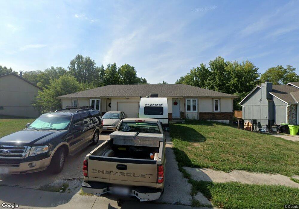
2409 Pearson Cir Unit 2411 Harrisonville, MO 64701
Estimated Value: $290,000 - $339,000
4
Beds
2
Baths
1,650
Sq Ft
$189/Sq Ft
Est. Value
About This Home
This home is located at 2409 Pearson Cir Unit 2411, Harrisonville, MO 64701 and is currently estimated at $311,961, approximately $189 per square foot. 2409 Pearson Cir Unit 2411 is a home located in Cass County with nearby schools including Harrisonville Elementary School, McEowen Elementary School, and Harrisonville Middle School.
Ownership History
Date
Name
Owned For
Owner Type
Purchase Details
Closed on
Sep 10, 2024
Sold by
Cpsk Insurance Services Inc
Bought by
Southard John T and Southard Diane H
Current Estimated Value
Purchase Details
Closed on
Dec 28, 2013
Sold by
Southard John T and Southard Diane H
Bought by
Southard Ryan T
Purchase Details
Closed on
Dec 19, 2012
Sold by
Southard John T and Southard Diane H
Bought by
Southard Ryan T
Purchase Details
Closed on
Dec 20, 2011
Sold by
Southard John T and Southard Diane H
Bought by
Southard Ryan T
Purchase Details
Closed on
Dec 20, 2010
Sold by
Southard John T and Southard Diane H
Bought by
Southard Ryan T
Purchase Details
Closed on
Dec 29, 2009
Sold by
Southard John T and Southard Diane H
Bought by
Southard Ryan T
Purchase Details
Closed on
Jan 2, 2008
Sold by
Southard John T and Southard Diane H
Bought by
Southard Ryan T
Purchase Details
Closed on
Dec 19, 2007
Sold by
Southard John T and Southard Diane H
Bought by
Southard Ryan T
Purchase Details
Closed on
Jan 3, 2006
Sold by
Southard John T and Southard Diane H
Bought by
Southard Ryan T
Purchase Details
Closed on
Dec 29, 2005
Sold by
Southard John T and Southard Diane H
Bought by
Southard Ryan T
Create a Home Valuation Report for This Property
The Home Valuation Report is an in-depth analysis detailing your home's value as well as a comparison with similar homes in the area
Home Values in the Area
Average Home Value in this Area
Purchase History
| Date | Buyer | Sale Price | Title Company |
|---|---|---|---|
| Southard John T | -- | None Listed On Document | |
| Southard Ryan T | -- | None Available | |
| Southard Ryan T | -- | None Available | |
| Southard Ryan T | -- | None Available | |
| Southard Ryan T | -- | -- | |
| Southard Ryan T | -- | None Available | |
| Southard Ryan T | -- | -- | |
| Southard Ryan T | -- | -- | |
| Southard Ryan T | -- | -- | |
| Southard Ryan T | -- | -- |
Source: Public Records
Tax History Compared to Growth
Tax History
| Year | Tax Paid | Tax Assessment Tax Assessment Total Assessment is a certain percentage of the fair market value that is determined by local assessors to be the total taxable value of land and additions on the property. | Land | Improvement |
|---|---|---|---|---|
| 2024 | $2,293 | $34,160 | $3,570 | $30,590 |
| 2023 | $2,293 | $34,160 | $3,570 | $30,590 |
| 2022 | $2,008 | $29,570 | $3,570 | $26,000 |
| 2021 | $2,008 | $29,570 | $3,570 | $26,000 |
| 2020 | $1,926 | $28,450 | $3,570 | $24,880 |
| 2019 | $1,783 | $28,450 | $3,570 | $24,880 |
| 2018 | $1,621 | $25,650 | $3,140 | $22,510 |
| 2017 | -- | $25,650 | $3,140 | $22,510 |
| 2016 | $1,490 | $23,400 | $3,140 | $20,260 |
| 2015 | -- | $23,400 | $3,140 | $20,260 |
| 2014 | -- | $23,400 | $3,140 | $20,260 |
| 2013 | -- | $23,400 | $3,140 | $20,260 |
Source: Public Records
Map
Nearby Homes
- 104 Brookridge Dr
- 304 Andrea Ln
- 2618 Meadowlark Dr
- 909 Mission Dr
- 616 Silver Maple Dr
- 2203 Twin Oaks Dr
- 1001 Twin Oaks Terrace
- 2201 Twin Oaks Dr
- 902 Twin Oaks Terrace
- 1003 Twin Oaks Terrace
- 904 Twin Oaks Terrace
- 705 Galaxie Ave
- 1000 Twin Oaks Terrace
- 1002 Twin Oaks Terrace
- 2203 Mission Rd
- 2205 Mission Rd
- 2200 Mission Rd
- 2500 Twin Oaks Dr
- 1001 Bird Ave
- 1101 Mission Rd
- 2407 Pearson Cir
- 202 Brookridge Dr Unit 204
- 2405 Pearson Cir
- 304 Brookridge Dr
- 2406 Ridgewood Rd
- 2403 Pearson Cir
- 2404 Ridgewood Rd
- 2408 Ridgewood Rd
- 2412 Pearson Cir
- 2414 Pearson Cir
- 201 Brookridge Dr Unit 203
- 207 Brookridge Dr
- 2410 Pearson Cir
- 2402 Ridgewood Rd
- 2401 Pearson Cir
- 2402 Pearson Cir
- 2408 Pearson Cir
- 2404 Pearson Cir Unit 2406
- 205 Brookridge Dr Unit 207
- 303 Brookridge Dr