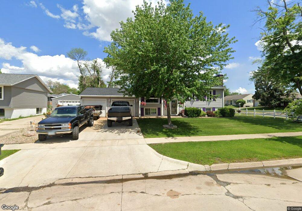
241 Broadmore Rd SW Cedar Rapids, IA 52404
Cherry Hill Park NeighborhoodEstimated Value: $208,000 - $222,115
4
Beds
2
Baths
894
Sq Ft
$238/Sq Ft
Est. Value
About This Home
This home is located at 241 Broadmore Rd SW, Cedar Rapids, IA 52404 and is currently estimated at $212,779, approximately $238 per square foot. 241 Broadmore Rd SW is a home located in Linn County with nearby schools including Junction City Elementary School, West Willow Elementary School, and Bourbon Central Elementary School.
Ownership History
Date
Name
Owned For
Owner Type
Purchase Details
Closed on
Sep 23, 2016
Sold by
Mann Joel D
Bought by
Mann Carol A
Current Estimated Value
Create a Home Valuation Report for This Property
The Home Valuation Report is an in-depth analysis detailing your home's value as well as a comparison with similar homes in the area
Home Values in the Area
Average Home Value in this Area
Purchase History
| Date | Buyer | Sale Price | Title Company |
|---|---|---|---|
| Mann Carol A | -- | None Available |
Source: Public Records
Tax History Compared to Growth
Tax History
| Year | Tax Paid | Tax Assessment Tax Assessment Total Assessment is a certain percentage of the fair market value that is determined by local assessors to be the total taxable value of land and additions on the property. | Land | Improvement |
|---|---|---|---|---|
| 2025 | $3,172 | $216,800 | $42,200 | $174,600 |
| 2024 | $3,430 | $201,500 | $36,900 | $164,600 |
| 2023 | $3,430 | $189,700 | $36,900 | $152,800 |
| 2022 | $2,980 | $171,500 | $31,600 | $139,900 |
| 2021 | $2,974 | $152,800 | $31,600 | $121,200 |
| 2020 | $2,974 | $143,400 | $28,100 | $115,300 |
| 2019 | $2,624 | $130,300 | $28,100 | $102,200 |
| 2018 | $2,548 | $130,300 | $28,100 | $102,200 |
| 2017 | $2,635 | $125,900 | $28,100 | $97,800 |
| 2016 | $2,635 | $124,000 | $28,100 | $95,900 |
| 2015 | $2,731 | $128,344 | $28,110 | $100,234 |
| 2014 | $2,546 | $128,344 | $28,110 | $100,234 |
| 2013 | $2,486 | $128,344 | $28,110 | $100,234 |
Source: Public Records
Map
Nearby Homes
- 6118 Greenbriar Ln SW Unit D
- 6008 Eastview Ave SW
- 6305 Greenbriar Ln SW Unit B
- 323 Norwick Rd SW
- 1590 Stoney Pt Rd & 6600 16th Ave SW
- 5918 Sharon Ln NW
- 164 Cherry Hill Rd NW
- 6812 Underwood Ave SW
- 6907 Rock Wood Dr SW
- 509 Grey Slate Dr SW
- 150 Meadowlark Ln NW
- 6916 Rock Wood Dr SW
- 106 Leroy St NW
- 200 Cherry Park Dr NW
- 614 Grey Slate Dr SW
- 620 Grey Slate Dr SW
- 225 Rockvalley Ln NW
- 6608 Limestone Ct NW
- 5127 Holly Ave NW
- 4975 Kesler Rd NW
- 235 Broadmore Rd SW
- 6040 Langdon Ave SW
- 6036 Langdon Ave SW
- 233 Broadmore Rd SW
- 6051 Eastview Ave SW
- 6109 Langdon Ave SW
- 6103 Langdon Ave SW
- 6115 Langdon Ave SW
- 242 Broadmore Rd SW
- 6045 Eastview Ave SW
- 236 Broadmore Rd SW
- 6035 Langdon Ave SW
- 6032 Langdon Ave SW
- 6121 Langdon Ave SW
- 234 Broadmore Rd SW
- 6039 Eastview Ave SW
- 6031 Langdon Ave SW
- 6129 Langdon Ave SW
- 6204 Langdon Ave SW
- 6110 Underwood Ave SW