J
Seller's Agent in 2025
Jake Pereira
HERE Realty
(774) 284-3802
1 in this area
4 Total Sales
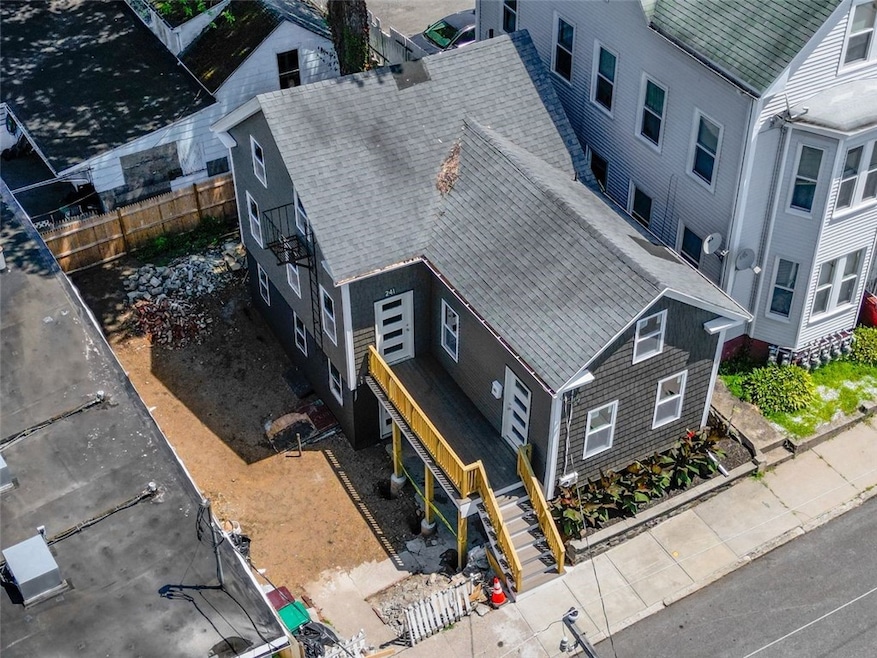
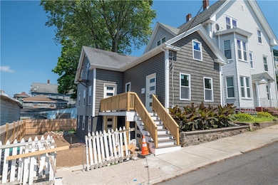
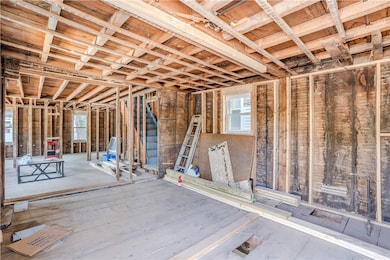
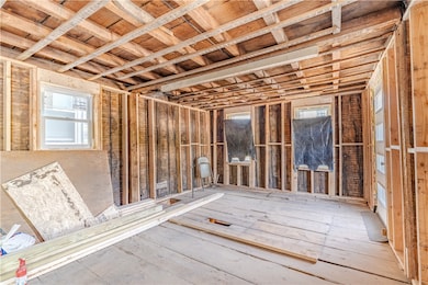
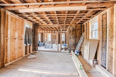
Way more spacious than it seems, this interior offers room to grow in this unique opportunity at 241 Cato Street. Possibility for two separate living areas. Recent exterior updates include brand-new construction windows, maintenance-free vinyl siding, and a new deck, setting a solid foundation for the next phase of renovation. Whether you're an investor or an owner-occupant, this property provides the chance to build equity and create your vision. Located in an area showing signs of revitalization, this home offers plenty of upside. Don't miss out on this one.
| Date | Type | Sale Price | Title Company |
|---|---|---|---|
| Warranty Deed | $145,000 | -- | |
| Foreclosure Deed | $86,000 | None Available | |
| Foreclosure Deed | $86,000 | None Available | |
| Warranty Deed | $86,000 | -- | |
| Warranty Deed | $86,000 | -- |
| Date | Status | Loan Amount | Loan Type |
|---|---|---|---|
| Open | $276,000 | Future Advance Clause Open End Mortgage | |
| Previous Owner | $110,000 | Purchase Money Mortgage | |
| Previous Owner | $142,754 | No Value Available | |
| Previous Owner | $141,500 | No Value Available | |
| Previous Owner | $128,500 | No Value Available |
| Date | Event | Price | List to Sale | Price per Sq Ft |
|---|---|---|---|---|
| 11/05/2025 11/05/25 | Sold | $145,000 | -12.1% | $137 / Sq Ft |
| 10/09/2025 10/09/25 | Pending | -- | -- | -- |
| 09/29/2025 09/29/25 | Price Changed | $165,000 | -15.4% | $156 / Sq Ft |
| 09/06/2025 09/06/25 | Price Changed | $195,000 | -13.3% | $184 / Sq Ft |
| 08/01/2025 08/01/25 | For Sale | $225,000 | -- | $213 / Sq Ft |
| Year | Tax Paid | Tax Assessment Tax Assessment Total Assessment is a certain percentage of the fair market value that is determined by local assessors to be the total taxable value of land and additions on the property. | Land | Improvement |
|---|---|---|---|---|
| 2025 | $2,138 | $190,400 | $72,200 | $118,200 |
| 2024 | $2,260 | $155,400 | $73,600 | $81,800 |
| 2023 | $2,172 | $155,400 | $73,600 | $81,800 |
| 2022 | $2,172 | $155,400 | $73,600 | $81,800 |
| 2021 | $2,247 | $94,600 | $32,200 | $62,400 |
| 2020 | $2,270 | $94,600 | $32,200 | $62,400 |
| 2018 | $2,278 | $94,600 | $32,200 | $62,400 |
| 2017 | $2,742 | $91,100 | $32,800 | $58,300 |
| 2016 | $2,901 | $91,100 | $32,800 | $58,300 |
| 2015 | $3,332 | $91,100 | $32,800 | $58,300 |
| 2014 | $3,177 | $88,400 | $36,100 | $52,300 |
J
Seller's Agent in 2025
Jake Pereira
HERE Realty
(774) 284-3802
1 in this area
4 Total Sales

Buyer's Agent in 2025
Lisa Green-Browne
Keller Williams Realty
(857) 719-7278
1 in this area
76 Total Sales
Source: State-Wide MLS
MLS Number: 1391537
APN: WOON-000014T-000231-000002
Disclaimer: Certain information contained herein is derived from information provided by parties other than Homes.com. All information provided is deemed reliable, but is not guaranteed to be accurate and should be independently verified.
![]() IDX information is provided exclusively for personal, non-commercial use, and may not be used for any purpose other than to identify prospective properties consumers may be interested in purchasing. Information is deemed reliable but not guaranteed.
IDX information is provided exclusively for personal, non-commercial use, and may not be used for any purpose other than to identify prospective properties consumers may be interested in purchasing. Information is deemed reliable but not guaranteed.
Copyright © 2026 State-Wide MLS, Inc. All rights reserved.
Ask me questions while you tour the home.