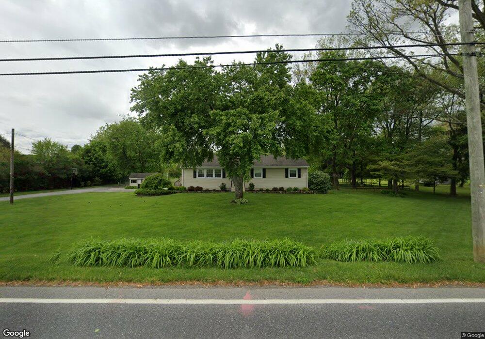
241 Cedar Rd Mickleton, NJ 08056
Estimated Value: $507,650 - $614,000
Studio
--
Bath
1,976
Sq Ft
$285/Sq Ft
Est. Value
About This Home
This home is located at 241 Cedar Rd, Mickleton, NJ 08056 and is currently estimated at $562,913, approximately $284 per square foot. 241 Cedar Rd is a home located in Gloucester County with nearby schools including Centre City School, J. Mason Tomlin Elementary School, and Clearview Regional Middle School.
Ownership History
Date
Name
Owned For
Owner Type
Purchase Details
Closed on
Dec 28, 2021
Sold by
Holland Arthur F
Bought by
Holland Arthur F and Caputo Vincent J
Current Estimated Value
Home Financials for this Owner
Home Financials are based on the most recent Mortgage that was taken out on this home.
Original Mortgage
$223,000
Outstanding Balance
$205,360
Interest Rate
3.05%
Mortgage Type
New Conventional
Estimated Equity
$357,553
Purchase Details
Closed on
Apr 24, 1998
Sold by
Jernoske Charles J and Jernoske Barbara M
Bought by
Holland Arthur F and Metella Laura
Home Financials for this Owner
Home Financials are based on the most recent Mortgage that was taken out on this home.
Original Mortgage
$119,700
Interest Rate
7.04%
Create a Home Valuation Report for This Property
The Home Valuation Report is an in-depth analysis detailing your home's value as well as a comparison with similar homes in the area
Home Values in the Area
Average Home Value in this Area
Purchase History
| Date | Buyer | Sale Price | Title Company |
|---|---|---|---|
| Holland Arthur F | -- | Land Title Services | |
| Holland Arthur F | -- | Land Title Services | |
| Holland Arthur F | $133,000 | -- |
Source: Public Records
Mortgage History
| Date | Status | Borrower | Loan Amount |
|---|---|---|---|
| Open | Holland Arthur F | $223,000 | |
| Closed | Holland Arthur F | $223,000 | |
| Previous Owner | Holland Arthur F | $119,700 |
Source: Public Records
Tax History
| Year | Tax Paid | Tax Assessment Tax Assessment Total Assessment is a certain percentage of the fair market value that is determined by local assessors to be the total taxable value of land and additions on the property. | Land | Improvement |
|---|---|---|---|---|
| 2025 | $9,502 | $378,900 | $164,000 | $214,900 |
| 2024 | $9,402 | $369,000 | $164,000 | $205,000 |
Source: Public Records
Map
Nearby Homes
- 253 Jennings Way
- L13 N Bridgeton Pike
- 231 N Main St
- 446 Heritage Rd
- 253 Jessups Mill Rd
- 325 Windsor Rd
- 0 Jessups Mill Rd
- 642 Bainbridge Dr
- 326 Stonehouse Ln
- 18 Millwood Dr
- 552 Hereford Ln
- 607 Apple Dr
- 41 Redkist Dr
- 32 Redkist Dr
- 34 Redkist Dr
- 30 Redkist Dr
- 28 Redkist Dr
- 26 Redkist Dr
- 110 Earlington Ave
- 106 Earlington Ave
Your Personal Tour Guide
Ask me questions while you tour the home.