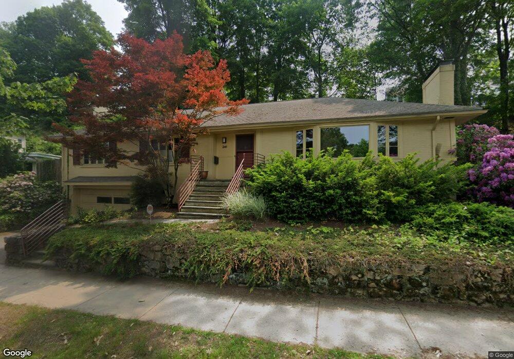
241 Crafts Rd Chestnut Hill, MA 02467
Chestnut Hill NeighborhoodEstimated Value: $1,889,135 - $2,167,000
3
Beds
3
Baths
1,951
Sq Ft
$1,041/Sq Ft
Est. Value
About This Home
This home is located at 241 Crafts Rd, Chestnut Hill, MA 02467 and is currently estimated at $2,030,034, approximately $1,040 per square foot. 241 Crafts Rd is a home located in Norfolk County with nearby schools including Heath Elementary School, Brimmer & May School, and Torah Academy.
Ownership History
Date
Name
Owned For
Owner Type
Purchase Details
Closed on
Jul 16, 1992
Sold by
Shander Carole M
Bought by
Coley Christopher M
Current Estimated Value
Home Financials for this Owner
Home Financials are based on the most recent Mortgage that was taken out on this home.
Original Mortgage
$300,000
Interest Rate
8.54%
Mortgage Type
Purchase Money Mortgage
Create a Home Valuation Report for This Property
The Home Valuation Report is an in-depth analysis detailing your home's value as well as a comparison with similar homes in the area
Home Values in the Area
Average Home Value in this Area
Purchase History
| Date | Buyer | Sale Price | Title Company |
|---|---|---|---|
| Coley Christopher M | $385,000 | -- |
Source: Public Records
Mortgage History
| Date | Status | Borrower | Loan Amount |
|---|---|---|---|
| Closed | Coley Christopher M | $292,000 | |
| Closed | Coley Christopher M | $300,000 | |
| Closed | Coley Christopher M | $258,000 |
Source: Public Records
Tax History Compared to Growth
Tax History
| Year | Tax Paid | Tax Assessment Tax Assessment Total Assessment is a certain percentage of the fair market value that is determined by local assessors to be the total taxable value of land and additions on the property. | Land | Improvement |
|---|---|---|---|---|
| 2025 | $17,206 | $1,743,300 | $1,132,500 | $610,800 |
| 2024 | $16,321 | $1,670,500 | $1,089,000 | $581,500 |
| 2023 | $14,607 | $1,465,100 | $894,300 | $570,800 |
| 2022 | $14,218 | $1,395,300 | $851,700 | $543,600 |
| 2021 | $13,148 | $1,341,600 | $818,900 | $522,700 |
| 2020 | $11,894 | $1,258,600 | $744,500 | $514,100 |
| 2019 | $11,231 | $1,198,600 | $709,000 | $489,600 |
| 2018 | $11,792 | $1,246,500 | $706,600 | $539,900 |
| 2017 | $11,619 | $1,176,000 | $666,700 | $509,300 |
| 2016 | $11,453 | $1,099,100 | $623,100 | $476,000 |
| 2015 | $10,970 | $1,027,200 | $582,300 | $444,900 |
| 2014 | $10,723 | $941,400 | $529,300 | $412,100 |
Source: Public Records
Map
Nearby Homes
- 142 Crafts Rd
- 30 Ackers Ave
- 540 Chestnut Hill Ave
- 88 Cutler Ln
- 174 Middlesex Rd
- 2400 Beacon St Unit 112
- 675 Chestnut Hill Ave
- 1014 Boylston St
- 130 Cabot St
- 6 Sutherland Rd Unit 41
- 44 Orkney Rd Unit 3
- 17 Strathmore Rd Unit 2
- 41 Orkney Rd
- 120 Seaver St Unit A103
- 120 Seaver St Unit C-102
- 8 Strathmore Rd Unit G
- 31 Orkney Rd Unit 54
- 1880 Beacon St Unit 6
- 55 Leicester St
- 1856 Beacon St Unit 2C
- 247 Crafts Rd
- 191 Reservoir Rd
- 187 Reservoir Rd
- 197 Reservoir Rd
- 183 Reservoir Rd
- 233 Crafts Rd
- 154 Eliot St
- 201 Reservoir Rd
- 180 Eliot St
- 177 Reservoir Rd
- 319 Dean Rd
- 150 Eliot St
- 209 Reservoir Rd
- 175 Eliot St
- 225 Crafts Rd
- 221 Crafts Rd
- 221 Crafts Rd Unit 1
- 219 Crafts Rd Unit 3
- 219 Crafts Rd Unit 2
- 183 Eliot St