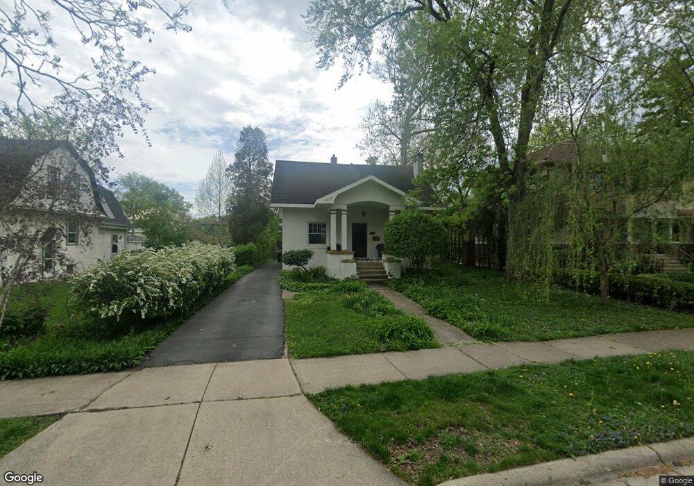
241 Olmsted Rd Riverside, IL 60546
Estimated Value: $608,000 - $651,800
3
Beds
4
Baths
2,025
Sq Ft
$309/Sq Ft
Est. Value
About This Home
This home is located at 241 Olmsted Rd, Riverside, IL 60546 and is currently estimated at $625,450, approximately $308 per square foot. 241 Olmsted Rd is a home located in Cook County with nearby schools including Central Elementary School, L J Hauser Jr High School, and Riverside Brookfield High School.
Ownership History
Date
Name
Owned For
Owner Type
Purchase Details
Closed on
Oct 24, 2024
Sold by
Garbe James D and Garbe Darby
Bought by
Straka Michael J
Current Estimated Value
Purchase Details
Closed on
Jul 13, 2009
Sold by
Wells Fargo Bank National Association
Bought by
Garbe James and Garbe Darby
Home Financials for this Owner
Home Financials are based on the most recent Mortgage that was taken out on this home.
Original Mortgage
$220,000
Interest Rate
5.29%
Mortgage Type
Unknown
Purchase Details
Closed on
Mar 26, 2009
Sold by
Czerwin
Bought by
Wells Fargo Bank National Association
Create a Home Valuation Report for This Property
The Home Valuation Report is an in-depth analysis detailing your home's value as well as a comparison with similar homes in the area
Home Values in the Area
Average Home Value in this Area
Purchase History
| Date | Buyer | Sale Price | Title Company |
|---|---|---|---|
| Straka Michael J | $285,000 | None Listed On Document | |
| Garbe James | $315,000 | First American Title | |
| Wells Fargo Bank National Association | -- | None Available |
Source: Public Records
Mortgage History
| Date | Status | Borrower | Loan Amount |
|---|---|---|---|
| Previous Owner | Garbe James | $220,000 |
Source: Public Records
Tax History Compared to Growth
Tax History
| Year | Tax Paid | Tax Assessment Tax Assessment Total Assessment is a certain percentage of the fair market value that is determined by local assessors to be the total taxable value of land and additions on the property. | Land | Improvement |
|---|---|---|---|---|
| 2024 | $14,935 | $46,075 | $7,600 | $38,475 |
| 2023 | $13,485 | $50,000 | $7,600 | $42,400 |
| 2022 | $13,485 | $38,626 | $6,650 | $31,976 |
| 2021 | $12,990 | $38,625 | $6,650 | $31,975 |
| 2020 | $12,646 | $38,625 | $6,650 | $31,975 |
| 2019 | $10,519 | $33,316 | $6,080 | $27,236 |
| 2018 | $11,246 | $36,354 | $6,080 | $30,274 |
| 2017 | $12,132 | $40,077 | $6,080 | $33,997 |
| 2016 | $10,251 | $31,605 | $5,320 | $26,285 |
| 2015 | $9,973 | $31,605 | $5,320 | $26,285 |
| 2014 | $10,984 | $35,046 | $5,320 | $29,726 |
| 2013 | $10,252 | $35,493 | $5,320 | $30,173 |
Source: Public Records
Map
Nearby Homes
- 172 Olmsted Rd
- 7335 Oakwood Ave Unit P-10
- 7335 Oakwood Ave Unit P-12
- 7335 Oakwood Ave Unit P-8
- 7335 Oakwood Ave Unit P-11
- 7335 Oakwood Ave Unit P-14
- 3515 S Harlem Ave Unit 1B
- 7316 40th St Unit P-9
- 7316 40th St Unit P-10
- 7316 40th St Unit P-13
- 3731 Maple Ave
- 3816 Wisconsin Ave
- 3829 Wisconsin Ave
- 269 Shenstone Rd
- 7032 Pershing Rd
- 3900 Home Ave
- 56 Forest Ave Unit 1N
- 4115 S Harlem Ave Unit GE
- 7825 41st Place
- 3742 Clinton Ave
- 237 Olmsted Rd
- 233 Olmsted Rd
- 272 Blackhawk Rd
- 268 Blackhawk Rd
- 276 Blackhawk Rd
- 261 Olmsted Rd
- 229 Olmsted Rd
- 264 Blackhawk Rd
- 259 Olmsted Rd
- 260 Blackhawk Rd
- 225 Olmsted Rd
- 284 Blackhawk Rd
- 120 S Herbert Rd
- 248 Olmsted Rd
- 256 Blackhawk Rd
- 265 Olmsted Rd
- 288 Blackhawk Rd
- 252 Olmsted Rd
- 110 S Herbert Rd
- 221 Olmsted Rd