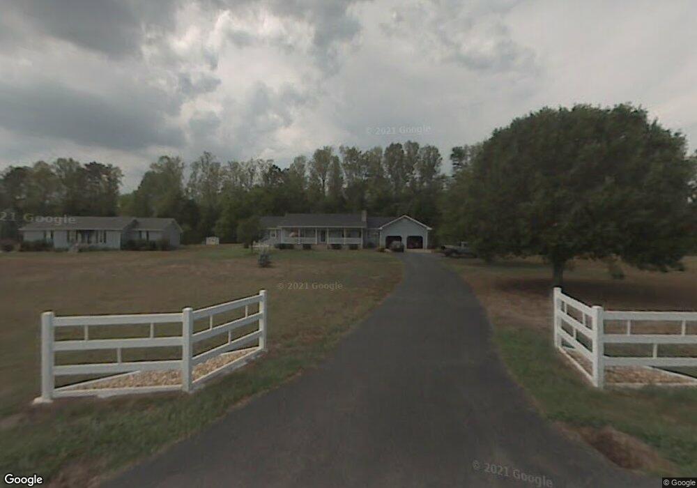
241 Rockholt Ln Georgetown, TN 37336
Estimated Value: $308,924 - $681,000
3
Beds
2
Baths
1,776
Sq Ft
$268/Sq Ft
Est. Value
About This Home
This home is located at 241 Rockholt Ln, Georgetown, TN 37336 and is currently estimated at $475,231, approximately $267 per square foot. 241 Rockholt Ln is a home located in Meigs County with nearby schools including Meigs County High School.
Ownership History
Date
Name
Owned For
Owner Type
Purchase Details
Closed on
Jun 12, 2012
Sold by
Malone Charles D
Bought by
Pierce Louise and Pierce James
Current Estimated Value
Purchase Details
Closed on
Jul 9, 2008
Sold by
Phillips Lester F
Bought by
Malone Charles D
Purchase Details
Closed on
Apr 30, 2004
Sold by
Gladson Joyce R
Bought by
Phillips Lester F
Purchase Details
Closed on
Jun 2, 2000
Sold by
Mullins Joe H
Bought by
Gladson Joyce R
Purchase Details
Closed on
Aug 12, 1985
Bought by
Mullins Joe H and Mullins Vera S
Purchase Details
Closed on
Jul 18, 1985
Create a Home Valuation Report for This Property
The Home Valuation Report is an in-depth analysis detailing your home's value as well as a comparison with similar homes in the area
Home Values in the Area
Average Home Value in this Area
Purchase History
| Date | Buyer | Sale Price | Title Company |
|---|---|---|---|
| Pierce Louise | -- | -- | |
| Pierce Louise | -- | -- | |
| Malone Charles D | $175,000 | -- | |
| Malone Charles D | $175,000 | -- | |
| Phillips Lester F | $145,000 | -- | |
| Phillips Lester F | $145,000 | -- | |
| Gladson Joyce R | $125,000 | -- | |
| Mullins Joe H | -- | -- | |
| Mullins Joe H | -- | -- | |
| -- | -- | -- | |
| -- | -- | -- |
Source: Public Records
Tax History Compared to Growth
Tax History
| Year | Tax Paid | Tax Assessment Tax Assessment Total Assessment is a certain percentage of the fair market value that is determined by local assessors to be the total taxable value of land and additions on the property. | Land | Improvement |
|---|---|---|---|---|
| 2024 | $913 | $54,075 | $15,000 | $39,075 |
| 2023 | $913 | $54,075 | $15,000 | $39,075 |
| 2022 | $913 | $54,075 | $15,000 | $39,075 |
| 2021 | $913 | $54,075 | $15,000 | $39,075 |
| 2020 | $848 | $50,325 | $11,250 | $39,075 |
| 2019 | $848 | $42,825 | $10,500 | $32,325 |
| 2018 | $848 | $42,825 | $10,500 | $32,325 |
| 2017 | $848 | $42,825 | $10,500 | $32,325 |
| 2016 | $848 | $42,825 | $10,500 | $32,325 |
| 2015 | $802 | $42,825 | $10,500 | $32,325 |
| 2014 | $599 | $31,975 | $4,750 | $27,225 |
Source: Public Records
Map
Nearby Homes
- 334 Windmill Ln
- 362 Windmill Ln
- 238 Ware Ln
- 675 Ware Ln
- 383 Lakehaven Cir
- 783 Lakehaven Cir
- 0 Horner Hollow Rd Unit 1522334
- 0 Horner Hollow Rd Unit RTC3007780
- 0 Horner Hollow Rd Unit 20254688
- 482 Hiwassee Dr
- Lot 7 Lake Forest Dr
- 152 Hiwassee Dr
- 5682 Tennessee 58
- 132 Hiwassee Dr
- 3313 Redman Ln
- 260 Sam Johnson Rd NW
- 225 Woods Subdivision Ln
- Lot 35 Tennessee 60
- Lot 31 Tennessee 60
- Lot 28 Tennessee 60
- 207 Rockholt Ln
- 267 Rockholt Ln
- 281 Rockholt Ln
- 244 Rockholt Ln
- 270 Rockholt Ln
- 190 Kimbrough Ln
- 0 Kimbrough Ln
- 150 Rockholt Ln
- 300 Rockholt Ln
- 198 Kimbrough Ln
- 179 Kimbrough Ln
- 185 Kimbrough Ln
- 311 Rockholt Ln
- 344 Rockholt Ln
- 331 Rockholt Ln
- 3 Rockholt Ln
- 1 Rockholt Ln
- 2 Rockholt Ln
- 0 Rockholt Ln
- Rockholt C Rockholt Ln