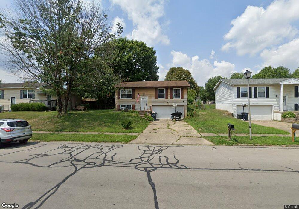
241 Trace Dr Lancaster, OH 43130
Estimated Value: $212,000 - $230,000
3
Beds
2
Baths
1,080
Sq Ft
$205/Sq Ft
Est. Value
About This Home
This home is located at 241 Trace Dr, Lancaster, OH 43130 and is currently estimated at $221,457, approximately $205 per square foot. 241 Trace Dr is a home located in Fairfield County with nearby schools including General Sherman Junior High School, Lancaster High School, and St Mary Elementary School.
Ownership History
Date
Name
Owned For
Owner Type
Purchase Details
Closed on
Nov 11, 2009
Sold by
Siegfried Karen and Estate Of Helen L Gears
Bought by
Avellino Luigi and Avellino Tanya M
Current Estimated Value
Home Financials for this Owner
Home Financials are based on the most recent Mortgage that was taken out on this home.
Original Mortgage
$108,989
Outstanding Balance
$69,857
Interest Rate
4.96%
Mortgage Type
FHA
Estimated Equity
$151,600
Purchase Details
Closed on
Aug 1, 1989
Purchase Details
Closed on
Aug 1, 1986
Create a Home Valuation Report for This Property
The Home Valuation Report is an in-depth analysis detailing your home's value as well as a comparison with similar homes in the area
Home Values in the Area
Average Home Value in this Area
Purchase History
| Date | Buyer | Sale Price | Title Company |
|---|---|---|---|
| Avellino Luigi | $111,000 | Lawyers Title-Lancaster | |
| -- | $49,000 | -- | |
| -- | $42,500 | -- |
Source: Public Records
Mortgage History
| Date | Status | Borrower | Loan Amount |
|---|---|---|---|
| Open | Avellino Luigi | $108,989 |
Source: Public Records
Tax History
| Year | Tax Paid | Tax Assessment Tax Assessment Total Assessment is a certain percentage of the fair market value that is determined by local assessors to be the total taxable value of land and additions on the property. | Land | Improvement |
|---|---|---|---|---|
| 2025 | $4,203 | $62,020 | $20,350 | $41,670 |
| 2024 | $4,203 | $46,750 | $10,850 | $35,900 |
| 2023 | $1,701 | $46,750 | $10,850 | $35,900 |
| 2022 | $1,707 | $46,750 | $10,850 | $35,900 |
| 2021 | $1,463 | $37,540 | $10,340 | $27,200 |
| 2020 | $1,402 | $37,540 | $10,340 | $27,200 |
| 2019 | $1,333 | $37,540 | $10,340 | $27,200 |
| 2018 | $1,159 | $31,550 | $10,340 | $21,210 |
| 2017 | $1,159 | $31,000 | $10,340 | $20,660 |
| 2016 | $1,129 | $31,000 | $10,340 | $20,660 |
| 2015 | $1,159 | $30,890 | $10,340 | $20,550 |
| 2014 | $1,104 | $30,890 | $10,340 | $20,550 |
| 2013 | $1,104 | $30,890 | $10,340 | $20,550 |
Source: Public Records
Map
Nearby Homes
- 426 Ridgemere Way
- 219 Peters Ave
- 114-116 S Cedar Ave
- 772 Pennsylvania Ave
- 1414 Cedar Hill Rd
- 1511 Cedar Hill Rd
- 729 Pennsylvania Ave
- 453 Bren Dr
- 157 Cedar Hill Rd
- 0 Highland Ave
- 215 Summitview Dr
- 302 Washington Ave
- 757 W Mulberry St
- 520 W Wheeling St
- 1829 Shoshone Dr
- 505 Busby Ave
- 461 N Shoshone Dr
- 507 Washington Ave
- 539 N Ohio Ave
- 621 Washington Ave
- 249 Trace Dr
- 233 Trace Dr
- 324 Williamsburg Ln NW
- 227 Trace Dr
- 316 Williamsburg Ln NW
- 0 Canterbury Ct Unit 438A
- 232 Trace Dr
- 232 Trace Dr Unit 6B
- 232 Trace Dr Unit C
- 232 Trace Dr Unit B
- 250 Trace Dr C
- 250 Trace Dr
- 219 Trace Dr
- 250 Trace Dr
- 250 Trace Dr
- 250 Trace Dr
- 250 Trace Dr Unit 7D
- 250 Trace Dr Unit D
- 250 Trace Dr Unit B
- 250 Trace Dr Unit A
Your Personal Tour Guide
Ask me questions while you tour the home.