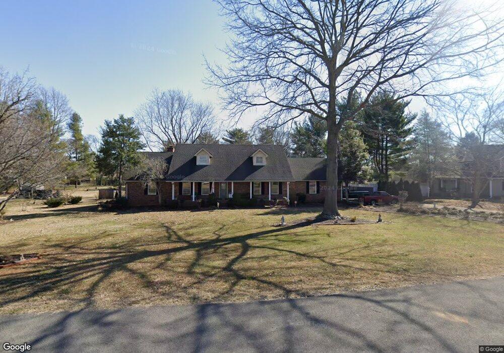
2410 Spaulding Cir Murfreesboro, TN 37128
Estimated Value: $448,601 - $534,000
--
Bed
3
Baths
2,543
Sq Ft
$194/Sq Ft
Est. Value
About This Home
This home is located at 2410 Spaulding Cir, Murfreesboro, TN 37128 and is currently estimated at $493,650, approximately $194 per square foot. 2410 Spaulding Cir is a home located in Rutherford County with nearby schools including Cason Lane Academy, Rockvale Middle School, and Rockvale High School.
Ownership History
Date
Name
Owned For
Owner Type
Purchase Details
Closed on
Apr 28, 2006
Sold by
John Giles
Bought by
Brown Luther W and Brown Diane L
Current Estimated Value
Home Financials for this Owner
Home Financials are based on the most recent Mortgage that was taken out on this home.
Original Mortgage
$230,000
Outstanding Balance
$131,944
Interest Rate
6.33%
Mortgage Type
Purchase Money Mortgage
Estimated Equity
$361,706
Create a Home Valuation Report for This Property
The Home Valuation Report is an in-depth analysis detailing your home's value as well as a comparison with similar homes in the area
Home Values in the Area
Average Home Value in this Area
Purchase History
| Date | Buyer | Sale Price | Title Company |
|---|---|---|---|
| Brown Luther W | $230,000 | -- |
Source: Public Records
Mortgage History
| Date | Status | Borrower | Loan Amount |
|---|---|---|---|
| Open | Brown Luther W | $230,000 |
Source: Public Records
Tax History Compared to Growth
Tax History
| Year | Tax Paid | Tax Assessment Tax Assessment Total Assessment is a certain percentage of the fair market value that is determined by local assessors to be the total taxable value of land and additions on the property. | Land | Improvement |
|---|---|---|---|---|
| 2025 | $2,910 | $102,850 | $13,750 | $89,100 |
| 2024 | $2,910 | $102,850 | $13,750 | $89,100 |
| 2023 | $1,930 | $102,850 | $13,750 | $89,100 |
| 2022 | $1,662 | $102,850 | $13,750 | $89,100 |
| 2021 | $1,535 | $69,150 | $11,250 | $57,900 |
| 2020 | $1,535 | $69,150 | $11,250 | $57,900 |
| 2019 | $1,535 | $69,150 | $11,250 | $57,900 |
| 2018 | $2,109 | $69,150 | $0 | $0 |
| 2017 | $2,109 | $54,250 | $0 | $0 |
| 2016 | $2,109 | $54,250 | $0 | $0 |
| 2015 | $2,109 | $54,250 | $0 | $0 |
| 2014 | $1,349 | $54,250 | $0 | $0 |
| 2013 | -- | $48,925 | $0 | $0 |
Source: Public Records
Map
Nearby Homes
- 539 River Rock Blvd
- 2123 River Chase Dr
- 627 Tidesridge Ct
- 2113 River Chase Dr
- 2121 River Chase Dr
- 647 Stonetrace Dr
- 725 Stonetrace Dr
- 1111 Thomas Johns Ct
- 2018 Queenie Johns Dr
- 2022 Queenie Johns Dr
- 2026 Queenie Johns Dr
- 2038 Queenie Johns Dr
- 2046 Queenie Johns Dr
- 2905 Stonehedge Dr
- 2040 Grace Johns Cir
- 2045 Grace Johns Cir
- 2038 Grace Johns Cir
- 2044 Grace Johns Cir
- 2047 Grace Johns Cir
- 2034 Queenie Johns Dr
- 2414 Spaulding Cir
- 2406 Spaulding Cir
- 710 River Rock Blvd
- 714 River Rock Blvd
- 2405 Racquet Club Dr
- 706 River Rock Blvd
- 2409 Racquet Club Dr
- 2402 Spaulding Cir
- 718 River Rock Blvd
- 2405 Spaulding Cir
- 2413 Racquet Club Dr
- 2409 Spaulding Cir
- 2401 Spaulding Cir
- 802 River Rock Blvd
- 2401 Racquet Club Dr
- 2501 Racquet Club Dr
- 715 River Rock Blvd
- 711 River Rock Blvd
- 719 River Rock Blvd
- 806 River Rock Blvd